You are using an out of date browser. It may not display this or other websites correctly.
You should upgrade or use an alternative browser.
You should upgrade or use an alternative browser.
ROAD DEVELOPMENT AND ROAD CONSTRUCTION IN LAOS
- Thread starter Lone Rider
- Start date
Lone Rider
Blokes Who Can
Road No 9 upgrade 62 percent complete
The improvement project to upgrade a 58km section of National Road No 9 in Savannakhet province is now about 62 percent complete, after it was started back in 2012. Head of the Savannakhet provincial Public Works and Transport Deparment, Dr Sengthong Vangkeomany, told the media that work on this project was now already 62 percent complete, but admitted that work had progressed a little slower than projected in the original plans. He was still confident, however, that the project would be completed on time.
The budget for the project was set at 3.273 billion yen, coming via a grant by the Japanese government through the Japan International Cooperation Agency. The project is scheduled to run for three years from April 2012 to March 2015, with the work being divided into two sections. The first phase runs from Atsaphangthong to Phalanxay districts over a length of 47 kilometres and the second from the Xethamourk area to Phin district over a length of 11 kilometres. The work is contracted out to a joint venture between Obayashi Corporation and the Obayashi Road Corporation and is supervised by Oriental Consultants Co Ltd.
Previously the road was of variable thickness which resulted in the creation of potholes due to the passage of large numbers of heavy vehicles. But the new surface will be much thicker, so the road will be able to withstand heavy traffic. National Road No 9 is another important route in terms of the country's socio-economic development. The road links the east and west parts of Laos and is part of the East-West Economic Corridor which is of strategic importance for the region.
Adapted from Vientiane Times
Road No. 9 upgraded to Asean standards
Sections of National Road No. 9 linking Thailand and Vietnam through Savannakhet province of Laos are being upgraded to Asean standards so they can bear loads of 11 tonnes per axle. The Asean Economic Community comes into effect at the end of this year, and roads in Laos will need to be improved so they fall in line with common standards imposed by the regional bloc.
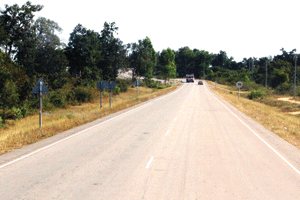
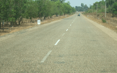
A section of National Road No. 9 in Savannakhet province. (File photo)
An official from the Savannakhet Public Works and Transport Department, who asked not to be named, told Vientiane Times on Tuesday that Road No. 9 is one of many roads in Laos that can safely carry loads of only 9 tonnes per axle, which is substandard. “We expect the modification of roads to bring them up to standard will be complete in the next three years,” he said. A 58-kilometre section of Road No. 9 has been resurfaced with two layers of asphalt, adding 10cm to the thickness of the surface. The newly surfaced section runs from Atsaphangthong to Phalanxay districts and from the Xethamuak area to Phin district. It opened to traffic in March this year. The work was funded by grant assistance from the Japanese government through the Japan International Cooperation Agency (JICA), valued at over US$32 million. Streetlights and drainage were also included in the upgrade.
Source: Vientiane Times October 10, 2015 - Road_No9.htm
- Joined
- Aug 15, 2012
- Bikes
- KTM 613 EXC, BMW R90S & Dakar, MZ250, Norton 16H, Honda - 500 Fs & Xs, DRZs, XLs XRs CRFs CT110s etc
I rode Route 4B from Luang Prabang to Hongsa a couple of weeks back. First time I've done it that direction, did it same time of year in 2012 from Hongsa and in May last year from Hongsa.
In 2012, the road was diabolical. Three of us had tried to get through in August on big bikes that year (KTMs 950 Super Enduro and 990 Adventure and a Kwacka Versys) and we gave up on the big climb out of the village at the river, about 25 km in. It was extremely slippery and even with knobbies, we were sliding around just backing the throttle off. I went back that September on the KTM 525 and got through... but it was tough, with ruts up to 750mm deep. Took me about 7.5 hours.
Route 4B now is like a superhighway compared to then. Last year it was slippery in places, but had been graded. It is still in what I would call excellent condition now. This trip took me 3 hours 45 minutes from the ferry into the GH in Hongsa, plus two extended stops. That's half the time of the 2012 trip. A key factor with this route is the time since last rain. There had been plenty of it a few days before I went, but the surface had dried fairly well. It was slippery for 10 - 15 kilometres over the top, but nothing too bad. I had one close call, near the end of the day... didn't pay enough attention to a steep, rutted, dry climb. Ruts were only 150 - 200 mm deep but the one I was in had some gravel and I wasn't going / concentrating hard enough - doing maybe 50 kph. Front tyre went, bike was going down, but I reefed it up, ran over the heel of my boot with the back tyre as I gassed it and all was fine. Sure woke me up again.
The ruts aren't bad. The worst of them would have been 300 mm deep... and there's not that many. There were some mud holes and trees down, but nothing too bad. The creeks were all as easy as I've seen.
I gave a report on the road to a friend in Laos, who tried it a week later and turned back. He said it was raining and "wasn't fun". I actually like it in the rain, but it demands respect. There's some remote areas with big drops.
There's survey marks now every 500 metres. If you've ever wanted to do this road, do it now before the tar hits it. It's a great ride.
I'll post some photos
- Joined
- Aug 15, 2012
- Bikes
- KTM 613 EXC, BMW R90S & Dakar, MZ250, Norton 16H, Honda - 500 Fs & Xs, DRZs, XLs XRs CRFs CT110s etc
Start point for Route 4B is the ferry... which leaves about 100m upstream of where this shot was taken

I wasn't watching the GPS and missed the turnoff, a few km from the ferry. Some road development to one of the local villages makes it the major arm of the road. Didn't go too far out of my way, but worth watching.
Back on track... here's the first creek

It was quite deep when I did it in 2012, but is a doddle at present
Second creek. The approach was giving a guy in one of those bug-eyed Hyundai trucks some grief. He was backing down for another run at it.

One of the many small villages along the river flats

Nothing wrong with this track.

Third creek

Women doing all the heavy lifting. How unusual - never seen that before in Asia, eh?

Just a ditch

Plenty of these bogs along the way, from recent rains... no problems on a bike


I wasn't watching the GPS and missed the turnoff, a few km from the ferry. Some road development to one of the local villages makes it the major arm of the road. Didn't go too far out of my way, but worth watching.
Back on track... here's the first creek

It was quite deep when I did it in 2012, but is a doddle at present
Second creek. The approach was giving a guy in one of those bug-eyed Hyundai trucks some grief. He was backing down for another run at it.

One of the many small villages along the river flats

Nothing wrong with this track.

Third creek

Women doing all the heavy lifting. How unusual - never seen that before in Asia, eh?

Just a ditch

Plenty of these bogs along the way, from recent rains... no problems on a bike

- Joined
- Aug 15, 2012
- Bikes
- KTM 613 EXC, BMW R90S & Dakar, MZ250, Norton 16H, Honda - 500 Fs & Xs, DRZs, XLs XRs CRFs CT110s etc
The deepest of the creeks at the Luang Prabang end. No problems though

Plenty of minor landslides, but nothing that had the track blocked even for trucks

Just for the sake of completeness.

Two hours in, I stopped at the village on the ridgeline. Had a beer or several with the lads and some 2 minute noodles. I'd fueled up here in 2012 too IIRC.

I flew the drone there. Might upload a short clip later. This is a rather weird panorama from it... a full 360 degree rotation.

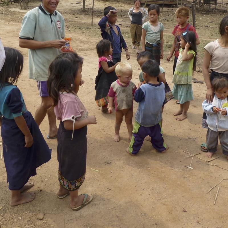
I'm told that the village with the (I think) albino kid has been relocated. The cattle like the peace and quiet

As mentioned... a few trees down. No great problems, which is good... seeing my saw blade seems to have gone missing

There weren't that many locals out and about

Another hour's ride and I stopped for a drink at the village beside the river. I conned this girl into a massage for 20,000 Kip. She did a solid half hour, so I tipped her another 20,000 and she was delighted.

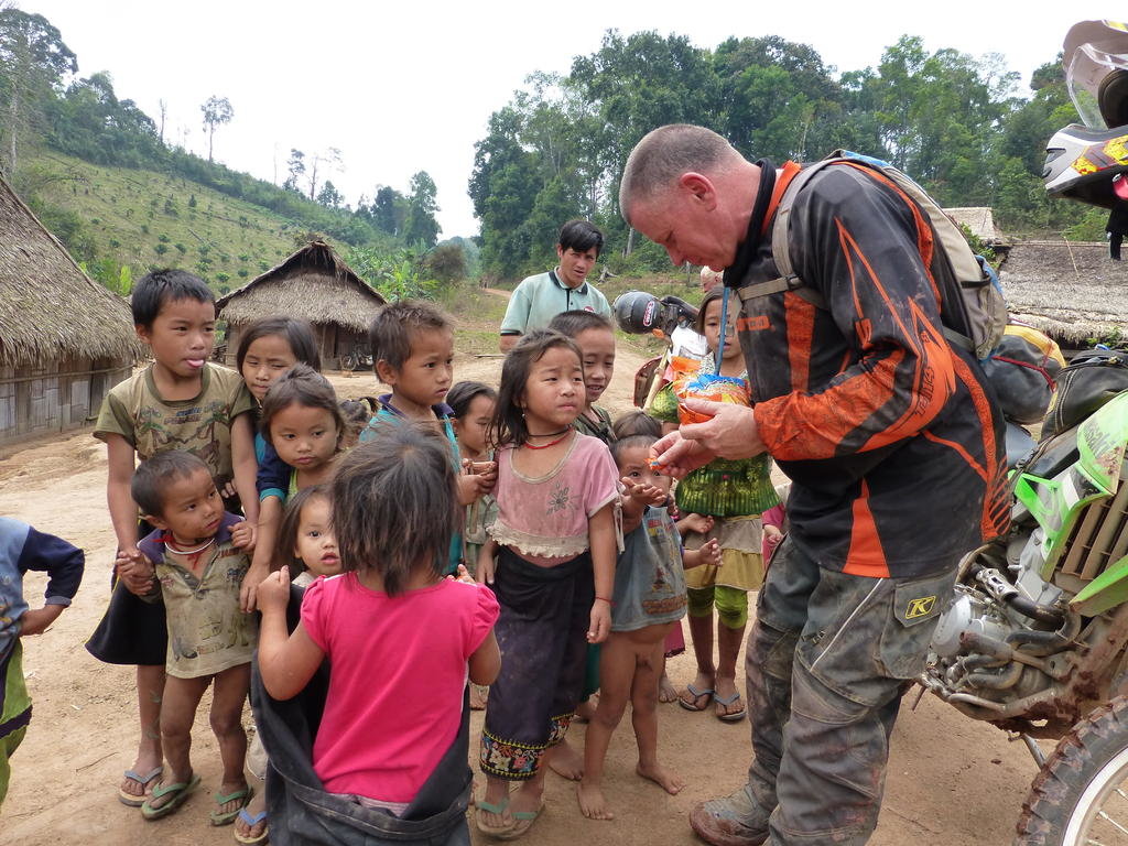
I declined the shopkeeper's Lao Lao offer. Shouted the local kids some ice treats... about 20 of them

The river isn't deep. I've done both choices. Rode the bridge in 2012 and discovered 3 missing planks, but they've been fixed.


I passed a 10 ton truck just before this. I don't know whether he'd accidentally lost his load... or this was a road treatment?

There was another four trucks waiting...

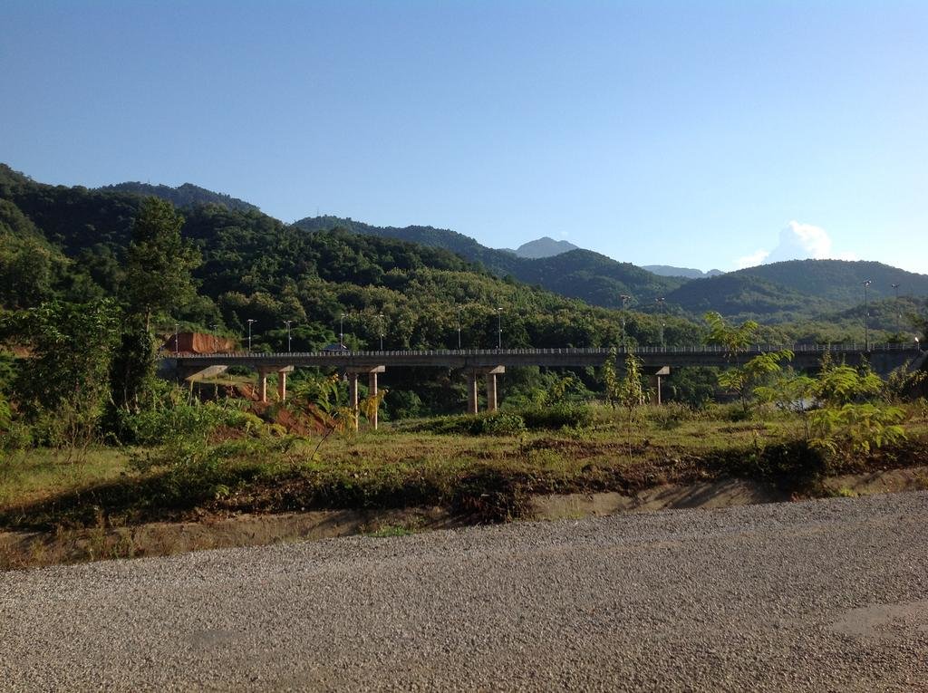
The start of the bitumen. Either turn right before the bridge for a smooth ride into town, or go a few hundred metres further on and turn right onto the pot-holed 4A


Plenty of minor landslides, but nothing that had the track blocked even for trucks

Just for the sake of completeness.

Two hours in, I stopped at the village on the ridgeline. Had a beer or several with the lads and some 2 minute noodles. I'd fueled up here in 2012 too IIRC.

I flew the drone there. Might upload a short clip later. This is a rather weird panorama from it... a full 360 degree rotation.

I'm told that the village with the (I think) albino kid has been relocated. The cattle like the peace and quiet

As mentioned... a few trees down. No great problems, which is good... seeing my saw blade seems to have gone missing

There weren't that many locals out and about

Another hour's ride and I stopped for a drink at the village beside the river. I conned this girl into a massage for 20,000 Kip. She did a solid half hour, so I tipped her another 20,000 and she was delighted.

I declined the shopkeeper's Lao Lao offer. Shouted the local kids some ice treats... about 20 of them

The river isn't deep. I've done both choices. Rode the bridge in 2012 and discovered 3 missing planks, but they've been fixed.


I passed a 10 ton truck just before this. I don't know whether he'd accidentally lost his load... or this was a road treatment?

There was another four trucks waiting...

The start of the bitumen. Either turn right before the bridge for a smooth ride into town, or go a few hundred metres further on and turn right onto the pot-holed 4A

- Joined
- Aug 15, 2012
- Bikes
- KTM 613 EXC, BMW R90S & Dakar, MZ250, Norton 16H, Honda - 500 Fs & Xs, DRZs, XLs XRs CRFs CT110s etc
As mentioned earlier... time since rain is important on Route 4B. This was it, in the rain, in 2012. It gets slippery. Very slippery.
At least these days it's relatively smooth


This next photo, I'd just "spun out"... slid to a stop sideways. The drop there was several hundred feet

Some of the hills are steep. I went down several on that trip with the engine off, bike in gear... both feet down, using the engine for braking.
This most recent trip, I lost my rear brake on the descent into the village by the river. PITA. That was my excuse for stopping for the extended massage
At least these days it's relatively smooth


This next photo, I'd just "spun out"... slid to a stop sideways. The drop there was several hundred feet

Some of the hills are steep. I went down several on that trip with the engine off, bike in gear... both feet down, using the engine for braking.
This most recent trip, I lost my rear brake on the descent into the village by the river. PITA. That was my excuse for stopping for the extended massage
Lone Rider
Blokes Who Can
As mentioned earlier... time since rain is important on Route 4B. This was it, in the rain, in 2012. It gets slippery. Very slippery. This next photo, I'd just "spun out"... slid to a stop sideways. The drop there was several hundred feet
Some of the hills are steep. I went down several on that trip with the engine off, bike in gear... both feet down, using the engine for braking. This most recent trip, I lost my rear brake on the descent into the village by the river. PITA. That was my excuse for stopping for the extended massage
So true! Just got a message from a friend that last week (when they had heavy rain for a few days) it took 2 bikers some 8 hours to cover the 120 km. off-road section from Hongsa to Luang Prabang They left one biker behind who, due to exhaustion, could not carry on. They had to send a truck in to pick him and the bike up.
- Joined
- Aug 15, 2012
- Bikes
- KTM 613 EXC, BMW R90S & Dakar, MZ250, Norton 16H, Honda - 500 Fs & Xs, DRZs, XLs XRs CRFs CT110s etc
So true! Just got a message from a friend that last week (when they had heavy rain for a few days) it took 2 bikers some 8 hours to cover the 120 km. off-road section from Hongsa to Luang Prabang They left one biker behind who, due to exhaustion, could not carry on. They had to send a truck in to pick him and the bike up.
In 2012, there were no trucks using the road, just a tracked crawler that the power line construction guys were using to get water from the river.

When I pulled up at their camp, they'd pulled their AK out after hearing me approach

I suspect that a lot of guys who strike trouble simply have too much air in their tyres. That road is special - worth seeing

bsacbob
Administrator (Retired)
- Joined
- Jul 1, 2012
- Location
- Chiang Rai
- Bikes
- Honda CRM-AR 250, Honda CRF 250-L, Suzuki V Strom XT 650 Honda XR250 Baja BMW F650GS
Lone Rider
Blokes Who Can
Work begins on the reconstruction of highway 13 North from Pak Mong (Luang Prabang) to Oudomxay
Oudomxay province : Reconstruction of Road No. 13 North between Oudomxay provincial capital to Pakmong in Luang Prabang province's Nambak district is underway following a stone-laying ceremony yesterday in Oudomxay. Chinese Yunnan Sunny Road and Bridge Co., Ltd. (YSRBC), and Third Railway Survey and Design Institute Group Corporation (TSDI) have been contracted to rebuild the 81.5 km section, working with the Ministry of Public Works and Transport.
The deal was inked on December 16, 2012. The US$82.5 million project will have a time frame of three years with Burapha Development Consultant as the supervisor. This is the first ever reconstruction of this section of road from Meuangxay-Pakmong since it was first built in 1976. The road will be constructed to a technically third class standard, while its sub-sections are to have different widths. A 73 km. sub-section from Pakmong to Oudomxay will be 7 metres wide and will have a 5-centimetre thick layer of asphalt. The road will be eight metres wide where it passes through villages. Some sections and connecting roads in Oudomxay provincial capital will be 12 to 18 metres wide and will be able to carry loads of up to 11 tonnes per axle. Sidewalks will also be installed on urban sections of the road.
Adapted from Vientiane Times
Update on Rd 13 North from Pakmong to Oudomxay
Things are moving fast (the work started in March 2014) and the first 10 Km. on the Oudomxay side are paved while on the Pakmong side the first 17 Km. are paved and the next 10 Km. are in varying stages of being sealed. In some of the villages such as Ban Lak 32 the road has been paved as well. All the old pavement has been taken out and the hard shoulders of the new road are more or less in place along the whole length of the road and it looks like that they are waiting for the dry season to start to continue with building up the roadbed, taking out some of the switchbacks, etc. before putting in more new pavement.


and a few pics of the parts that are ready


Last edited:
Lone Rider
Blokes Who Can
Vietnam considers $2.5 billion Vientiane – Hanoi expressway
VietNamNet Bridge - The Ministry of Transport is considering two plans to build the road connecting Hanoi and Vientiane (Laos) via the border gate of Thanh Thuy in Nghe An Province or the Cau Treo border gate in Ha Tinh province.

At a meeting on Tuesday, a representative of the Transport Engineering Design Consultant Company (TEDI) said the highway will be 760 km long, starting from National Highway 13 in Vientiane to the belt road No. 3 in Hanoi. TEDI representative said the highway may pass through six pairs of border gates. To have the shortest road, TEDI suggested the Thanh Thuy border gate in the central province of Nghe An and Nam On in BolyKhamxay Province of Laos. It is expected that the project will not only form a highway connecting Hanoi and Vientiane but also facilitate convenient connections with Thailand and Myanmar.
At the meeting, Mr. Nguyen Xuan Duong, Nghe An People's Committee Chairman proposed the Ministry of Transport to build a highway from the border gate of Thanh Thuy to Vinh City of Nghe An Province. Deputy Minister of Transport Le Dinh Tho told TEDI to focus studying the two plans of connecting Vientiane and Hanoi through the border gates of Thanh Thuy-Nam On (BolyKhamxay) and Cau Treo (Ha Tinh province-Vietnam) - Nam Phao (BolyKhamxay province-Laos).
The project will have a total investment of about $2.5 billion. The highway will have four lanes, with the minimum width of 22,5m, meeting technical standards of Vietnam and Laos. The project will be implemented in two phases, with $1.5 billion for phase 1 (from now to 2020) and $1 billion in phase 2 (after 2020).
Source: Vietnam-considers--2-5-billion-Vientiane---Hanoi-expressway
VietNamNet Bridge - The Ministry of Transport is considering two plans to build the road connecting Hanoi and Vientiane (Laos) via the border gate of Thanh Thuy in Nghe An Province or the Cau Treo border gate in Ha Tinh province.

At a meeting on Tuesday, a representative of the Transport Engineering Design Consultant Company (TEDI) said the highway will be 760 km long, starting from National Highway 13 in Vientiane to the belt road No. 3 in Hanoi. TEDI representative said the highway may pass through six pairs of border gates. To have the shortest road, TEDI suggested the Thanh Thuy border gate in the central province of Nghe An and Nam On in BolyKhamxay Province of Laos. It is expected that the project will not only form a highway connecting Hanoi and Vientiane but also facilitate convenient connections with Thailand and Myanmar.
At the meeting, Mr. Nguyen Xuan Duong, Nghe An People's Committee Chairman proposed the Ministry of Transport to build a highway from the border gate of Thanh Thuy to Vinh City of Nghe An Province. Deputy Minister of Transport Le Dinh Tho told TEDI to focus studying the two plans of connecting Vientiane and Hanoi through the border gates of Thanh Thuy-Nam On (BolyKhamxay) and Cau Treo (Ha Tinh province-Vietnam) - Nam Phao (BolyKhamxay province-Laos).
The project will have a total investment of about $2.5 billion. The highway will have four lanes, with the minimum width of 22,5m, meeting technical standards of Vietnam and Laos. The project will be implemented in two phases, with $1.5 billion for phase 1 (from now to 2020) and $1 billion in phase 2 (after 2020).
Source: Vietnam-considers--2-5-billion-Vientiane---Hanoi-expressway
Lone Rider
Blokes Who Can
UPDATE ON THE UPGRADING OF ROAD 16B FROM XEKONG VIA DAKCHEUNG TO THE VIETNAM BORDER (http://www.rideasia.net/motorcycle-...velopment-road-construction-laos.html#post337)
Xekong road project faces delays
Work on the 212km National Road 16B, linking Xekong province to the Vietnamese border, is facing delays as the construction company waits on its contract to be extended. Project head, Mr Bounchanh Sengdara, said Tonghomsombath Construction Company had signed a four-year contract with the government for the work in 2009, and had recently submitted a request to the government to extend the original contract. “We do not know when the government will allow the project to continue, so work has stopped temporarily,” he said.
While construction of the new road was initially expected to be complete by the end of the year, weather conditions and landslides have caused a number of delays. A late decision to widen the road from 9m to 13m and add sidewalks, lighting and improved drainage through 3km of the Xekong provincial capital also affected the project timeline. Mr Bounchanh said the company could not put a date on completion of the project and may face further delays while the government works on extending the contract. In 2009, the government authorised Tonghomsombath Construction Company to spend more than 370 billion kip (US$44 million) to build the road. That figure increased after the decision was made to widen the road in Xekong. The company is financing the project, with the government to repay the costs over a nine-year period.
Source: Vientiane Times 19 August 2013
Xekong-Vietnam road link set for completion in 2017
The construction of National Road No.16B linking Xekong provincial capital with Vietnam will be complete in 2017 after suffering a series of delays, an official in charge of the project has confirmed. The 120-km road is being built by two construction companies who have been allocated US$51.5 million of government money to undertake the project. The road passes through Dakcheung, one of the country's 42 districts officially classified as poor, before reaching the Vietnamese border.

Construction of Road No.16B is underway in Xekong province.
Director of the Xekong provincial Department of Public Works and Transport, Mr Soutsana Sihavong, told Vientiane Times on Friday that JICA is funding the construction of a US$15 million bridge across the Xekong River. The bridge is also scheduled for completion in 2017. Construction of National Road No.16B began in 2003 but work was delayed due to financial difficulties. But construction picked up in fiscal year 2014-15 as the government wanted the road to be finished in the same year as the bridge across the Xekong River. Currently only about 20km of the road is paved. Some sections make for treacherous driving as they are very narrow and potholed, as well as passing through mountainous terrain.
Source: Vientiane Times by Somsack Pongkhao - (Latest Update December 21, 2015)
Lone Rider
Blokes Who Can
The Donnokkhoun to Xiengda and the 450 Year Rd. bypass s through the That Luang Marsh
The Vientiane Natural Resources and Environment Department has announced that compensation will be awarded to people who have had their land appropriated to enable a 9.5 km. and 25 m. wide road to be built through the That Luang marsh. Forty owners of land on a section of the new road being built in Xiengda village were named on a list of people to be compensated by the department as their parcels of land were affected by the project.
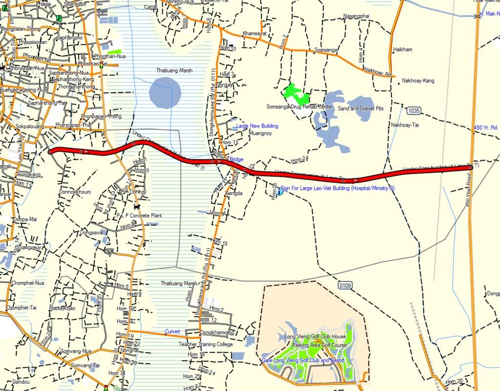
The land along this road is affected because a swathe of land 200 metres wide on either side of the road was sold off by the government to cover the cost of the road's construction, under the policy of converting land into capital. The road is being built in three phases. The first stage sees the road connecting Donnokkhoum village to Kamphaengmeuang Road in Donkoi village. The second phase links Kamphaengmeuang Road to Xiengda village across the marsh and the third section of the road runs from Xiengda village to the 450 Year Road. The cost of the 9.5 km highway is estimated at more than US$150 million. It is being built by the Namtha Road-Bridge Construction Company.

The daughter of Mrs Lom, who is on the list to receive compensation, said her mother owned over one hectare of rice fields in Xiengda village. Some people recently asked to buy the land for US$115 (about 933,000 kip) per square metre but she did not sell it because the land was located alongside the new road. She was shocked when she saw her name on the department's list for compensation for converting the 200 metres of land along each side of the road because it awarded her only US$10 (about 80,000 kip) per metre, or less than one tenth of what she could have sold it for.
Source: Vientiane Times - Story by Khonesavanh Latsaphao, (Latest Update December 23, 2015)
The Vientiane Natural Resources and Environment Department has announced that compensation will be awarded to people who have had their land appropriated to enable a 9.5 km. and 25 m. wide road to be built through the That Luang marsh. Forty owners of land on a section of the new road being built in Xiengda village were named on a list of people to be compensated by the department as their parcels of land were affected by the project.

The land along this road is affected because a swathe of land 200 metres wide on either side of the road was sold off by the government to cover the cost of the road's construction, under the policy of converting land into capital. The road is being built in three phases. The first stage sees the road connecting Donnokkhoum village to Kamphaengmeuang Road in Donkoi village. The second phase links Kamphaengmeuang Road to Xiengda village across the marsh and the third section of the road runs from Xiengda village to the 450 Year Road. The cost of the 9.5 km highway is estimated at more than US$150 million. It is being built by the Namtha Road-Bridge Construction Company.

The daughter of Mrs Lom, who is on the list to receive compensation, said her mother owned over one hectare of rice fields in Xiengda village. Some people recently asked to buy the land for US$115 (about 933,000 kip) per square metre but she did not sell it because the land was located alongside the new road. She was shocked when she saw her name on the department's list for compensation for converting the 200 metres of land along each side of the road because it awarded her only US$10 (about 80,000 kip) per metre, or less than one tenth of what she could have sold it for.
Source: Vientiane Times - Story by Khonesavanh Latsaphao, (Latest Update December 23, 2015)
Lone Rider
Blokes Who Can
Road 17 B - Muang Sing to Xiengkok and the Laos-Myanmar Friendship Bridge
The final unpaved section of Road No. 17B linking the Laos-Myanmar Friendship Bridge to Luang Namtha province is currently being surveyed prior to asphalt being laid. A 15-kilometre stretch of road links the bridge to Xiengkok village in Long district, of which about 10 km have already been sealed with asphalt. The Laos-Myanmar bridge also links to the Chinese border about 94 kilometres away through Long district.
The bridge, which crosses the Mekong River, is still waiting for the requisite legislation to be passed by Laos and Myanmar before opening to international traffic. At present it is used as an informal border crossing by local people for the sale of goods and personal visits. Authorities hope to open the Laos-Myanmar bridge to all traffic in the very near future so as to benefit from the changes introduced by the Asean Economic Community.
Source: Adapted from Vientiane Times By Khonesavanh Latsaphao, (Latest Update December 29, 2015)
Lone Rider
Blokes Who Can
Plans for a new Bokeo highway to accommodate goods transportation
China might invest to build a new highway from its south western border to Huayxai district in Bokeo province to enable the more rapid transport of goods. Provincial Public Works and Transport Department Official, Mr Khamphat Phommasing told Vientiane Times yesterday that the Ministry of Public Works and Transport is considering a proposal in relation to the project after the Chinese team leaders have collected the initial information from the provincial authorities. The information includes the conditions of the province, the economy and social context, the environment, geology and the situation in relation to the transportation sector. The ministry has set up a national committee to be responsible for the project and to coordinate with the Chinese investor, he said. The ministry is also looking at the possible route the high way could take, the length of the highway and how it would benefit Laos. It will then submit the proposal to the government to seek funding.
This new highway will be larger, of a higher standard and shorter than Road No R3 from Huayxai district, Bokeo province to the Boten area in Luang Namtha province at the Lao-Chinese border, China, he commented. The project will provide more facilities in goods transportation as well as boost trade, investment and tourism between Laos and China and links to the region. The increasing goods transportation between Laos and China along Road No R3, which is 225km long, cannot be guaranteed to meet service demands in the future, Mr Khamphat said.
Road R3 slows transport times because it is mountainous and winding while this new road will be straighter as the construction of the road will feature both tunnels and bridges. However, the road will require the imposition of a toll fee for collection from motorists as it shall be a private investment, he believed.
China has become the largest foreign investor in Laos and bilateral trade bet ween the two countries is increasing continuously. In 2014, Laos-China trade value reached about US$3.61 billion, increasing 31.87 percent compared to 2013. The exports from Laos to China are the largest for the country, involving 46.1 percent of all products shipped abroad.
Source: By Times Reporters - (Latest Update Janaury 7, 2016)
This may belong here.
Anyone thinking of driving from Buon Thai to Samphan... it's not going to happen.
Anyone wanting to ride from Buon Thai to Samphan, get ready for a ferry ride & have a Laos capable phone with you.
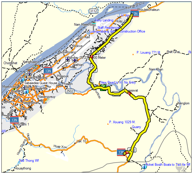
Early January we tried this. Because of the dam being built north of Samphan on the Nam Ou, some the road is no more, literally underwater. (see inset on photo of gps route)
We got there just on dark & had no idea what was going on, stayed up the hill in a village. Trying to ask how to get to Samphan failed until I showed them a previous photo of a bike in a canoe then it was all smiles says yes.
There was a board at the waters edge with a phone number but luckily a local lad was waiting for a ferry & had phoned them already. They showed up in a small baot the immediately rang for a bigger one.
Did not see any car capable ferries anywhere.
The road on the other side heading north is also gone, more ferries running over there.


Lone Rider
Blokes Who Can
Thanks for the info Pounce - by the way do you have an approximate waypoint of where you could go no further coming from the north-west (getting the bikes in the canoe) and if possible also for the point where you got of the canoes.
Attachments
Last edited:
Lone Rider
Blokes Who Can
Ferry Co ordinates.
It's a short ride & these may change as the water level changes, but not by much as the road will always end at the waters edge.
N21 25.759 E102 20.155
N21 24.832 E 102 20.614
GpxViewer
Thanks for the coordinates Peter
Lone Rider
Blokes Who Can
Highway 14 (A, B, C, A1).

Construction of the new road (Rd 14 A) west of the Mekong from highway 16 (Vangtao to Pakxe) to Champasack (Wat Pou) is going fast and it is expected that in a few months the whole road is asphalt.

Unesco's World Heritage Committee has given permission for a 5km section of Road No. 14A to pass through the Vat Phou World Heritage Site in Champassak province.
Road 14A from Road 16 to Champasack and the road to Vat Phou was finished a few years ago with the exception of a 5 km. stretch from Champasack to the road which leads to Vat Phou. It looks like that the last 5 km. will now also be paved as Unesco's World Heritage Committee, after five years of consideration, has decided that the 5km section of the 130km road, which is under construction, can pass through the world heritage site. Construction of the road, which was 60 percent complete at the time, was halted in 2010. The 5km section through the Vat Phou site, including three concrete bridges, should have been finished at the end of 2011. However, an official in the province’s Champassak district, Khampheng Sengmany, told Vientiane Times today that despite permission being given by Unesco, work on the road had not yet resumed. "The construction company has not yet begun work on the road through the Vat Phou area as they don’t have the necessary finances at present," he said.
Work on the road began in 2008, with the first section running through Phonthong district to the Cambodian border. The first 25 km. stretch linking Phonthong district to Champassak district was completed at a cost of US$33 million. The second section will run 35km from Champassak and will cost about US$19 million. This phase includes the 5km stretch through Vat Phou area while some 18 km. from the Vat Phou road to the border between Champasack and the Sukhuma districts have been paved already. The second phase was scheduled for completion by 2015, under the provision that Unesco allowed the road to pass through the temple complex.
In addition to Road 14A, sections of Rd 14C1 have been paved while road construction activities to upgrade and pave Rd 14A from Sukhuma to Rd 14C as well as Rd 14C from Moonlapamok to the junction of Rd 14C with Rd. 14B have been started as well.
Source Vientiane Times 25 February 2016 and other sources
Lone Rider
Blokes Who Can
Road 1G (Rd 23) to be upgraded and Paved
The construction of 64-km National Road No 1 G South, stretching from Savannakhet border to Nadonekhouang Village, Saravane Province, is planned to be renovated soon.
The project worth a total of 548.6 billion kip, partly financed with a Government contribution approved by the National Assembly in 2012-2013. According to the plan, this road will give access to seven villages of Saravane district and nine villages of Toumlan district, which are scheduled to be paved by asphalt. The renovation work is expected to be completed by next 48 months.
The construction of Road No 1 G is a national priority project, a strategic channel linking the north to the south. This road aims to serve the national defense and security, accessing to remote areas and connecting localities and districts with the central part and neighboring countries. Upon completion this road will spur the growth of economy, society, trade and investment in industry, creating jobs and upgrade living condition of the locals, favoring agriculture and tourism.
The contract for No 1 G road renovation was signed by Saravane Governor Khamboun Douangpanya and President of Douangchaleun Construction Company Group, Mr. Khamphai Silasha in Vientiane, on May 18. Witnesses of the event were the LT Gen. Duangchay Phicith, Deputy Prime Minister and Minister of National Defense, Mr. Sommath Pholsena, Minister of Public Works and Transport and various officials concerned.
Source: :: KPL :: Lao News Agency
Note by LR: The road improvement starts from Rd 15 and goes north up to the provincial border between Saravane and Savannakhet - this would leave the last 20 km. which is very bad (very difficult for cars as well as bikes) from the provincial border to the Xe Banghiang river in its present state.
View attachment 17398
Saravan to Savannakhet road facing delays
Saravan province : A road that would provide a short cut from Toumlan district in Saravan province to Savannakhet province might not be finished by next year as planned. Head of the Road 1G project in Toumlan district, Mr Phounuan Kaiyalath, said yesterday that construction of the 64km road started in 2012 and was slated to finish in 2017, allowing motorists to go from Toumlan district to Thapangthong district and connect with Phin district in Savannakhet province. He explained that on the Savannakhet side, over 50km of road construction was underway from Thappangthong district to Phin district. When finished it would be an easier journey for people travelling from Xekong and Attapeu provinces to Vientiane, instead of going through Pakxe.
“The project is now over 30 percent complete, but it won't be finished on time because the construction company currently has only one team working on the road and still doesn't have other sub-contractors to help with the work,” he noted. “ Furthermore, stones and sand have to be transported quite a long way from Pakxe district in Champassak,” he added. Asphalting has not yet begun as originally planned, but work on clearing the upgraded route to the border with Savannakhet province is continuing, he said. Mr Phounuan said the road would be 11 metres in width through residential areas and 8 metres wide through farmland. It would have 33 bridges totalling 883 metres in length.
Source: By Times Reporters (Latest Update March 2, 2016)
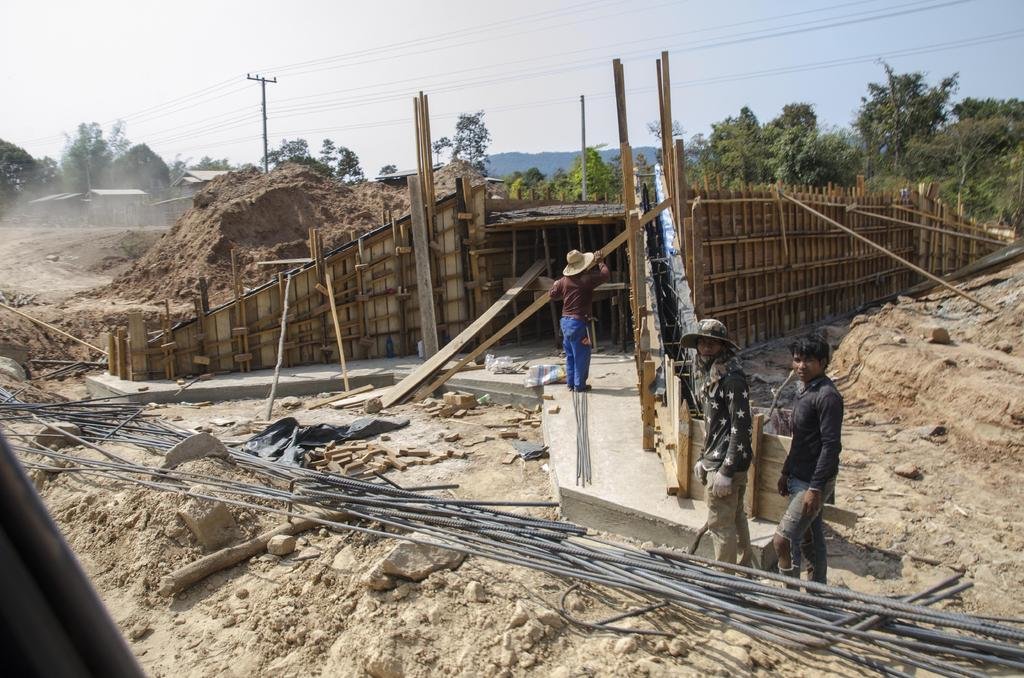
Note LR: Happened to be on that road about 2 weeks ago and while there is progress, still a lot needs to be done in particular with regard to the bridges. We saw them working on 1 bridge but nothing was happening at all the other bridges so it may take quite some time before the whole road will be ready
Lone Rider
Blokes Who Can
Update on Rd 13 North from Pakmong to Oudomxay
Things are moving fast (the work started in March 2014) and the first 10 Km. on the Oudomxay side are paved while on the Pakmong side the first 17 Km. are paved and the next 10 Km. are in varying stages of being sealed. In some of the villages such as Ban Lak 32 the road has been paved as well. All the old pavement has been taken out and the hard shoulders of the new road are more or less in place along the whole length of the road and it looks like that they are waiting for the dry season to start to continue with building up the roadbed, taking out some of the switchbacks, etc. before putting in more new pavement.
A few pics of the road:


Road 13 North from Pakmong to Oudomxay almost ready - Rode along this road 2 days ago and the road is now completely paved. They are still busy with putting the final layer of asphalt on and at a few places they were patching up the hard shoulders of the road but otherwise there are no problems and the road is now a fun road to ride.
- Joined
- Aug 15, 2012
- Bikes
- KTM 613 EXC, BMW R90S & Dakar, MZ250, Norton 16H, Honda - 500 Fs & Xs, DRZs, XLs XRs CRFs CT110s etc
There's a significant show of force along the road at present, with a tent set up every few kilometres and armed troops patrolling the road.


Lone Rider
Blokes Who Can
Korea offers US$3.5 million grant for a study on a Road No 8 upgrade
Korea International Cooperation Agency (KOICA) has dispatched a group of South Korean experts to Laos in order to accomplish an implementation survey of the detailed feasibility study for upgrading Road No. 8 on the Asean Highway network from March 27 to April 1. KOICA, the representative agency of the Republic of Korea's government, has provided a grant of US$3.5 million for an 18 month feasibility study to improve the 132km-long proposed road on Asean Highway Route 15 between Viengkham village in Pakkading district and Namphao village in Khamkeuth district, Borikhamxay province from 2016 until 2017.
Source: Vientiane Times http://vientianetimes.org.la/FreeContent/FreeConten_Korea_offers.htm, (Latest Update April 4, 2016)
Lone Rider
Blokes Who Can
Xekong-Vietnam road link set for completion in 2017
The construction of National Road No.16B linking Xekong provincial capital with Vietnam will be complete in 2017 after suffering a series of delays, an official in charge of the project has confirmed. The 120-km road is being built by two construction companies who have been allocated US$51.5 million of government money to undertake the project. The road passes through Dakcheung, one of the country's 42 districts officially classified as poor, before reaching the Vietnamese border.

Construction of Road No.16B is underway in Xekong province.
Director of the Xekong provincial Department of Public Works and Transport, Mr Soutsana Sihavong, told Vientiane Times on Friday that JICA is funding the construction of a US$15 million bridge across the Xekong River. The bridge is also scheduled for completion in 2017. Construction of National Road No.16B began in 2003 but work was delayed due to financial difficulties. But construction picked up in fiscal year 2014-15 as the government wanted the road to be finished in the same year as the bridge across the Xekong River. Currently only about 20km of the road is paved. Some sections make for treacherous driving as they are very narrow and potholed, as well as passing through mountainous terrain.
Source: Vientiane Times by Somsack Pongkhao - (Latest Update December 21, 2015)
New Xe Kong Bridge in Sekong
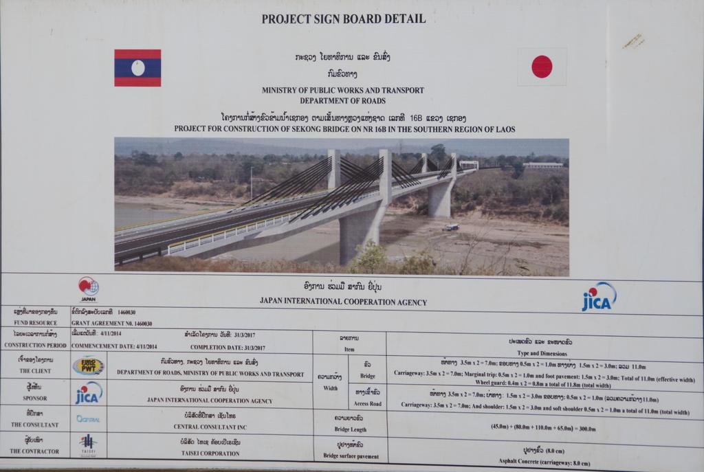
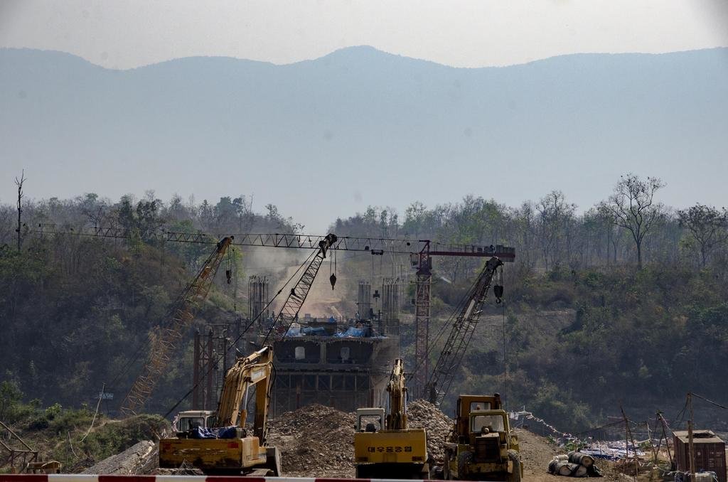
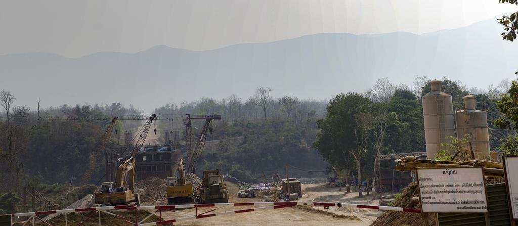
Recently we passed through Sekong and we had a quick look at the construction of the new bridge over the Xe Kong river. In addition to the new bridge which links Sekong (replacing the ferry) with Rd. 16B coming from the Vietnam border via Dakcheung, also a new bypass road is being constructed around Sekong and this new road links with Rd. 16 north-east of Sekong.
Pictures: Copyright Ian B. Gatenby
Lone Rider
Blokes Who Can
Xe Bangfai Bridge - Rd. 5528
In June 2013 the contract for the construction of a bridge over the Xe Bangfai river in the road (part of the HCM trail) running from Ban Langkhang/Na Phao on Rd. 12 to Boualapha and onwards to Vilaboury and Rd. 9 was signed. According to the contract, the construction work is determined to be completed two years after the signing date (so, if everything goes according to schedule the bridge will be ready in June 2015). The bridge, costing 40 billion kip, is designed to be 181 m long and 10 m wide with a footpath on each side and street lights.
Extracted from :: KPL :: Lao News Agency
This is how the crossing in June 2013 looking north when Johnny and Matt crossed the river when the river was still quite low - just imagine how it will be a few month from now at the height of the rainy season.


Fast forward to February 2016 - On our way to the south of Laos we found ourselves again on this unpaved road which is part of the former Ho Chi Minh trail. We headed south from Langkhang on Rd. 12 to Boualapha to Sepon on Rd. 9. There are many river crossings in the first part of this unpaved road (Rd 5528), one of these is the Xe Bangfai river crossing. Although a contract for the construction of a bridge over the river was signed in 2013 and the bridge should have been ready in 2015 reality showed, as so often happens in Laos, that the contractor disappeared, leaving just a few bits and pieces of the foundation in place so it was again through the river instead of over the bridge.
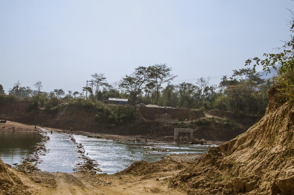
Looking south at the Xe Bangfai crossing
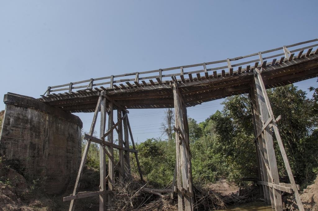
In the same road there are many more small stream crossings. Most of them have wooden bridges often with an option for larger trucks to go through the streams as most of the bridges are old and might collapse when a heavy truck would cross over it. Two of these stream crossings/bridges are being replaced by concrete bridges - the Nam In crossing west of Ban Phanop and the Houay Kachan crossing south of Ban Khagnou. Both bridges might be ready before the next rainy season starts (June/July 2016)
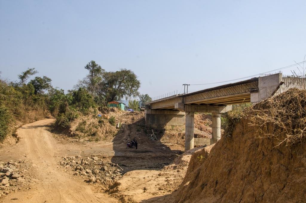
The Nam In crossing and the new bridge
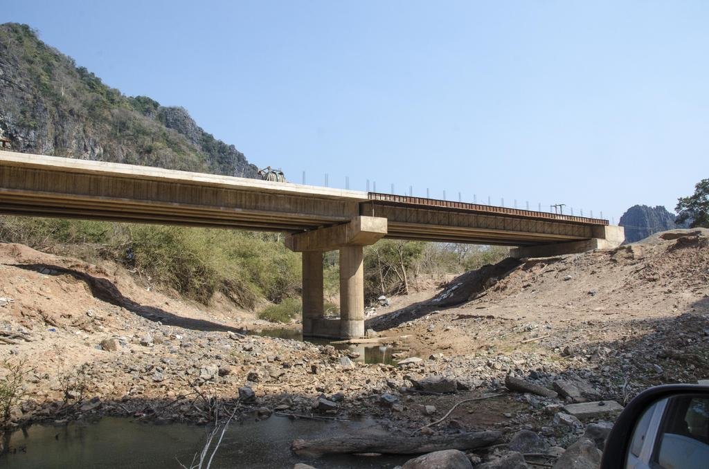
The Houay Kachan crossing and the new bridge
Pictures: Copyright Ian B. Gatenby
- Joined
- Aug 15, 2012
- Bikes
- KTM 613 EXC, BMW R90S & Dakar, MZ250, Norton 16H, Honda - 500 Fs & Xs, DRZs, XLs XRs CRFs CT110s etc
It pays to approach the old bridges with a modicum of care

More small bridge replacement

It struck me that a lot of the timber being used for formwork appeared to be furniture grade material

There's some sapwood visible here... but a lot of good timber too

- - - Updated - - -
It pays to approach the old bridges with a modicum of care

More small bridge replacement

It struck me that a lot of the timber being used for formwork appeared to be furniture grade material

There's some sapwood visible here... but a lot of good timber too


More small bridge replacement

It struck me that a lot of the timber being used for formwork appeared to be furniture grade material

There's some sapwood visible here... but a lot of good timber too

- - - Updated - - -
It pays to approach the old bridges with a modicum of care

More small bridge replacement

It struck me that a lot of the timber being used for formwork appeared to be furniture grade material

There's some sapwood visible here... but a lot of good timber too

Lone Rider
Blokes Who Can
The new bridge in Pakse replacing the old "French Bridge" opened yesterday (10 April) and is now open for traffic
The old "French" bridge on the west side of Pakse was a real bottleneck for traffic as it was very narrow and the traffic flow was regulated with traffic lights. This bridge has now been replaced by a new bridge while the road through Pakse has been widened to a 4-lane road. Here are a few pictures of the old bridge - sorry no pictures yet of the new bridge.
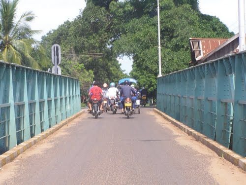
Traffic on the old bridge
Taking down segments of the old bridge
Construction of the new bridge
The old "French" bridge on the west side of Pakse was a real bottleneck for traffic as it was very narrow and the traffic flow was regulated with traffic lights. This bridge has now been replaced by a new bridge while the road through Pakse has been widened to a 4-lane road. Here are a few pictures of the old bridge - sorry no pictures yet of the new bridge.

Traffic on the old bridge

Taking down segments of the old bridge

Construction of the new bridge
Lone Rider
Blokes Who Can
The new bridge in Pakse replacing the old "French Bridge" opened yesterday (10 April) and is now open for traffic
The old "French" bridge on the west side of Pakse was a real bottleneck for traffic as it was very narrow and the traffic flow was regulated with traffic lights. This bridge has now been replaced by a new bridge while the road through Pakse has been widened to a 4-lane road. Here are a few pictures of the old bridge - sorry no pictures yet of the new bridge.
View attachment 46752
Traffic on the old bridge
View attachment 46751
Taking down segments of the old bridge
View attachment 46753
Construction of the new bridge
New Xedon-3 Bridge ready to serve Pakxe
The newly completed Xedon-3 bridge in Pakxe district, Champassak province is ready to boost transport and economic development for local communities. The new Xedon-3 bridge, costing more than at US$14 million, was officially opened on Sunday after construction work on the project began in 2013. Funding for the project came from Lao World Real Estate Company with the government to payback the company within 7 years.

The concrete bridge is 232 metres long and 17 metres wide consisting of 4 vehicle lanes and two sidewalks. The bridge will help to boost trade along the river by providing easier transport access. Lao World Public Company President Mr Sackchai Wongmalasith (Peter Chan) on behalf of Lao World Real Estate Company said, “At the beginning, the bridge was only going to be 11 metres wide and consist of two lanes, but our company wanted it to be bigger. So, we made a new decision and increased it to be 17 metres wide with 4 lanes for free, adding to our budget by 20 percent.”
Source: New Xedon Bridge (Latest Update April 11, 2016)
- Joined
- Aug 15, 2012
- Bikes
- KTM 613 EXC, BMW R90S & Dakar, MZ250, Norton 16H, Honda - 500 Fs & Xs, DRZs, XLs XRs CRFs CT110s etc
I'd be interested to hear if anyone knows the fate of the village on Route 4B where the major works have been happening. Can't recall the village name, but it's about 2 hours from Luang Prabang, heading to Hongsa.
Here's a couple of shots of the work and the village. I've always stopped there and had a beer, or noodles, or both... on my way through. It just seems to have an ominous look to it all from the air. A couple of drone shots from our last time through, in February.

and the village

Here's a couple of shots of the work and the village. I've always stopped there and had a beer, or noodles, or both... on my way through. It just seems to have an ominous look to it all from the air. A couple of drone shots from our last time through, in February.

and the village

Lone Rider
Blokes Who Can
I'd be interested to hear if anyone knows the fate of the village on Route 4B where the major works have been happening. Can't recall the village name, but it's about 2 hours from Luang Prabang, heading to Hongsa.
Here's a couple of shots of the work and the village. I've always stopped there and had a beer, or noodles, or both... on my way through. It just seems to have an ominous look to it all from the air. A couple of drone shots from our last time through, in February.

and the village

Will be leaving next week for Laos and might take the 4B on my way to Luang Prabang and, time permitting, will have a look.
- Joined
- Aug 15, 2012
- Bikes
- KTM 613 EXC, BMW R90S & Dakar, MZ250, Norton 16H, Honda - 500 Fs & Xs, DRZs, XLs XRs CRFs CT110s etc
A couple more shots of the roadworks on the section of Route 1E from Lak Xao, down past the reservoir to Nakai. My bike took a real hammering on this section in 2012 and I spent 5 days or so waiting for new wheel bearings in Nakai (yeah, yeah... I carry spares now). It won't be long by the look of it and it'll be a stroll in the park


Lone Rider
Blokes Who Can
A couple more shots of the roadworks on the section of Route 1E from Lak Xao, down past the reservoir to Nakai. My bike took a real hammering on this section in 2012 and I spent 5 days or so waiting for new wheel bearings in Nakai (yeah, yeah... I carry spares now). It won't be long by the look of it and it'll be a stroll in the park


Road 1E from Lak Xao to Gnommalat
Thanks for posting these pictures and Yes, road 1E is now mostly paved except for a 20 km. stretch starting a bit south of Lak Xao (February 2016) and with some luck the whole road could be paved before the rainy season starts this year in May/June.
Lone Rider
Blokes Who Can
New Laos-Vietnam border checkpoint for Luang Prabang
Work will begin on a new Laos-Vietnam border checkpoint in Luang Prabang province in 2015, moving the checkpoint from the province's mountainous areas to Naluang village in Phonthong district. Luang Prabang provincial Public Works and Transport Department Director, Mr Fasanan Thammavong, told Vientiane Times on Monday the border checkpoint could not be further developed at its present location, about 8km from Nasone village, as the area was too mountainous.
View attachment 20279
Naluang has been selected as the new international border checkpoint as part of a provincial strategy to develop the poverty-stricken village. The village is located in a flatland area, making it suitable for building the water systems, car parks, petrol stations, markets, hotels and transport facilities required at a border crossing. Luang Prabang province shares a border with Vietnam's Dien Bien Phu province. Last Friday, the Lao Ministry of Public Works and Transport signed a memorandum of understanding with its Vietnamese counterpart to build a new road between Luang Prabang's Phouthipheuang and Nasone areas and the Laos-Vietnam border.
The 104.7km road will bypass the centre of Phonthong district to avoid traffic congestion. Transport Engineering Design Inc. of Vietnam (TEID-Vietnam) will work with Luang Prabang provincial authorities to survey and design the new road. Vietnam's Ministry of Transportation will suggest TEID-Vietnam complete the survey by October 15 and submit a report to the two countries' governments. Mr Fasanan said work on the road, which will be constructed with two layers of asphalt, would begin in late 2014 or early 2015, as would work on the new border crossing. Luang Prabang provincial Public Works and Transport official, Mr Khamsy Souvanthong, said the new road would begin at the Road No. 1C junction in Ngoy district and extend to the border. He said main roads in the centre of Phonthong district would be paved with asphalt as part of the project.
Vientiane Times
I posted this article in the Vientiane Times in August 2013. Things move slow in Laos and the Vientiane Times of yesterday (30 May 2016) or about 3 years later indicate that: Government eyes restoration of Luang Prabang-Vietnam road link. The survey and design of a 104.7km road between the Phouthipheuang and Nasone areas in Luang Prabang province to the border with Vietnam's Dien Bien province is now complete
Lone Rider
Blokes Who Can
The Vientiane Times reported on 5 May 2016 in a short note that
Work begins on 165km Khammuan-Savannakhet road upgrade
The government will spend over 1 trillion kip to rebuild the 165-km dirt road that links the two provinces of Khammuan and Savannakhet.
==========================================
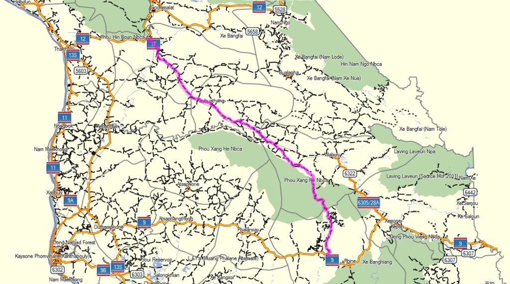
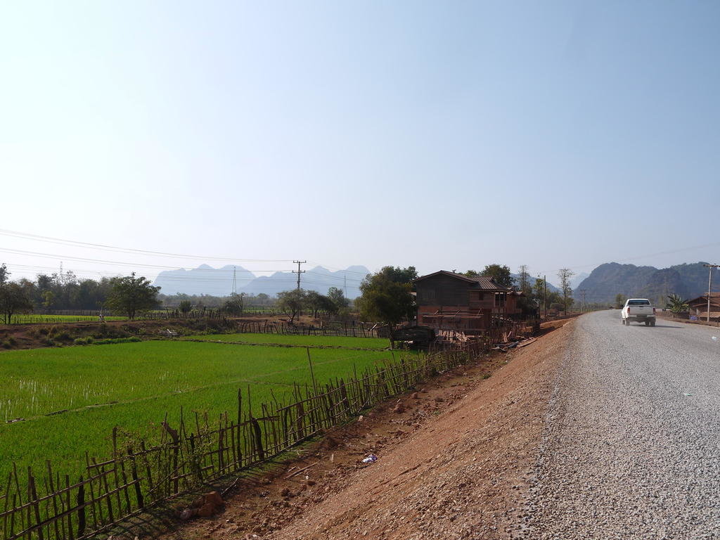
Up to now I have not yet been able to find any additional information other than that it most probably is an upgrade of Rd 1F from Mahaxay on Rd. 12 in Khammouane to Ban Xaisomboun on Rd 9 (Phin District) in Savannakhet which is about 160 km. long. In case I get additional info I will report it here.
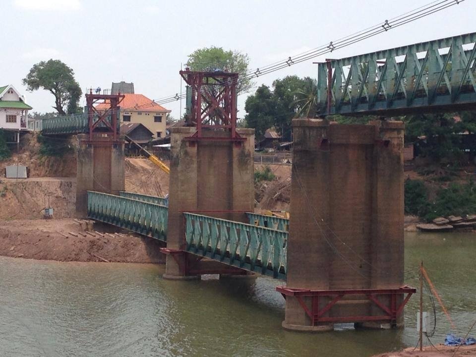
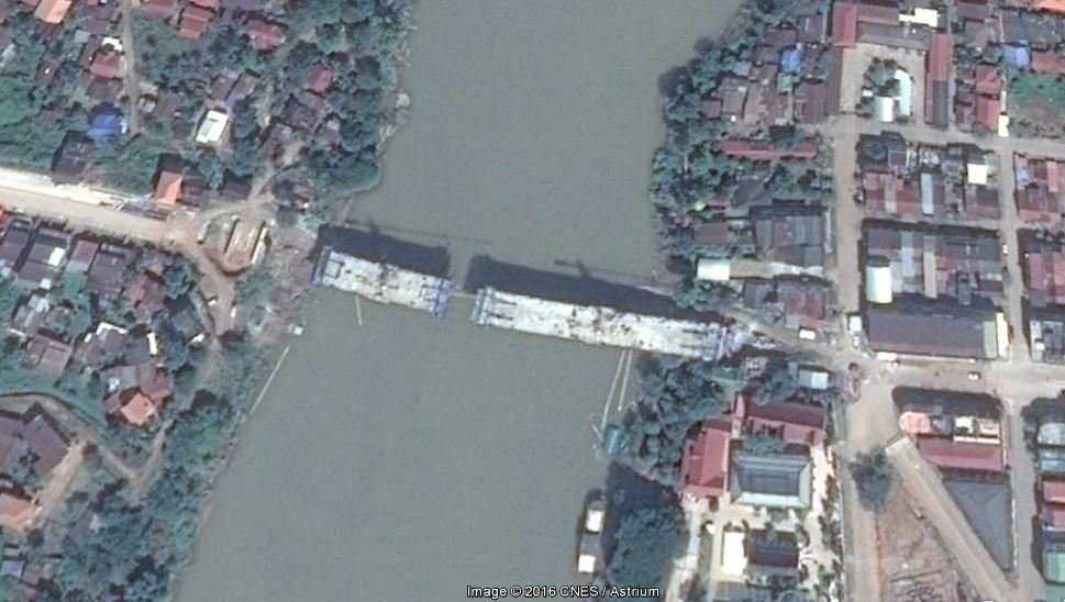
Part of Rd. 1F from Mahaxay on Rd. 12 to the bridge over the Xe Bangfai river at Phova Tai/Mahaxay was upgraded and paved a few years ago over a length of 8 km (see picture below).
Work begins on 165km Khammuan-Savannakhet road upgrade
The government will spend over 1 trillion kip to rebuild the 165-km dirt road that links the two provinces of Khammuan and Savannakhet.
==========================================
Up to now I have not yet been able to find any additional information other than that it most probably is an upgrade of Rd 1F from Mahaxay on Rd. 12 in Khammouane to Ban Xaisomboun on Rd 9 (Phin District) in Savannakhet which is about 160 km. long. In case I get additional info I will report it here.

Part of Rd. 1F from Mahaxay on Rd. 12 to the bridge over the Xe Bangfai river at Phova Tai/Mahaxay was upgraded and paved a few years ago over a length of 8 km (see picture below).

Lone Rider
Blokes Who Can
No progress on new Vientiane-Champassak highway
One year has passed but the new Vientiane-Champassak highway survey and design has not progressed following a Chinese company signing an agreement with the Ministry of Public Works and Transport. Recent images posted on social media showing the new impressive Vientiane to Champassak province highway design have caught the public's attention.
An official from the Ministry of Public Works and Transport, who did not wish to be named, told Vientiane Times on Tuesday that a Chinese company signed documents in Vientiane in May last year for the road survey and design. So far the construction company has yet to undertake the work. “We are now writing a letter to the company informing them that if they cannot perform the survey and design then the ministry will announce the cancellation of the project,” he revealed. Normally, construction companies start working on road survey and design within one month after signing with ministry or provincial officials.
The Vientiane-Champassak highway greenfield project will involve construction over a totally new route rather than upgrading the existing Road No. 13 South. Currently, Road No. 13 South, starts at the Dongdok intersection in Vientiane and heads south via Borikhamxay province. Members of the public are wondering why the ministry needs to construct a totally new road along the entire route from Vientiane to Champassak rather than incorporating much of the existing Road No. 13 South into the design.
Meanwhile, a study for a toll-way north of the capital has finished with the ministry assessing the pros and cons of upgrading the arterial highway to cater for the increasing traffic volume. Road No. 13 North may be rebuilt from the Sikeut junction in Vientiane to the bus station in Vangvieng district, a distance of 142 kilometres. Under consideration is a plan to make 57 km of the road, running from the Sikeut junction to Phonhong district in Vientiane province, into a four-lane highway, followed by an 85km two-lane stretch from there to Vangvieng, all of which would be asphalted.
Source: Vientiane Times (Latest Update June 15, 2016) - http://vientianetimes.org.la/
blackwolf
Senior Member
- Joined
- Mar 7, 2014
- Bikes
- Honda Sonic 125cc, 4 wheels, about to buy a 250cc dirt bike
Will be leaving next week for Laos and might take the 4B on my way to Luang Prabang and, time permitting, will have a look.
Nice shots. Who's drone took these shots? Did you bring along one or did you google and find this picture online?
- - - Updated - - -
Will be leaving next week for Laos and might take the 4B on my way to Luang Prabang and, time permitting, will have a look.
Nice shots. Who's drone took these shots? Did you bring along one or did you google and find this picture online?
blackwolf
Senior Member
- Joined
- Mar 7, 2014
- Bikes
- Honda Sonic 125cc, 4 wheels, about to buy a 250cc dirt bike
No progress on new Vientiane-Champassak highway
One year has passed but the new Vientiane-Champassak highway survey and design has not progressed following a Chinese company signing an agreement with the Ministry of Public Works and Transport. Recent images posted on social media showing the new impressive Vientiane to Champassak province highway design have caught the public's attention.
View attachment 47060
Road No.13 South connects Champassak province to the capital. (File photo)
An official from the Ministry of Public Works and Transport, who did not wish to be named, told Vientiane Times on Tuesday that a Chinese company signed documents in Vientiane in May last year for the road survey and design. So far the construction company has yet to undertake the work. “We are now writing a letter to the company informing them that if they cannot perform the survey and design then the ministry will announce the cancellation of the project,” he revealed. Normally, construction companies start working on road survey and design within one month after signing with ministry or provincial officials.
The Vientiane-Champassak highway greenfield project will involve construction over a totally new route rather than upgrading the existing Road No. 13 South. Currently, Road No. 13 South, starts at the Dongdok intersection in Vientiane and heads south via Borikhamxay province. Members of the public are wondering why the ministry needs to construct a totally new road along the entire route from Vientiane to Champassak rather than incorporating much of the existing Road No. 13 South into the design.
Meanwhile, a study for a toll-way north of the capital has finished with the ministry assessing the pros and cons of upgrading the arterial highway to cater for the increasing traffic volume. Road No. 13 North may be rebuilt from the Sikeut junction in Vientiane to the bus station in Vangvieng district, a distance of 142 kilometres. Under consideration is a plan to make 57 km of the road, running from the Sikeut junction to Phonhong district in Vientiane province, into a four-lane highway, followed by an 85km two-lane stretch from there to Vangvieng, all of which would be asphalted.
Source: Vientiane Times (Latest Update June 15, 2016) - http://vientianetimes.org.la/
I wouldn't hold my breath on any of these projects. In particular, building a whole new road separate to the existing Vientiane-Pakse (Champasak) highway makes absolutely no sense whatsoever. The existing road has very little traffic compared to anything across the border in Thailand or Vietnam and is actually one of the better roads in the whole country. Fairly flat, relatively straight and wide enough for most traffic to pass each other without having to slow down and go into the gutter.
The Vientiane Times is an absolutely unrealistic, overly optimistic communist propaganda bs mouthpiece. They can't even put together a proper website. The layout looks straight out of AltaVista's 1996 search engine.
Late last year they announced they would be upgrading the remaining 112km of the 140km road from Vientiane to Paksan to 4 lanes in their words "international standard" in just one year, by the end of 2016. Yet as of March this year, they haven't managed to do anything other than mark out the boundaries of the road with string, in a few places. 1 year to finish a road project? Not even in China do they manage to finish things that quickly. My guess is it will take them another 2-3 years just to finish the survey and perhaps in 10 years (if we're lucky) the project might be completed.
The latter announcement to upgrade the road to Vang Vieng was also made last year. Again, no progress. When I last drove that road in the evening hours from VV to Vientiane in late September last year, it was absolutely horrendous. So many potholes it felt like the US air force just recently came back to carpet bomb the road.
blackwolf
Senior Member
- Joined
- Mar 7, 2014
- Bikes
- Honda Sonic 125cc, 4 wheels, about to buy a 250cc dirt bike
Road 17 B - Muang Sing to Xiengkok and the Laos-Myanmar Friendship Bridge
The final unpaved section of Road No. 17B linking the Laos-Myanmar Friendship Bridge to Luang Namtha province is currently being surveyed prior to asphalt being laid. A 15-kilometre stretch of road links the bridge to Xiengkok village in Long district, of which about 10 km have already been sealed with asphalt. The Laos-Myanmar bridge also links to the Chinese border about 94 kilometres away through Long district.
The bridge, which crosses the Mekong River, is still waiting for the requisite legislation to be passed by Laos and Myanmar before opening to international traffic. At present it is used as an informal border crossing by local people for the sale of goods and personal visits. Authorities hope to open the Laos-Myanmar bridge to all traffic in the very near future so as to benefit from the changes introduced by the Asean Economic Community.
Source: Adapted from Vientiane Times By Khonesavanh Latsaphao, (Latest Update December 29, 2015)
International traffic is unlikely to be allowed to pass this border crossing until Myanmar opens up the Kengtung to Taunggyi highway to foreigners AND the country opens up it's borders to vehicles in general. Currently, foreign registered vehicles from Thailand, China and India are allowed into Myanmar across their respective borders, but only within a short distance from the border, usually on day trips. While foreign travelers are allowed to travel into the interior of Myanmar overland across 4 Thai-Myanmar border crossings, cars and motorcycles apart from those mentioned on day trips require a tour.
While I think there is a possibility that Myanmar will open up the Lao-Myanmar bridge to foreign travelers within about a year or so, it will probably take many more before vehicles can freely cross. Before that happens, bilateral agreements on cross border traffic need to be signed.
Even once it does, it won't be of much interest to anyone since traffic volume in that part of the region is tiny. Restrictions on Chinese vehicles crossing into Myanmar will probably also limit any significant interest in crossing there. It may benefit trade somewhat, but until a better series of roads are built on both sides of the border, linking the Chinese and Thai borders through Myanmar territory no trucking operators will be interested either. Trade volume between Myanmar and Laos is almost zero. Currently, it's very straightforward to use the Boten to Huay Xai highway and this is unlikely to change anytime soon. That road benefits Thai and Chinese traders, while Myanmar trades extensively with China and Thailand through Muse/Ruili and Myawady/Mae Sot respectively.
I therefore can't see any real benefit of the Lao-Myanmar bridge whatsoever.
Lone Rider
Blokes Who Can
Nice shots. Who's drone took these shots? Did you bring along one or did you google and find this picture online?
We took the drone with us into Laos and shot this movie of the 4B as well as several others while "on the road" earlier this year.
Some of the drone movies shot during this trip can be found in this thread: Some drone shots in Laos


