You are using an out of date browser. It may not display this or other websites correctly.
You should upgrade or use an alternative browser.
You should upgrade or use an alternative browser.
Recky tour - Chiang Mai to the Tibet border / Kawa Karpo at 6,740 meters (22,113')
- Thread starter KTMphil
- Start date
KTMphil
Senior member
Out of paradise and into the big town of Weixi
View attachment 17764
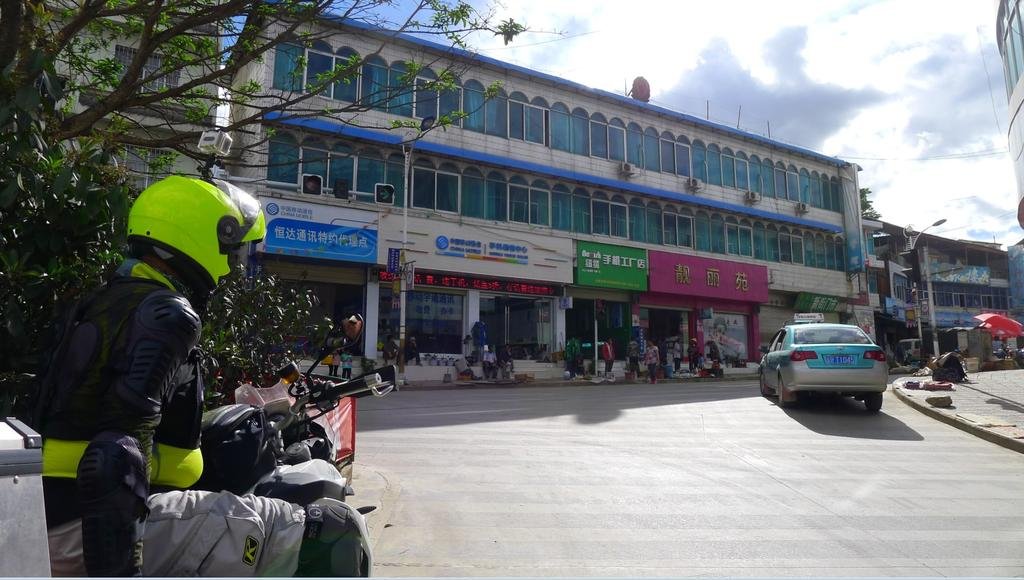
Being a town that 99.9% of people will never even of heard of, we tried to find out a little about Weixi (because it's not all about the riding, we like to immerse in the local culture of the places we are fortunate enough to visit).
Weixi, which is in the Deqin prefecture of Yunan Province, used to be a very important town as it was on the "tea horse and caravan road" (In layman's terms - the easy route through the Himalayas with horses)
The "Tea and Horse Caravan Road" of Southwest China is less well known than the famous Silk Road. Its route crosses some very high and dangerous terrain. It begins from Sichuan and Yunnan provinces in Southwest China, runs along the eastern foothills of the Hengduan Mountains, a center of tea production in China, then crosses the Hengduan mountain range and deep canyons of several major rivers, the Yalong, the Jinsha (the upper reaches of Yangtze), the Lancang (Mekong), and the Nu (Salween), thus spanning the two highest plateaus of China (Qinghai-Tibet and Yunnan-Guizhou) before finally reaching India south of the Himalayas.
The name of the road (Chamadao in the Chinese records meaning "the tea and horse road") indicates its importance in the trade of tea and horses, but other products passed along it as well. Horse caravans carried tea, sugar and salt from Sichuan and Yunnan to Tibet and brought back colorful local mountain goods. The Chinese over the ages often bought warhorses from Tibetan and other ethnic groups of Southwest China, and these too came over this road. The road also served as a significant corridor for migration as well as a channel for cultural communication among the ethnic groups in western China; beyond this, it was a bridge for international cultural and economic exchange between China and India. Although silk was not included in the trade goods carried over it, at times it has been termed the "Southern Silk Road of China," due to its importance in both economic and cultural aspects of Chinese history.


There is a high concentration of the Lisu tribe in Weixi
The Lisu are believed to originate from eastern Tibet. Research done by Lisu scholars indicates that they moved to northwestern Yunnan. They inhabited a region across Baoshan and the Tengchong plain for thousands of years. The Lisu, Lahu, Akha and Kachin languages are Tibetan-Burman languages, distantly related to Burmese and Tibetan.[SUP][5][/SUP][SUP][6][/SUP][SUP][7][/SUP][SUP][8][/SUP] After the Han Chinese Ming Dynasty, around 1140-1644 A.D. the eastern and Southern Lisu language and culture were greatly influenced by Han culture of China.[SUP][9][/SUP][SUP][10][/SUP] Taiping village in Yinjiang, Yunnan, China, was first established by Lu Shi Lisu people about 1000 years ago.[SUP][citation needed][/SUP] In the mid-19th century, Lisu peoples in Yinjiang began moving into Momeik, Burma, a population of Southern Lisu moved into Mogok, north-eastern Burma, and then in the late 19th century, moved into northern Thailand

Linguistically, the Lisu belong to theYi or Ngwi branch of the Sino-Tibetan family
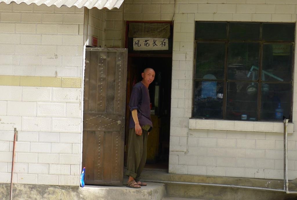
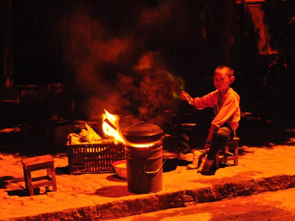
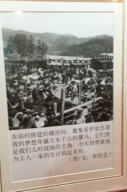
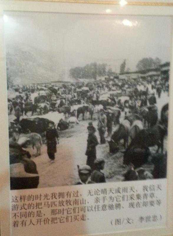
On the walls of the restaurant we dined at were ancient photo's of horse traders in Weixi town from the tea horse and caravan road days, with horses being of high importance
Weixi is also known for its world class orchids:
Orchid with quality class of propagation is known to the world, "Taibai" has won the second national orchid exposition. Weixi to experts were called "natural Rhododendron Garden", a total of 74 species of Rhododendron, 19 of which in the county is the original mode of origin, convex rhododendron leaf blade to 74 cm long, can be said of the world.

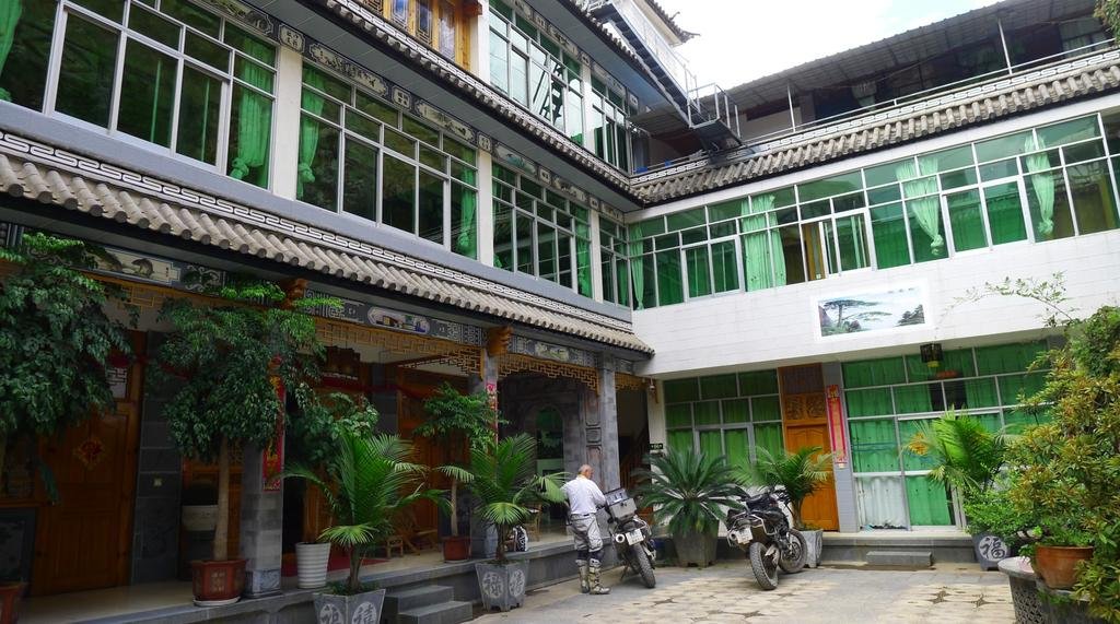
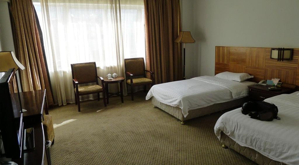
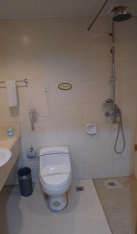
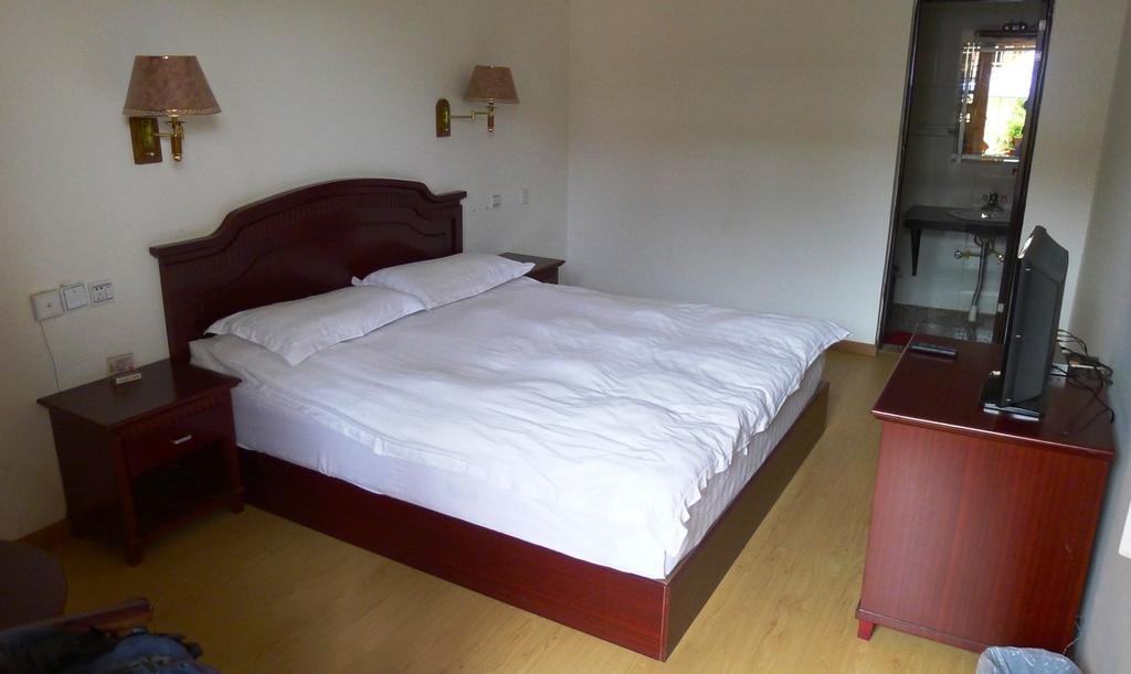
This is the best hotel in town - 200 Yuan
View attachment 17765
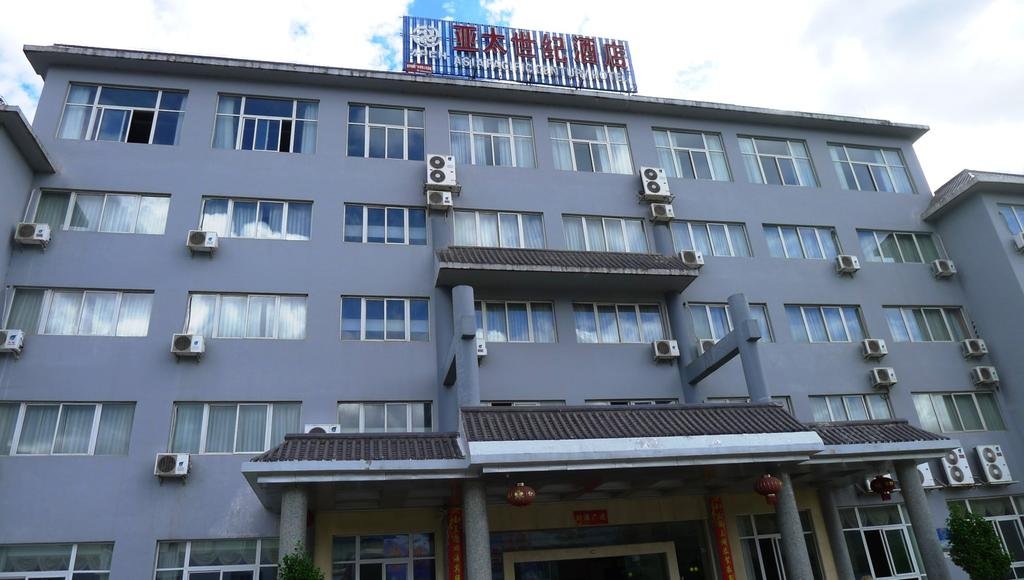
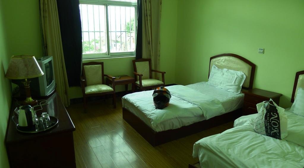
Big rooms with LAN internet in rooms
View attachment 17766
View attachment 17767
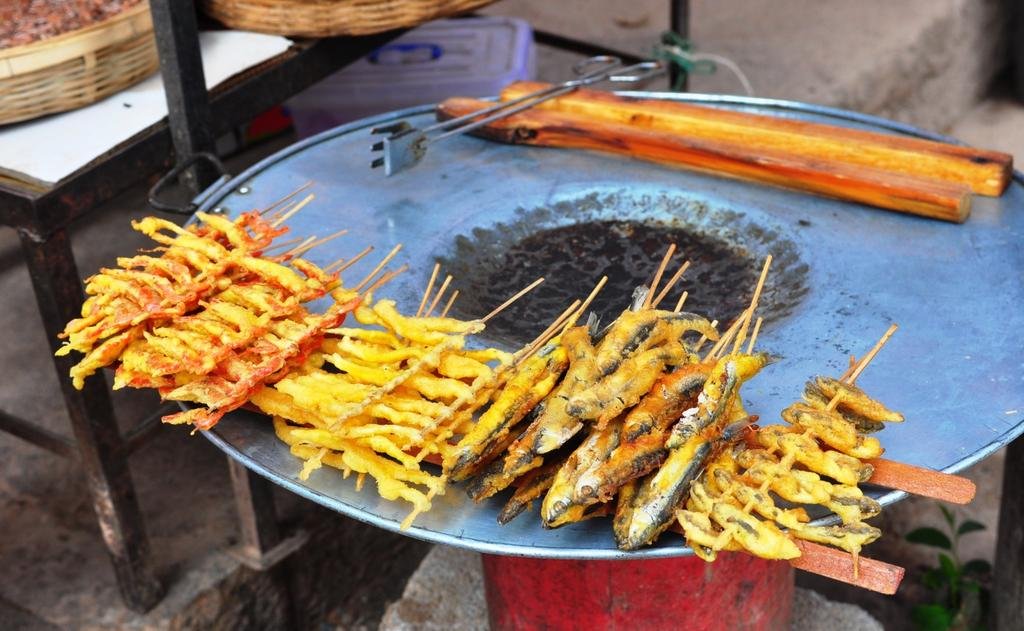
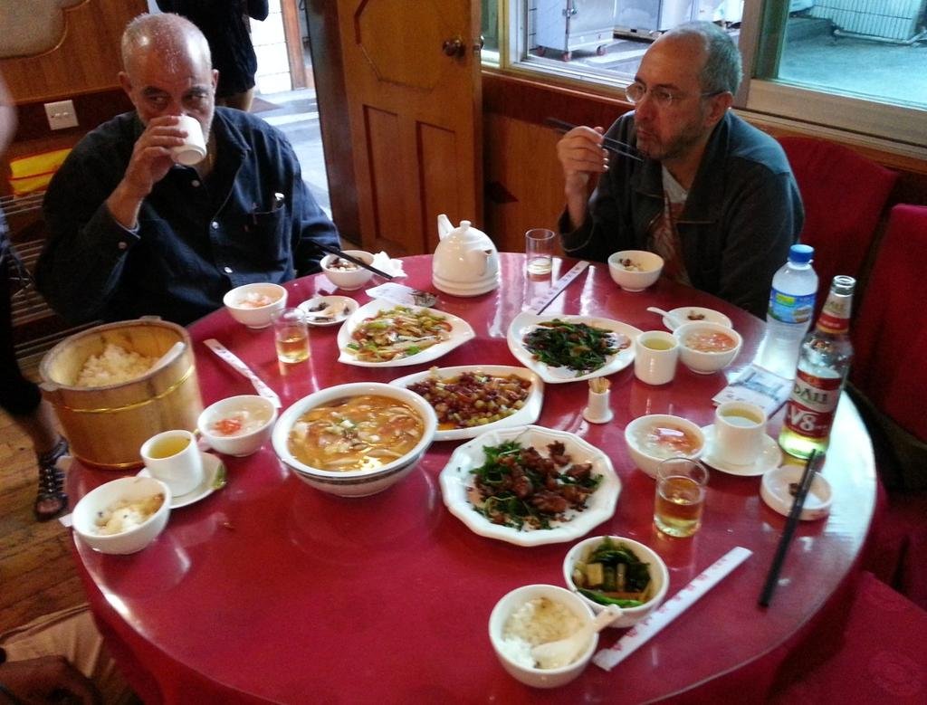
We found a decent restaurant in town that in the end produced some ice cold Dali beers
View attachment 17768
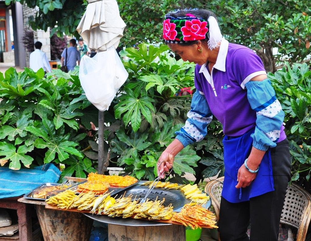
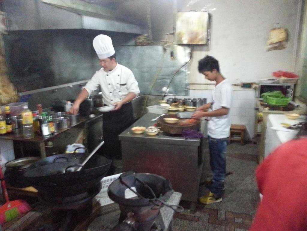
Cooked by these guys
View attachment 17769
View attachment 17764

Being a town that 99.9% of people will never even of heard of, we tried to find out a little about Weixi (because it's not all about the riding, we like to immerse in the local culture of the places we are fortunate enough to visit).
Weixi, which is in the Deqin prefecture of Yunan Province, used to be a very important town as it was on the "tea horse and caravan road" (In layman's terms - the easy route through the Himalayas with horses)
The "Tea and Horse Caravan Road" of Southwest China is less well known than the famous Silk Road. Its route crosses some very high and dangerous terrain. It begins from Sichuan and Yunnan provinces in Southwest China, runs along the eastern foothills of the Hengduan Mountains, a center of tea production in China, then crosses the Hengduan mountain range and deep canyons of several major rivers, the Yalong, the Jinsha (the upper reaches of Yangtze), the Lancang (Mekong), and the Nu (Salween), thus spanning the two highest plateaus of China (Qinghai-Tibet and Yunnan-Guizhou) before finally reaching India south of the Himalayas.
The name of the road (Chamadao in the Chinese records meaning "the tea and horse road") indicates its importance in the trade of tea and horses, but other products passed along it as well. Horse caravans carried tea, sugar and salt from Sichuan and Yunnan to Tibet and brought back colorful local mountain goods. The Chinese over the ages often bought warhorses from Tibetan and other ethnic groups of Southwest China, and these too came over this road. The road also served as a significant corridor for migration as well as a channel for cultural communication among the ethnic groups in western China; beyond this, it was a bridge for international cultural and economic exchange between China and India. Although silk was not included in the trade goods carried over it, at times it has been termed the "Southern Silk Road of China," due to its importance in both economic and cultural aspects of Chinese history.


There is a high concentration of the Lisu tribe in Weixi
The Lisu are believed to originate from eastern Tibet. Research done by Lisu scholars indicates that they moved to northwestern Yunnan. They inhabited a region across Baoshan and the Tengchong plain for thousands of years. The Lisu, Lahu, Akha and Kachin languages are Tibetan-Burman languages, distantly related to Burmese and Tibetan.[SUP][5][/SUP][SUP][6][/SUP][SUP][7][/SUP][SUP][8][/SUP] After the Han Chinese Ming Dynasty, around 1140-1644 A.D. the eastern and Southern Lisu language and culture were greatly influenced by Han culture of China.[SUP][9][/SUP][SUP][10][/SUP] Taiping village in Yinjiang, Yunnan, China, was first established by Lu Shi Lisu people about 1000 years ago.[SUP][citation needed][/SUP] In the mid-19th century, Lisu peoples in Yinjiang began moving into Momeik, Burma, a population of Southern Lisu moved into Mogok, north-eastern Burma, and then in the late 19th century, moved into northern Thailand

Linguistically, the Lisu belong to theYi or Ngwi branch of the Sino-Tibetan family
On the walls of the restaurant we dined at were ancient photo's of horse traders in Weixi town from the tea horse and caravan road days, with horses being of high importance


Weixi is also known for its world class orchids:
Orchid with quality class of propagation is known to the world, "Taibai" has won the second national orchid exposition. Weixi to experts were called "natural Rhododendron Garden", a total of 74 species of Rhododendron, 19 of which in the county is the original mode of origin, convex rhododendron leaf blade to 74 cm long, can be said of the world.

This is the best hotel in town - 200 Yuan
View attachment 17765

Big rooms with LAN internet in rooms
View attachment 17766

View attachment 17767

We found a decent restaurant in town that in the end produced some ice cold Dali beers
View attachment 17768

Cooked by these guys
View attachment 17769

KTMphil
Senior member
Some more on Weixi's history:
[h=2]History
[/h]From Tang Dynasty to Song Dynasty, the county have attached to the Tibet, Nanzhao, "Dali" jurisdiction. Yuan Yuan fourteen years (1277) Linxi County home, for the beginning of county governance. The Ming Dynasty, Linxi County building still continues. Chenghua four years (1468) after more than 100 years, Lijiang chieftain Mu and fan for the battle of Linxi, battle of Linxi County, to Wanli (1573 to 1620), throughout the Lijiang military government governance return of weixi.
 Weixi Lisu Autonomous County
Qing emperor Yong Zheng five years (in 1727) the chieftain, built in Weixi department, territory east across Jinsha River, north of Tibet Mangkam County, west of Nu River, northwest to the Longjiang, including the current Weixi, Deqin, Gongshan, Fugong County four and five rural habitats in Shangri-La county. At the beginning of Weixi Department jurisdiction of Heqing, twenty-one years of Qianlong (1756) after the government is Lijiang.
In 2 years (in 1913) to set up Weixi County, Deqin, Fugong, Yama successively. In 37 years (1948) Office of the chief inspector thirteenth had arranged in the county.
In May 12, 1949, the leadership of the party organizations of the party in the armed forces of the people on the riots, overthrew the Kuomintang leadership in Weixi County Government, established a temporary government. In October 1st of the same year, the formal establishment of Weixi County People's government, the Lijiang area jurisdiction. 1957 was placed under the Diqing Tibetan Autonomous prefecture.
June 11, 1985, approved by the State Council to revoke the Weixi County, establish Weixi Lisu Autonomous County, Autonomous County People's Government in the same year, was formally established in October 13th, is still under Di Qingzhou .
 Weixi Lisu Autonomous County
In 1961 five exit zone (township) was placed under the Zhongdian county (now the Shangri-La County).
In December 8, 1965, Sixth District, Lanping County, Nu River (Providence) 10 communes, 115 production teams of 1950 families of 8071 people, was placed under the Weixi Lisu Autonomous county.
Jurisdiction over 1 towns, 9 townships of Lisu Nationality Autonomous County Weixi lisuzu 1997:
And the town area of 14 sq km, population 9000. Jurisdiction street, 2 rural village.
Yongchun Township, an area of 662 square km, population 22000. Xia Yongchun, Laba bottom, high springs, Rome, pull, pull on the river column, blue permanent, tri village, dragging branches, Qing temple, four micron, chrysanthemum, 13 village committees.
Bardi Township, an area of 601 square km, population 7000. Jurisdiction over Bardi, sworn, O ruler, Luo Yi, play the GA s, holding eight village 6.
...... (this missing data)
* * above regionalization list, area, population data according to the "ceremony" Chinese Administrative Region, data as of 1997. Note: the data to be sorted through supplement
[h=2]History
[/h]From Tang Dynasty to Song Dynasty, the county have attached to the Tibet, Nanzhao, "Dali" jurisdiction. Yuan Yuan fourteen years (1277) Linxi County home, for the beginning of county governance. The Ming Dynasty, Linxi County building still continues. Chenghua four years (1468) after more than 100 years, Lijiang chieftain Mu and fan for the battle of Linxi, battle of Linxi County, to Wanli (1573 to 1620), throughout the Lijiang military government governance return of weixi.

Qing emperor Yong Zheng five years (in 1727) the chieftain, built in Weixi department, territory east across Jinsha River, north of Tibet Mangkam County, west of Nu River, northwest to the Longjiang, including the current Weixi, Deqin, Gongshan, Fugong County four and five rural habitats in Shangri-La county. At the beginning of Weixi Department jurisdiction of Heqing, twenty-one years of Qianlong (1756) after the government is Lijiang.
In 2 years (in 1913) to set up Weixi County, Deqin, Fugong, Yama successively. In 37 years (1948) Office of the chief inspector thirteenth had arranged in the county.
In May 12, 1949, the leadership of the party organizations of the party in the armed forces of the people on the riots, overthrew the Kuomintang leadership in Weixi County Government, established a temporary government. In October 1st of the same year, the formal establishment of Weixi County People's government, the Lijiang area jurisdiction. 1957 was placed under the Diqing Tibetan Autonomous prefecture.
June 11, 1985, approved by the State Council to revoke the Weixi County, establish Weixi Lisu Autonomous County, Autonomous County People's Government in the same year, was formally established in October 13th, is still under Di Qingzhou .

In 1961 five exit zone (township) was placed under the Zhongdian county (now the Shangri-La County).
In December 8, 1965, Sixth District, Lanping County, Nu River (Providence) 10 communes, 115 production teams of 1950 families of 8071 people, was placed under the Weixi Lisu Autonomous county.
Jurisdiction over 1 towns, 9 townships of Lisu Nationality Autonomous County Weixi lisuzu 1997:
And the town area of 14 sq km, population 9000. Jurisdiction street, 2 rural village.
Yongchun Township, an area of 662 square km, population 22000. Xia Yongchun, Laba bottom, high springs, Rome, pull, pull on the river column, blue permanent, tri village, dragging branches, Qing temple, four micron, chrysanthemum, 13 village committees.
Bardi Township, an area of 601 square km, population 7000. Jurisdiction over Bardi, sworn, O ruler, Luo Yi, play the GA s, holding eight village 6.
...... (this missing data)
* * above regionalization list, area, population data according to the "ceremony" Chinese Administrative Region, data as of 1997. Note: the data to be sorted through supplement
KTMphil
Senior member
Tomorrow - Weixi to Shaxi, a spectacularly preserved ancient Yunan town.
Shaxi China Old Theatre Inn - Shaxi - China
Shaxi China Old Theatre Inn - Shaxi - China
harrygps
Senior Member
Million BIG WOW!! Great tour.
WarProfiteer
Senior Member
- Joined
- May 17, 2013
- Bikes
- currently renting & deciding
I probably wont be in CM in October, but for future reference, has a range or price point been set for this intended tour route?
KTMphil
Senior member
I probably wont be in CM in October, but for future reference, has a range or price point been set for this intended tour route?
Kevin - Reed will work it all out once we're back in Chiang Mai.
KTMphil
Senior member
Reed's coverage of our ride around the Tibetan border region over the last couple of days
Shangri-La Here We Come - A Motorcycle Touring Blog from Chiang Mai, Thailand to the Tibet-China Border - Asian Motorcycle Tours - Thailand, Laos, Cambodia, Vietnam Motorcycle Tours
Post #8 & Post #9
Dateline: Friday, June 7; time: early morning.
Welcome to the “Shangri-La Here We Come” Blog.
So sorry, interested readers for missing yesterday’s post. We stayed in a shithole of a hotel last night. My only furniture was a bed; couldn’t set up my computer gear to write. Bad internet connection. Dead tired as well. Sensory overload of the highest degree. More below……
Yesterday’s (Wednesday’s) destination: Diqen
Riding distance to Diqen from Shangri-La: 188 kms.
Driving (moving) time): 4:32
Moving average: 41.4 kph.
Diqen elevation: 3458 meters
Highest elevation reached: 4292 meters (highpoint on this tour).
Total trip cumulative distance to Diqen: 2239 kms.
Trip track shown on map below:
 Route-Chiang Mai to Weixi
Thursday, June 6 present location: Weixi with side trip to Tibet border.
Riding distance to Weixi from Diqen including side trip to Tibet border: 330 kms.
Driving (moving) time): 6:14
Moving average: 55.1
Weixi elevation: 2247 meters
Highest elevation reached: 3467 meters
Total trip cumulative distance: 2569 kms.
Trip track shown on map below:
 Last 2 days: Shangri-La to Kara Karpo to Tibet Border – Turn around – Drive south to Weixi
Phil Gibbins is taking a ton of photos, way more than me. He is posting them online on his RideAsia.net rider forum. But this url changes daily. To see the photos from our ride to Diqen, the Tibet border, and Weixi, you can view them at the following 2 urls:
To Diqen:
http://www.rideasia.net/motorcycle-...-karpo-6-740-meters-22-113-a-6.html#post29646
To the Tibet border and return, then on to Weixi:
http://www.rideasia.net/motorcycle-...-karpo-6-740-meters-22-113-a-8.html#post29761
Tomorrow’s destination: Shaxi
Approximate distance: 220 kms
Guesstimate driving time: 6 hours
Hello Interested Parties,
Somehow, someway, the riding just gets better and better and better. Today, though, we finally hit some bad road conditions due to a lot of landslide activity along the route. Some parts were downright hairy; still great fun in a sick sort of way. Always feels good to survive a ride.
Let me start off with yesterday’s ride to Kawa Karpo, the world’s highest unclimbed mountain at 6740 meters. To get there we had to drive up and down and up and down and up again the three river basins of three of the most important rivers in Asia. From east to west, they are; the Yangtze, the Mekong, and the Salween. These rivers run basically parallel to each other in upper Yunnan Province for a couple of hundred kilometers, rushing south from their headwaters deeper inside the Himalayas. In my rough estimation, as the bird flies, the three rivers are no more than fifty kilometers apart but separated by high mountain ridges in the 5000 meter range. Only one road connects all three, Rt. G 233 and this is what we drove north northwest on all day. The mountains around us still have snow cover in early June, and some of them are glaciated, like Kara Karpo itself. If we are not on the roof of the world, we are close to it.
The road conditions continue to be excellent, and we could be driving a lot faster than we are, but the jaw-dropping scenery is holding us up, as are frequent photo stops. In fact, anywhere you point a camera, you will wind up with a dramatic photo of nature at its most awesome. You should look at some of Phil Gibbins photos at the url at the top of this page to see firsthand what we are experiencing on our bikes. Meanwhile, here is a GPS screenshot of one section of road.
 GPS track from ride to Weixi
It is amazing that the Chinese built such great roads in such a rugged and remote region, but thank you very much. The people living in northwestern Yunnan are Tibetans, not the predominant Han Chinese, and it is said that they live a more traditional lifestyle than their brethren in most of Tibet. Their main livelihood seems to be animal husbandry, especially yaks, as they are well suited to life at altitudes above 3000 meters.
Their houses are huge, square around the base, two or three stories high, with slightly inward leaning, slightly trapezoidal walls. The eaves, rooflines, and gateways are intricately carved and colorfully painted. I would love to live in one.
The Tibetans believe that one of their gods dwells on Kawa Karpo. Tibetan pilgrims from all over make a point to visit it sometime in their lives. The way they pay homage to the god is to walk around the base which takes more than a week.
Phil, George, and I paid homage to Kawa Karpo by driving to it, muttering thanks all the way for making such a ride possible. I thought I would have had some kind of epiphany when I arrived there because of the statue I have in my apartment, but the wonder I felt at seeing such an awesome mountain was shared equally by every visitor in the town of Diqen.
We never saw the entirety of Kawa Karpo because part of it was always hidden in clouds, but I do think I saw the peak briefly in a small slot in the cloud cover.
Our hotel in Diqen was a shithole, as I mentioned earlier. But other choices were even poorer. There was one expensive option, the USD400/night Regalia hotel. That was beyond all of our budgets, even if all six of us crammed into one room.
Today, Thursday morning, George woke up with a fever, chills, and a headache and was not able to ride his bike. We let George sleep in late and Phil and I rode northwards with Pae following in the 4×4 to the Tibet-China border just to see what we could see. We knew we couldn’t get through because we didn’t have the right paperwork, nor did we want to. We just needed the slimmest of excuses to ride our mcs anywhere there was a road. And just like all the other roads, this one was another great one.
It was 55 kms to the border and the same back to Diqen. When we returned, George still was feeling ill and could not ride his bike, so he let our ground handler, Jah, ride his mc, and he rode in the pick-up.
We left Diqen before noon and rode down from the Himalaya Plateau on into the Mekong River Basin. The Tibetans and their homes and culture gradually dissipated and Han Chinese culture took over, which is based on irrigated rice growing.
We followed the Mekong River most of the day. Sometimes the road was several hundred meters above it but by the end of the day we were just a little ways above the river surface itself. The Mekong up here is an angry young river and the part we first followed was filled with roiling rapids. High, sheer cliffs hemmed the Mekong in, and hundreds of waterfalls running crystal clear added to the surging flow.
The river road started out at around 2000 meters, and by the end of the day we ever so gradually descended to 1700 meters before climbing out of the river basin to tonight’s hotel in Diqen.
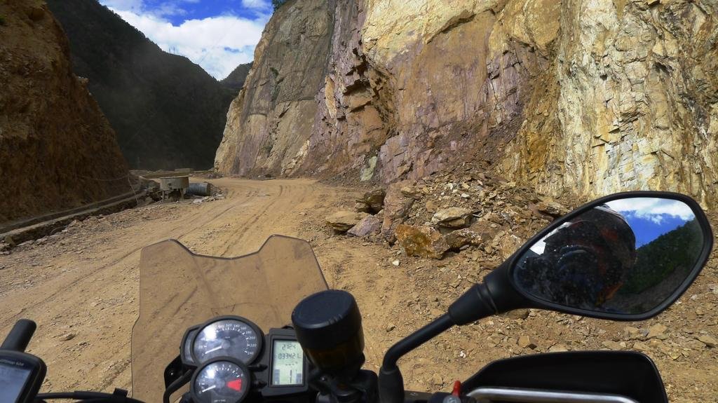
The sheer cliffs and ridges hemming in the Mekong are prone to landslides and this damaged the road surface in hundreds of places during the day. The near-perfect road conditions finally petered out.
At one point there was a landslide in progress, and dirt and rocks of various sizes tumbled down a steep canyon wall across the roadway. When the falling scree slowed down in volume and nothing big was tumbling across the road we made a dash across the landslide path.
 Riding through a landslide
But listen interested parties, it is after one in the morning and my brain is shutting down. I can’t write anymore and need to gotta get some sleep.
So until tomorrow, Bye, bye.
Shangri-La Here We Come - A Motorcycle Touring Blog from Chiang Mai, Thailand to the Tibet-China Border - Asian Motorcycle Tours - Thailand, Laos, Cambodia, Vietnam Motorcycle Tours
Post #8 & Post #9
Dateline: Friday, June 7; time: early morning.
Welcome to the “Shangri-La Here We Come” Blog.
So sorry, interested readers for missing yesterday’s post. We stayed in a shithole of a hotel last night. My only furniture was a bed; couldn’t set up my computer gear to write. Bad internet connection. Dead tired as well. Sensory overload of the highest degree. More below……
Yesterday’s (Wednesday’s) destination: Diqen
Riding distance to Diqen from Shangri-La: 188 kms.
Driving (moving) time): 4:32
Moving average: 41.4 kph.
Diqen elevation: 3458 meters
Highest elevation reached: 4292 meters (highpoint on this tour).
Total trip cumulative distance to Diqen: 2239 kms.
Trip track shown on map below:
 Route-Chiang Mai to Weixi
Thursday, June 6 present location: Weixi with side trip to Tibet border.
Riding distance to Weixi from Diqen including side trip to Tibet border: 330 kms.
Driving (moving) time): 6:14
Moving average: 55.1
Weixi elevation: 2247 meters
Highest elevation reached: 3467 meters
Total trip cumulative distance: 2569 kms.
Trip track shown on map below:
 Last 2 days: Shangri-La to Kara Karpo to Tibet Border – Turn around – Drive south to Weixi
Phil Gibbins is taking a ton of photos, way more than me. He is posting them online on his RideAsia.net rider forum. But this url changes daily. To see the photos from our ride to Diqen, the Tibet border, and Weixi, you can view them at the following 2 urls:
To Diqen:
http://www.rideasia.net/motorcycle-...-karpo-6-740-meters-22-113-a-6.html#post29646
To the Tibet border and return, then on to Weixi:
http://www.rideasia.net/motorcycle-...-karpo-6-740-meters-22-113-a-8.html#post29761
Tomorrow’s destination: Shaxi
Approximate distance: 220 kms
Guesstimate driving time: 6 hours
Hello Interested Parties,
Somehow, someway, the riding just gets better and better and better. Today, though, we finally hit some bad road conditions due to a lot of landslide activity along the route. Some parts were downright hairy; still great fun in a sick sort of way. Always feels good to survive a ride.
Let me start off with yesterday’s ride to Kawa Karpo, the world’s highest unclimbed mountain at 6740 meters. To get there we had to drive up and down and up and down and up again the three river basins of three of the most important rivers in Asia. From east to west, they are; the Yangtze, the Mekong, and the Salween. These rivers run basically parallel to each other in upper Yunnan Province for a couple of hundred kilometers, rushing south from their headwaters deeper inside the Himalayas. In my rough estimation, as the bird flies, the three rivers are no more than fifty kilometers apart but separated by high mountain ridges in the 5000 meter range. Only one road connects all three, Rt. G 233 and this is what we drove north northwest on all day. The mountains around us still have snow cover in early June, and some of them are glaciated, like Kara Karpo itself. If we are not on the roof of the world, we are close to it.
The road conditions continue to be excellent, and we could be driving a lot faster than we are, but the jaw-dropping scenery is holding us up, as are frequent photo stops. In fact, anywhere you point a camera, you will wind up with a dramatic photo of nature at its most awesome. You should look at some of Phil Gibbins photos at the url at the top of this page to see firsthand what we are experiencing on our bikes. Meanwhile, here is a GPS screenshot of one section of road.
 GPS track from ride to Weixi
It is amazing that the Chinese built such great roads in such a rugged and remote region, but thank you very much. The people living in northwestern Yunnan are Tibetans, not the predominant Han Chinese, and it is said that they live a more traditional lifestyle than their brethren in most of Tibet. Their main livelihood seems to be animal husbandry, especially yaks, as they are well suited to life at altitudes above 3000 meters.
Their houses are huge, square around the base, two or three stories high, with slightly inward leaning, slightly trapezoidal walls. The eaves, rooflines, and gateways are intricately carved and colorfully painted. I would love to live in one.
The Tibetans believe that one of their gods dwells on Kawa Karpo. Tibetan pilgrims from all over make a point to visit it sometime in their lives. The way they pay homage to the god is to walk around the base which takes more than a week.
Phil, George, and I paid homage to Kawa Karpo by driving to it, muttering thanks all the way for making such a ride possible. I thought I would have had some kind of epiphany when I arrived there because of the statue I have in my apartment, but the wonder I felt at seeing such an awesome mountain was shared equally by every visitor in the town of Diqen.
We never saw the entirety of Kawa Karpo because part of it was always hidden in clouds, but I do think I saw the peak briefly in a small slot in the cloud cover.
Our hotel in Diqen was a shithole, as I mentioned earlier. But other choices were even poorer. There was one expensive option, the USD400/night Regalia hotel. That was beyond all of our budgets, even if all six of us crammed into one room.
Today, Thursday morning, George woke up with a fever, chills, and a headache and was not able to ride his bike. We let George sleep in late and Phil and I rode northwards with Pae following in the 4×4 to the Tibet-China border just to see what we could see. We knew we couldn’t get through because we didn’t have the right paperwork, nor did we want to. We just needed the slimmest of excuses to ride our mcs anywhere there was a road. And just like all the other roads, this one was another great one.
It was 55 kms to the border and the same back to Diqen. When we returned, George still was feeling ill and could not ride his bike, so he let our ground handler, Jah, ride his mc, and he rode in the pick-up.
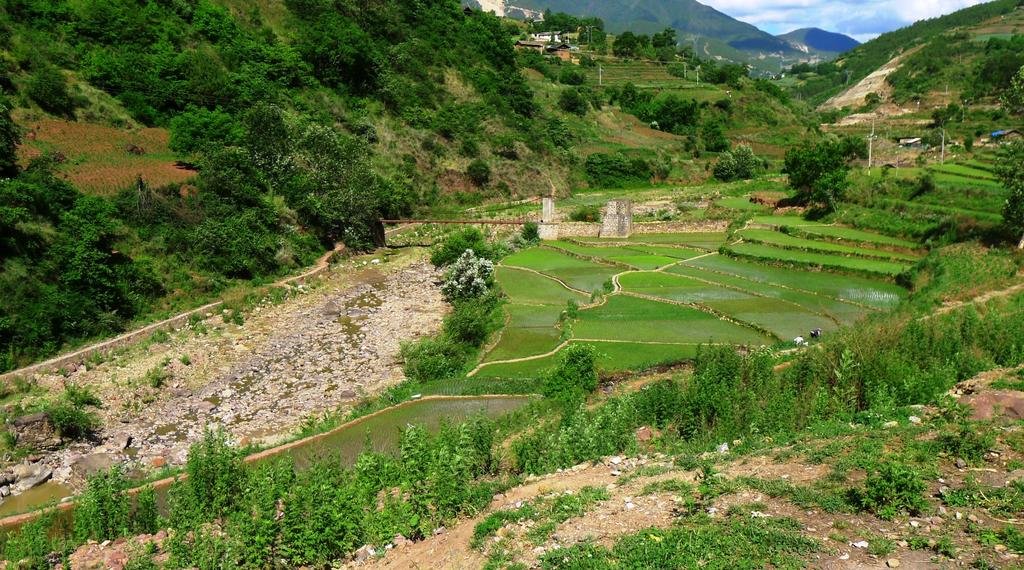
We left Diqen before noon and rode down from the Himalaya Plateau on into the Mekong River Basin. The Tibetans and their homes and culture gradually dissipated and Han Chinese culture took over, which is based on irrigated rice growing.
We followed the Mekong River most of the day. Sometimes the road was several hundred meters above it but by the end of the day we were just a little ways above the river surface itself. The Mekong up here is an angry young river and the part we first followed was filled with roiling rapids. High, sheer cliffs hemmed the Mekong in, and hundreds of waterfalls running crystal clear added to the surging flow.
The river road started out at around 2000 meters, and by the end of the day we ever so gradually descended to 1700 meters before climbing out of the river basin to tonight’s hotel in Diqen.
The sheer cliffs and ridges hemming in the Mekong are prone to landslides and this damaged the road surface in hundreds of places during the day. The near-perfect road conditions finally petered out.
At one point there was a landslide in progress, and dirt and rocks of various sizes tumbled down a steep canyon wall across the roadway. When the falling scree slowed down in volume and nothing big was tumbling across the road we made a dash across the landslide path.
 Riding through a landslide
But listen interested parties, it is after one in the morning and my brain is shutting down. I can’t write anymore and need to gotta get some sleep.
So until tomorrow, Bye, bye.
KTMphil
Senior member
KTMphil
Senior member
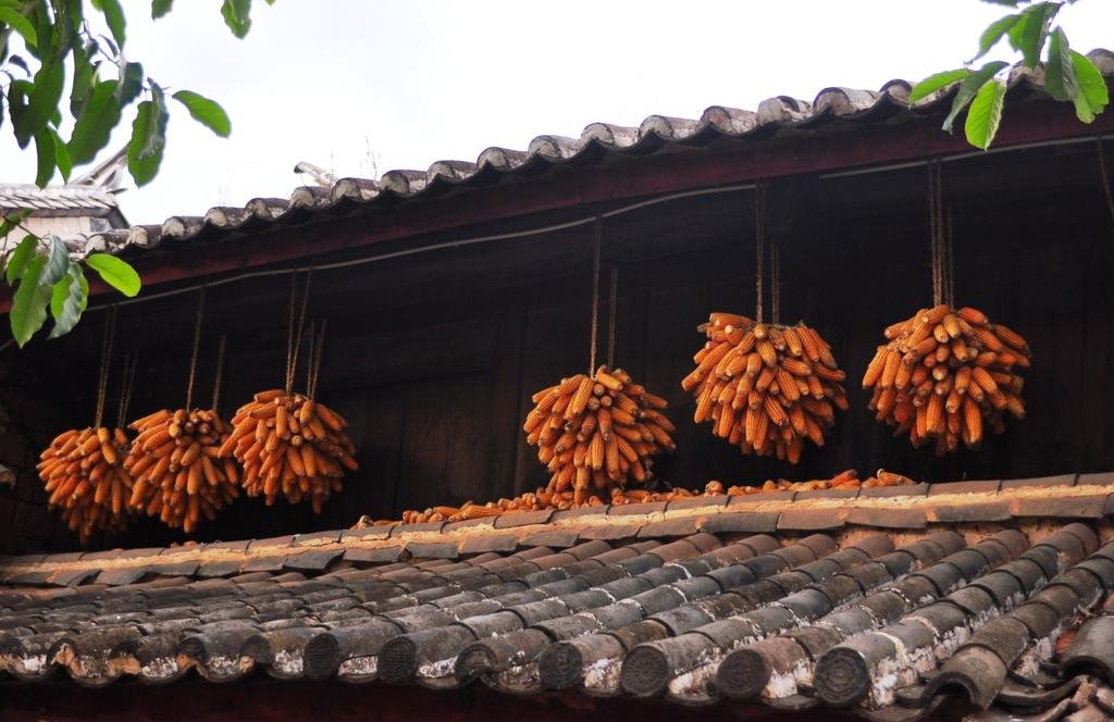
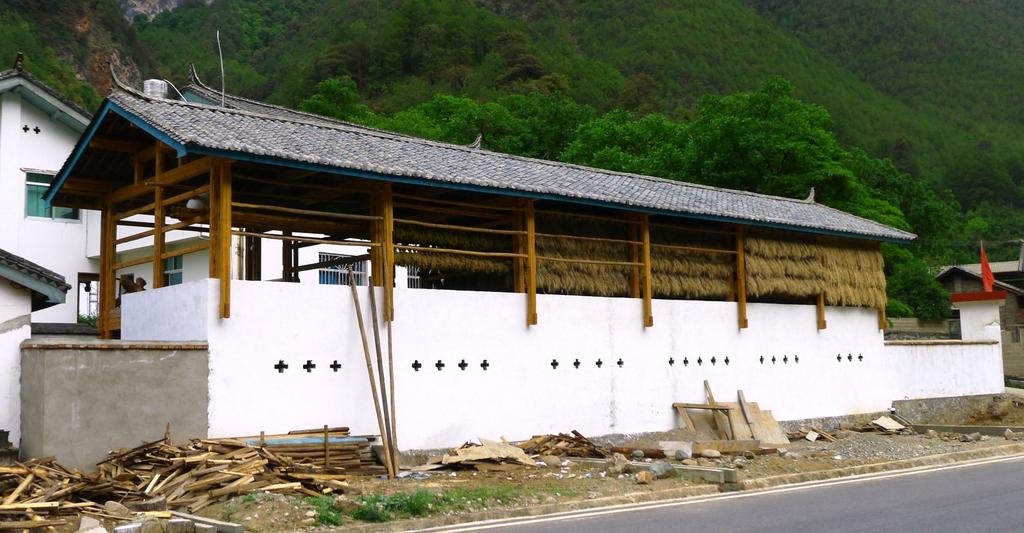
We were seeing this harvested crop drying in all the villages, we couldn't decide was it was , it looked like rice, but we've never seen it needed to be dried like this before
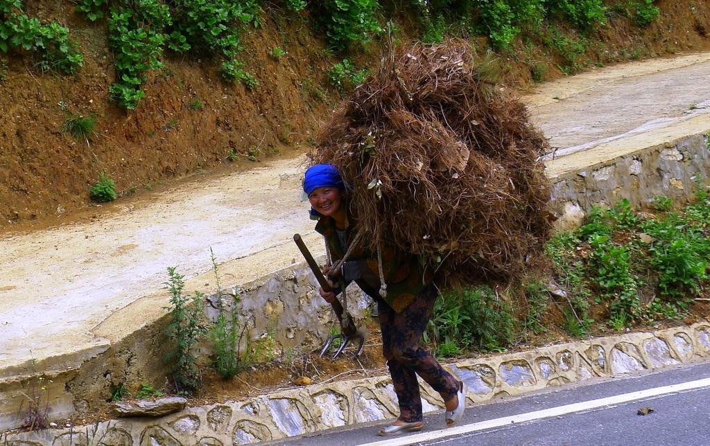
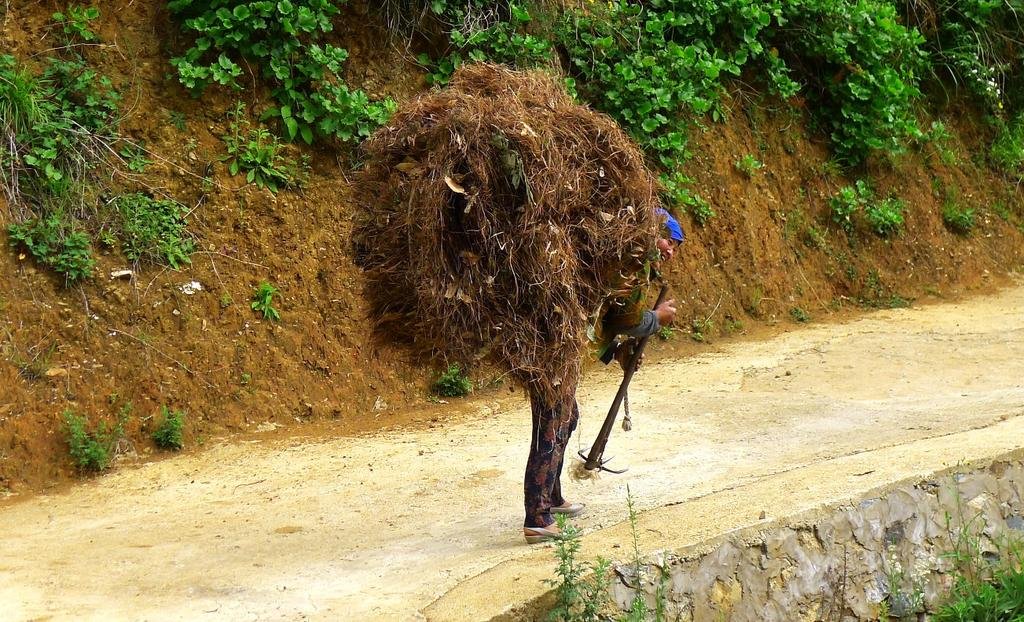
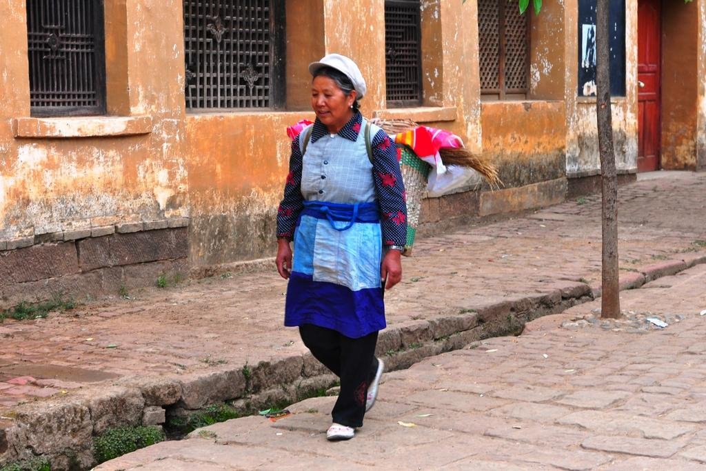
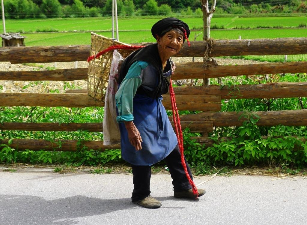
Great old lady on the way to the fields
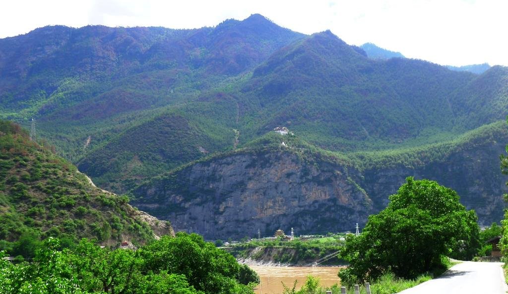
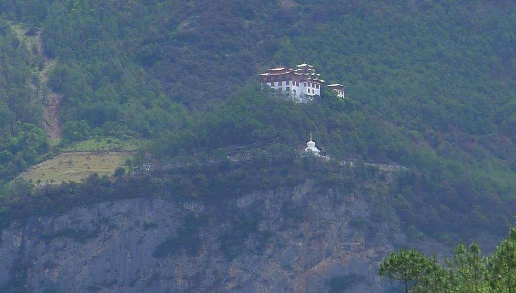
A little further south of Weixi, a Tibetan style monastery high in the hills. We've now crossed over river valley's and are now following the Yangtze River south.

Great old lady on the way to the fields

A little further south of Weixi, a Tibetan style monastery high in the hills. We've now crossed over river valley's and are now following the Yangtze River south.


KTMphil
Senior member
KTMphil
Senior member
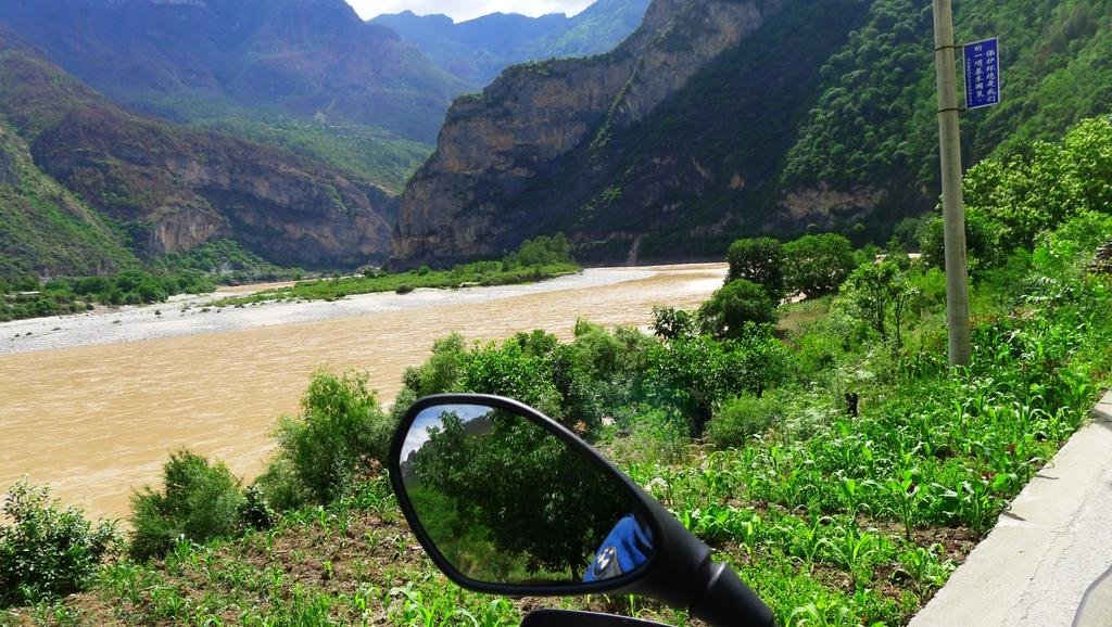
The road south from Weixi to Shaxi is completely different from what we've been experiencing so far. Up until now we've been high in the mountains, following ridge lines, we're now right down in the valley following the Yangtze River, one of the 3 parallel rivers in the Yunan province (Mekong, Yangtze & Salaween). It a beautiful curvy road with views of the river all the time
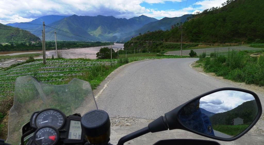
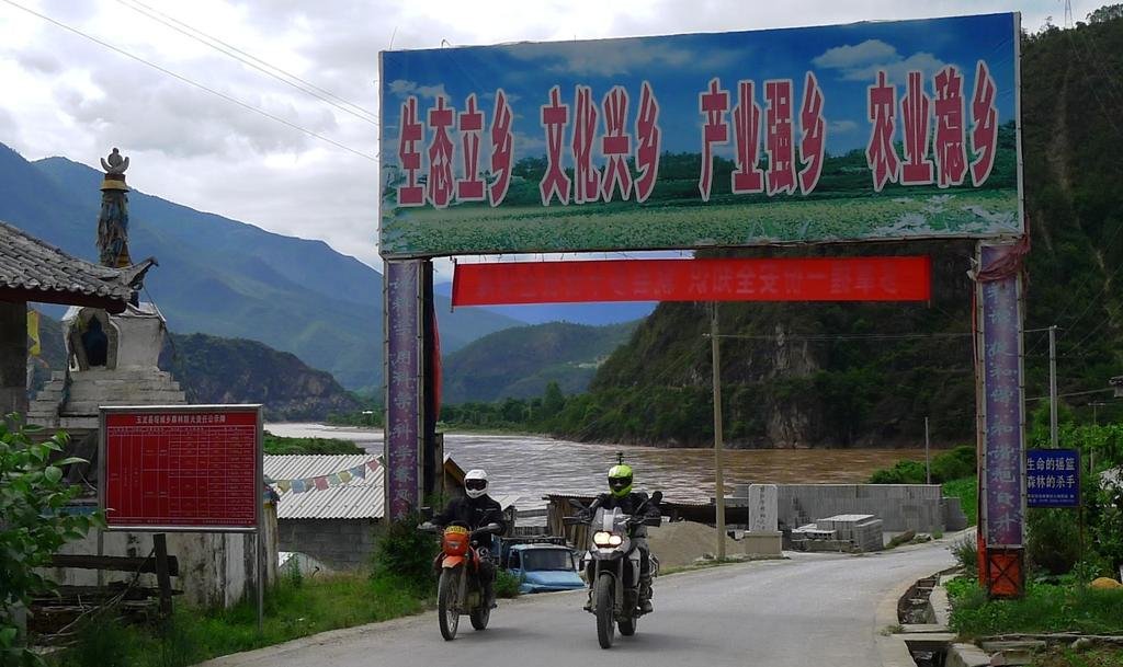
Lots of interest from the locals, I bet they've not seen many foreign bikes along this unusual route
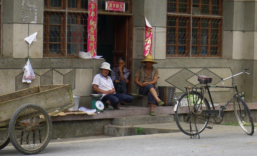

Lots of interest from the locals, I bet they've not seen many foreign bikes along this unusual route

KTMphil
Senior member
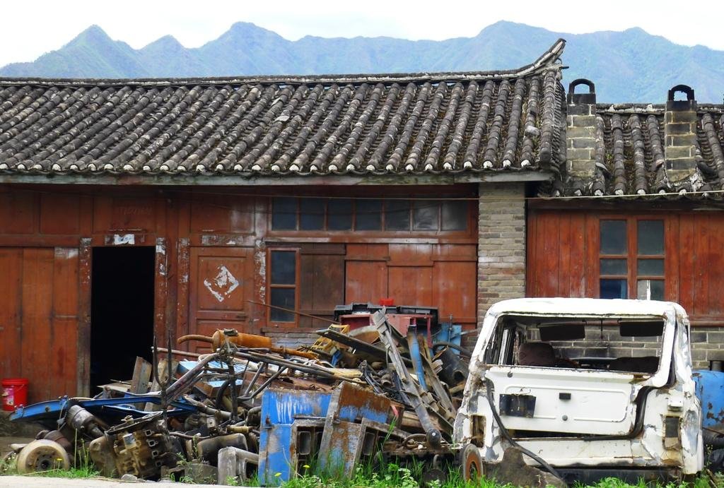
Chinese junk
View attachment 17795
We get back onto G 214 south of Lijian, there's a turn here with a village 52km to the west, I haven't been down there so that's for next time
View attachment 17796
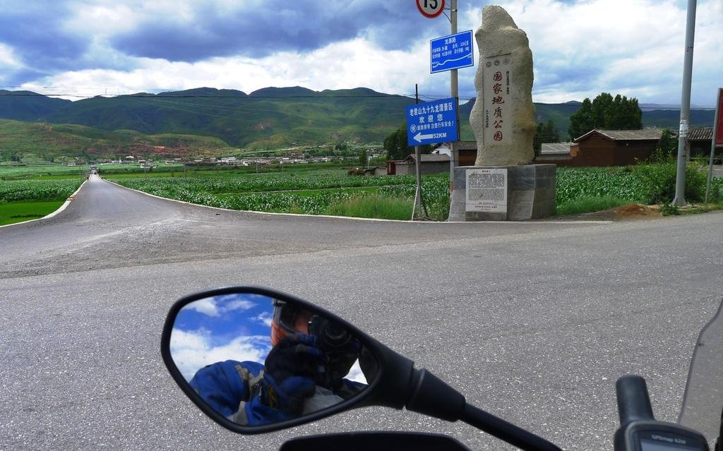
The turn for Shaxi off of G 214
View attachment 17797
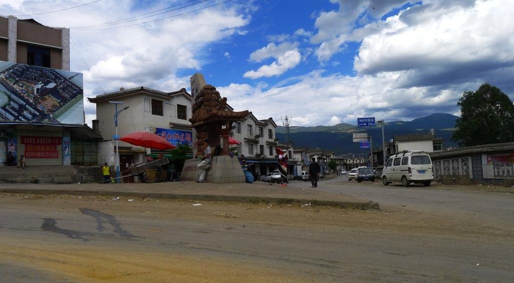
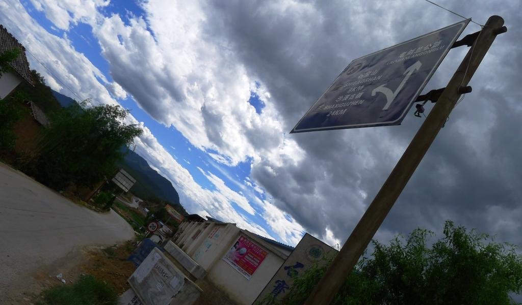
Internet is so painfully slow, i'll finish this tomorrow
View attachment 17795

We get back onto G 214 south of Lijian, there's a turn here with a village 52km to the west, I haven't been down there so that's for next time
View attachment 17796

The turn for Shaxi off of G 214
View attachment 17797


Internet is so painfully slow, i'll finish this tomorrow
KTMphil
Senior member
Just to finish off for today, i have to show the toilet at the lunch-stop today
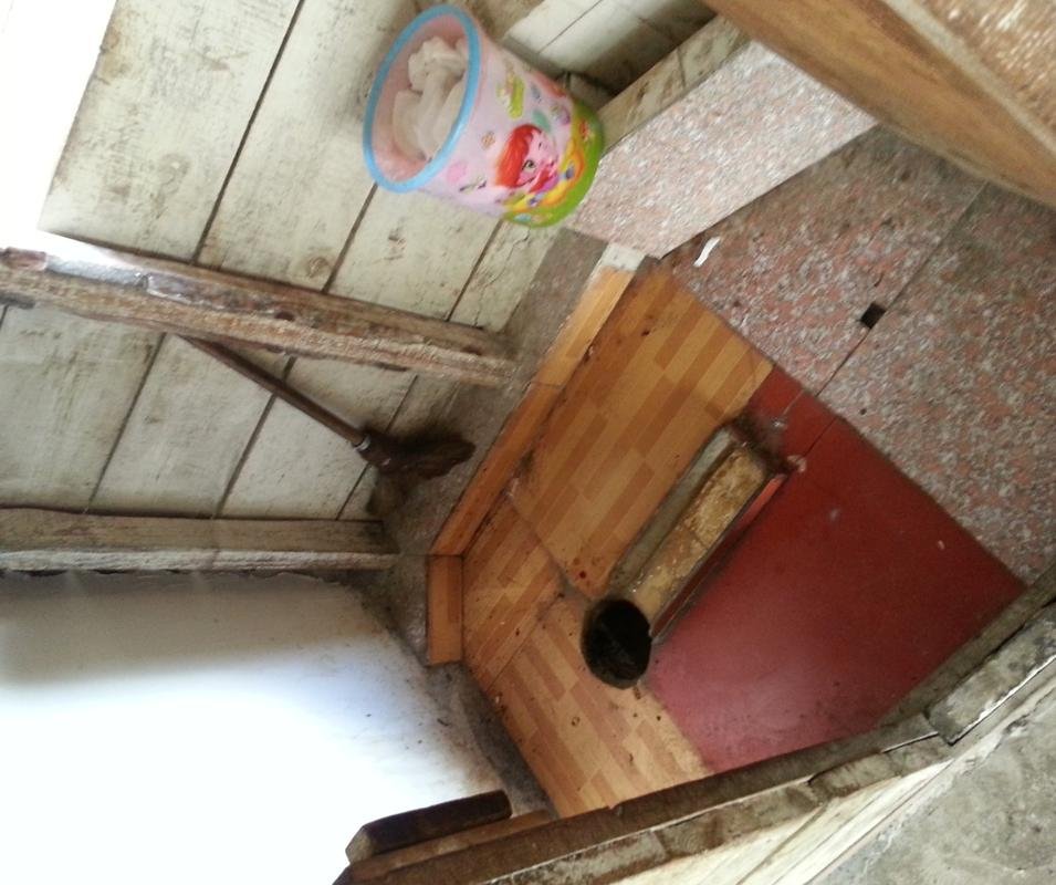
It was one of the best I'd seen so far. From the hole in the floor your excretions free-fell about 3 meters. This all seemed a little strange, then it dawned on me that they collect all the human waste and use it as manure in the fields
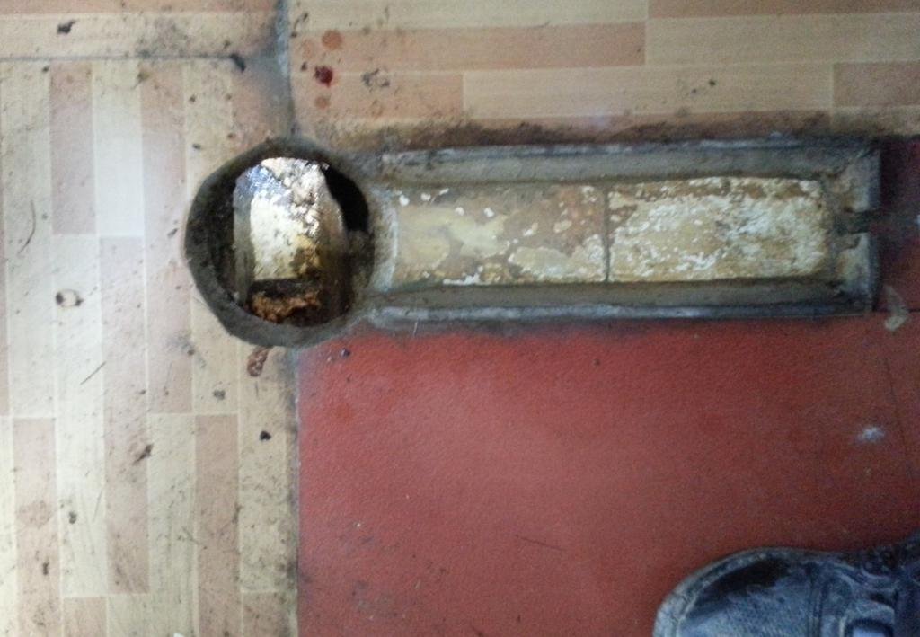

It was one of the best I'd seen so far. From the hole in the floor your excretions free-fell about 3 meters. This all seemed a little strange, then it dawned on me that they collect all the human waste and use it as manure in the fields

KTMphil
Senior member
KTMphil
Senior member
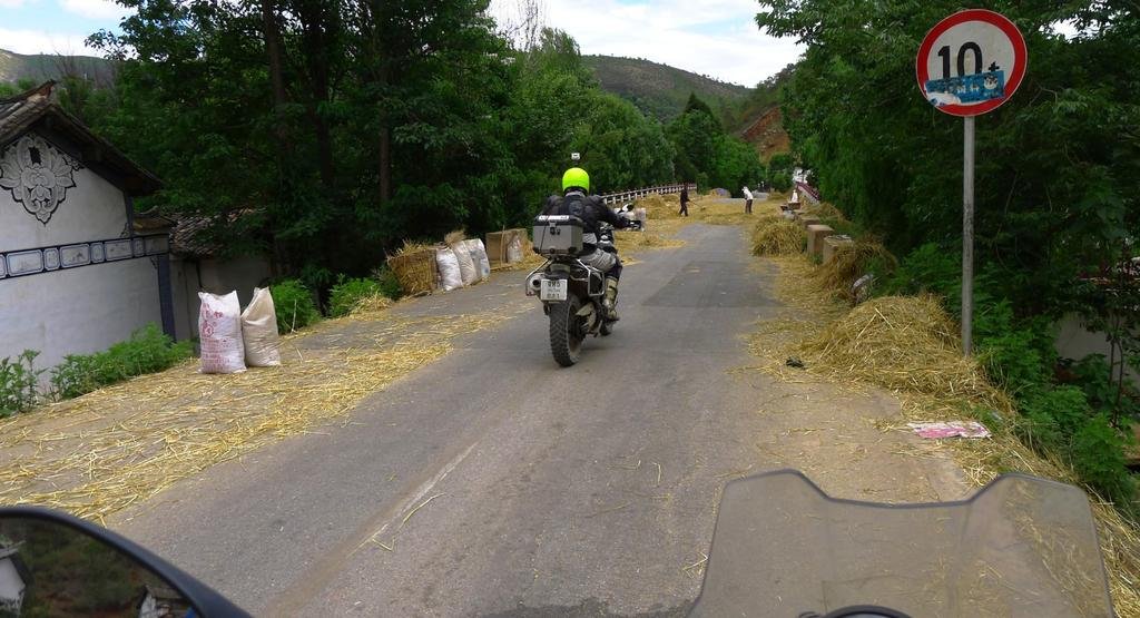
The road from G 214 SW to Shaxi is a sweeping mountain road very similar to one you might find in Thailand. Here they want you to drive over the harvested rice to thrash the rice husk
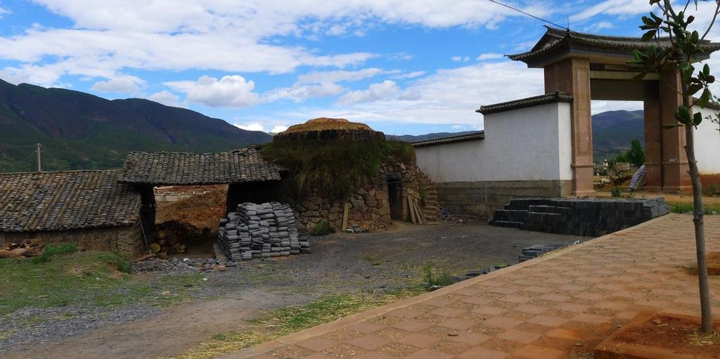
Roof tile kiln just outside Shaxi
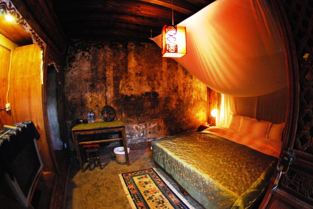
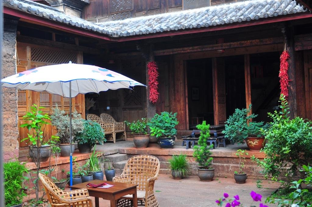
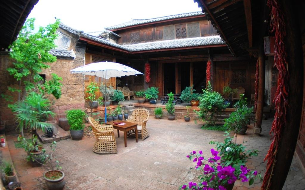
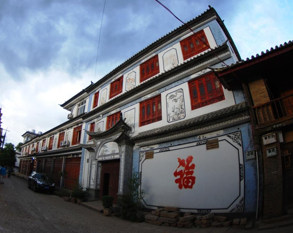
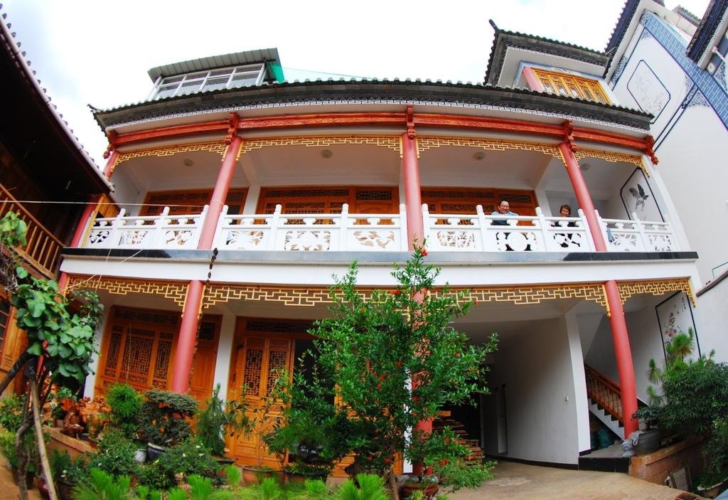
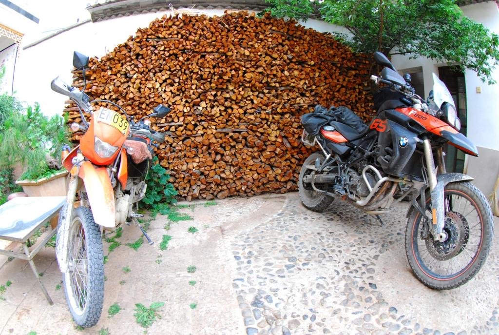
Riding into Shaxi old town we manage to find this GH with secure parking for the bikes in its courtyard, it's opposite the old town cobbled street

Roof tile kiln just outside Shaxi

Riding into Shaxi old town we manage to find this GH with secure parking for the bikes in its courtyard, it's opposite the old town cobbled street


KTMphil
Senior member
So Shaxi here we are, one of the most beautifully preserved old towns in China (again on the "tea horse & caravan road)
From:
Shaxi, historical market town | XinTuo Ecotourism
[h=1]Shaxi, historical market town[/h]
 Shaxi is an historical old town. In 2001, the World Memorial Fund for Architecture (WMF), an international fund for the protection of world heritage sites announced that Shaxi has been added to the list of internationally significant sites, together with the Great Wall, the Ohel Rachel Synagogue of Shanghai and the Christian Pagoda, and the Monastery of Shaanxi Province.
Shaxi lies southwest of Jianchuan in Yunnan, southeast of the Three Parallel River (Jinsha, Lancang, Nujiang) Nature Reserve area, the most famous Shibaoshan lies here too. It is also between Lijiang old town and Dali landscape area. Shaxi is a small plain which is surrounded by green mountain, there is clean water, good weather, abundant products, also good place to live. The branch of Lancang river----Heihui river, through whole plain, total is 287 km², the plain is 26 km², it is called hometown of honey and milk (hometown fish and rice, and dance and sing) beautiful mountain, water and plain. There are local fish, many kinds of mushroom, you can enjoy the dancing, singing, old music in Shaxi.
Shaxi a thousand years’ old town with long history, we can talk it from about 2400 years ago. There are many old graves, the bronze relics on Huacong shan east of the shaxi tells us: before B.C 400year, it was became the base for smelting the bronze with the Heihui river as the centre. The ancestor of Shaxi has the higher/better ability for smelting the bronze and become one of resource of bronze culture.
During Tang and Song period, Shaxi was an old town on the road to Nanzhao and Dali, performing a positive role. Buddism influnced the Nanzhao and Dali very depth,making they had very depth color of religion. Shaxi is the one of witness for propagating Buddhism culture during that time.
All the rock caves which made in Nanzhao and Dali period in Shadengjing, Shizhongshan is the best explanation. This means during the Tang and Song period time Shaxi is between from Nanzhao and Dali to Shadengjing rock cave it was an economic and exchange land route dock on the road for Tang and Tufan.
The two main minority people of Shaxi are the Bai and Yi people.
From:
Shaxi, historical market town | XinTuo Ecotourism
[h=1]Shaxi, historical market town[/h]

Shaxi lies southwest of Jianchuan in Yunnan, southeast of the Three Parallel River (Jinsha, Lancang, Nujiang) Nature Reserve area, the most famous Shibaoshan lies here too. It is also between Lijiang old town and Dali landscape area. Shaxi is a small plain which is surrounded by green mountain, there is clean water, good weather, abundant products, also good place to live. The branch of Lancang river----Heihui river, through whole plain, total is 287 km², the plain is 26 km², it is called hometown of honey and milk (hometown fish and rice, and dance and sing) beautiful mountain, water and plain. There are local fish, many kinds of mushroom, you can enjoy the dancing, singing, old music in Shaxi.
Shaxi a thousand years’ old town with long history, we can talk it from about 2400 years ago. There are many old graves, the bronze relics on Huacong shan east of the shaxi tells us: before B.C 400year, it was became the base for smelting the bronze with the Heihui river as the centre. The ancestor of Shaxi has the higher/better ability for smelting the bronze and become one of resource of bronze culture.
During Tang and Song period, Shaxi was an old town on the road to Nanzhao and Dali, performing a positive role. Buddism influnced the Nanzhao and Dali very depth,making they had very depth color of religion. Shaxi is the one of witness for propagating Buddhism culture during that time.
All the rock caves which made in Nanzhao and Dali period in Shadengjing, Shizhongshan is the best explanation. This means during the Tang and Song period time Shaxi is between from Nanzhao and Dali to Shadengjing rock cave it was an economic and exchange land route dock on the road for Tang and Tufan.
The two main minority people of Shaxi are the Bai and Yi people.
KTMphil
Senior member
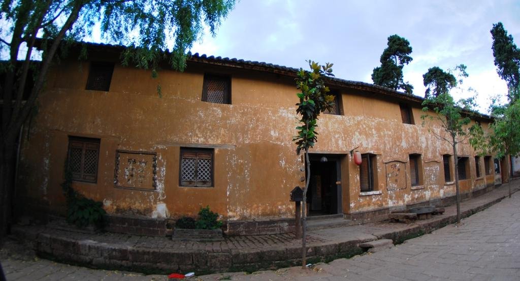
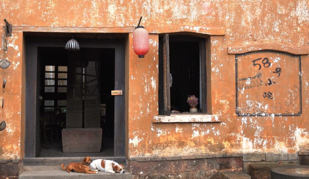
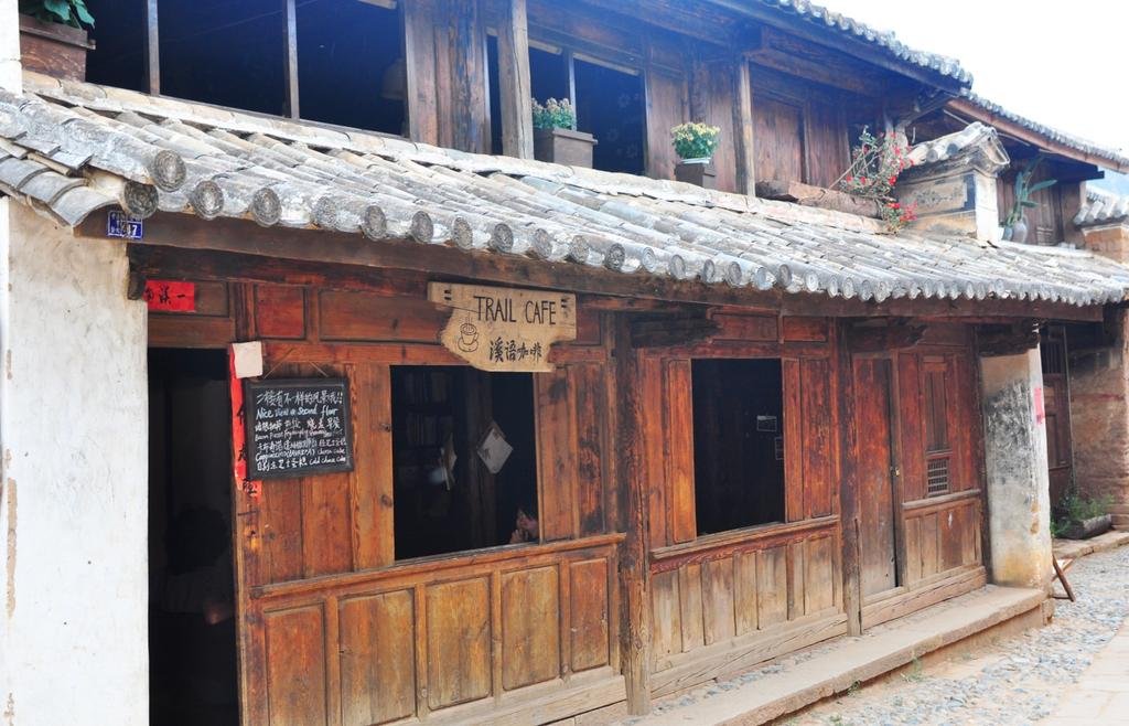
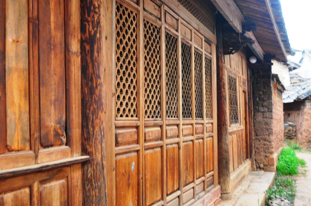
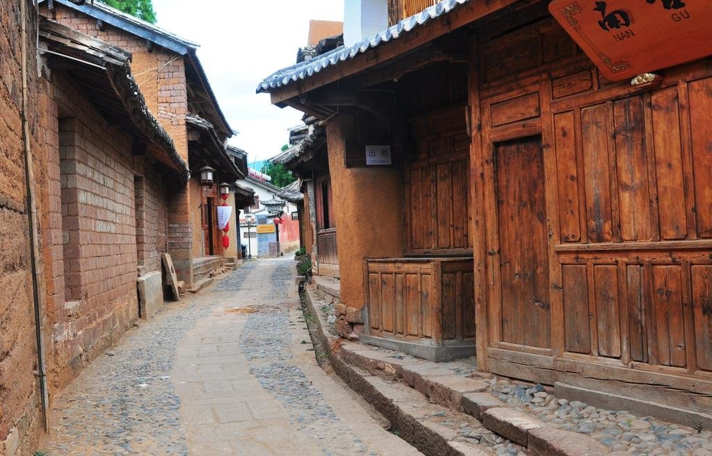
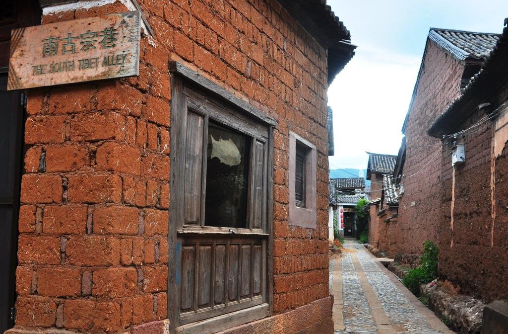
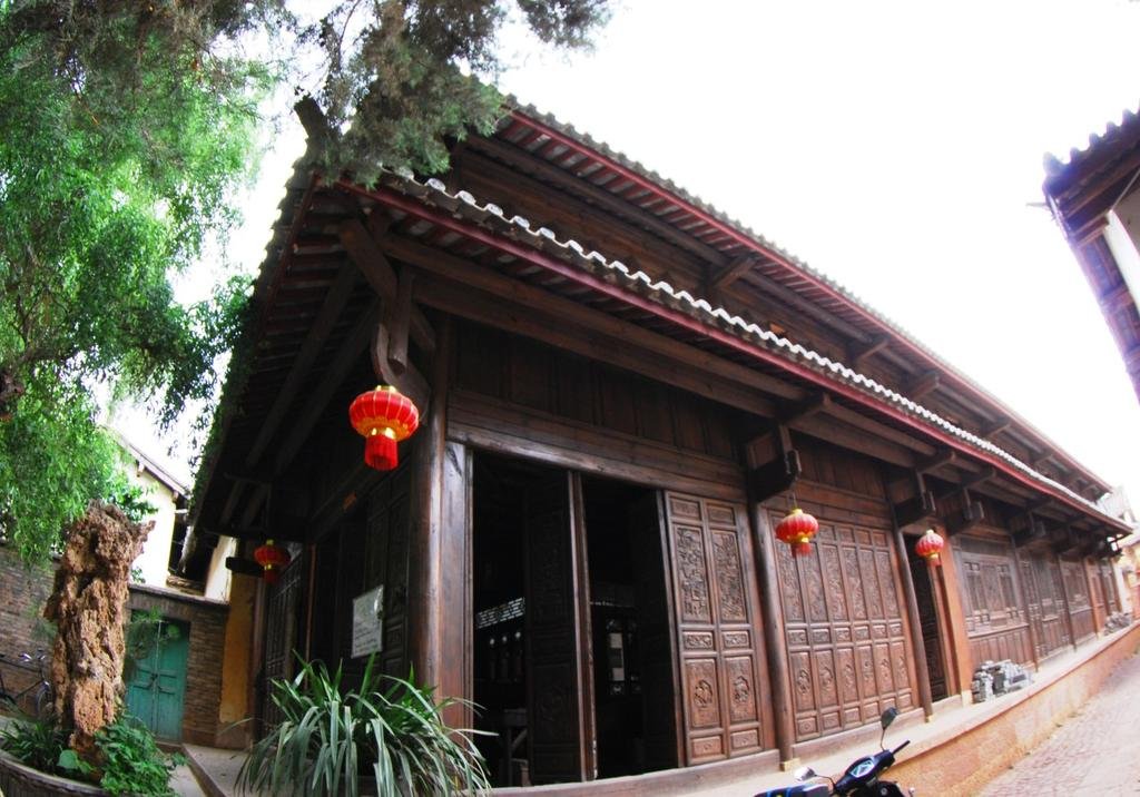
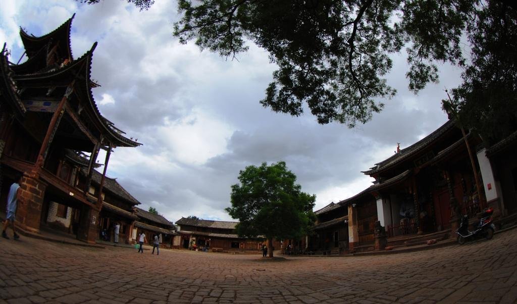
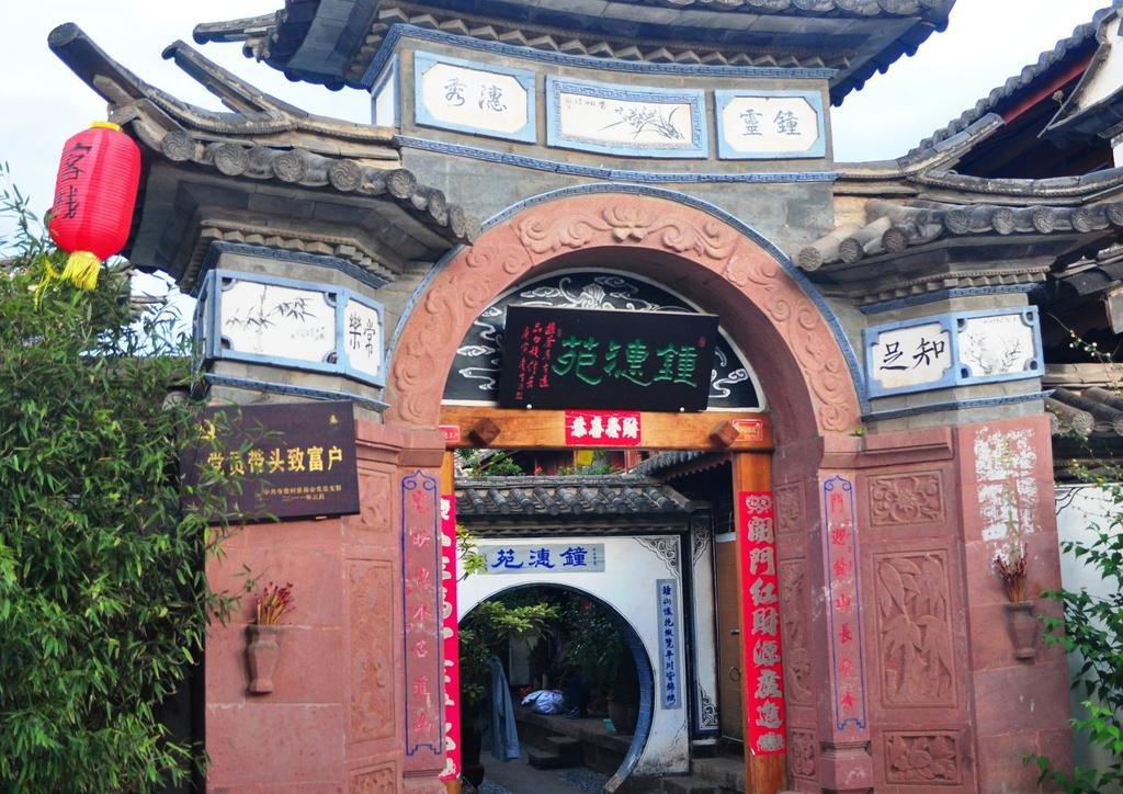
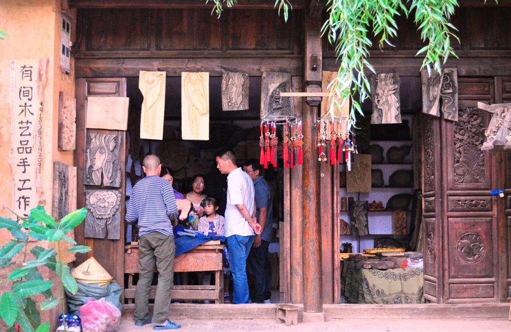
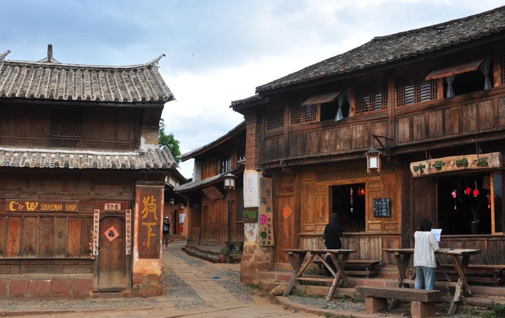
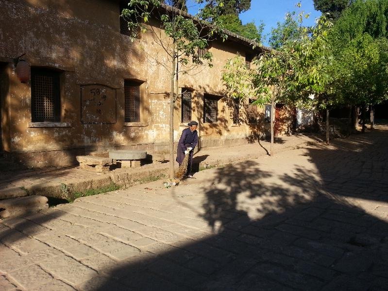
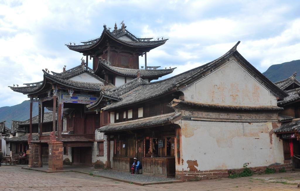
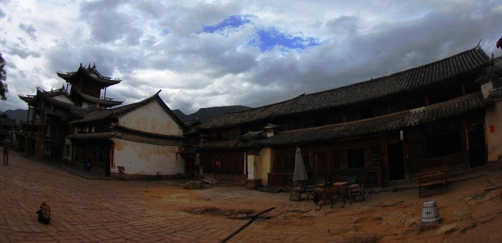
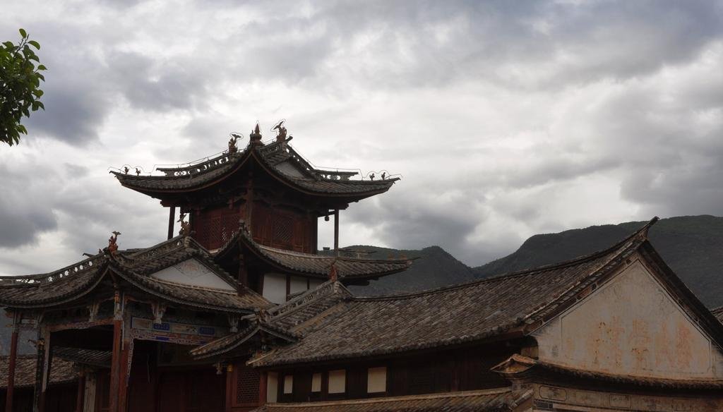
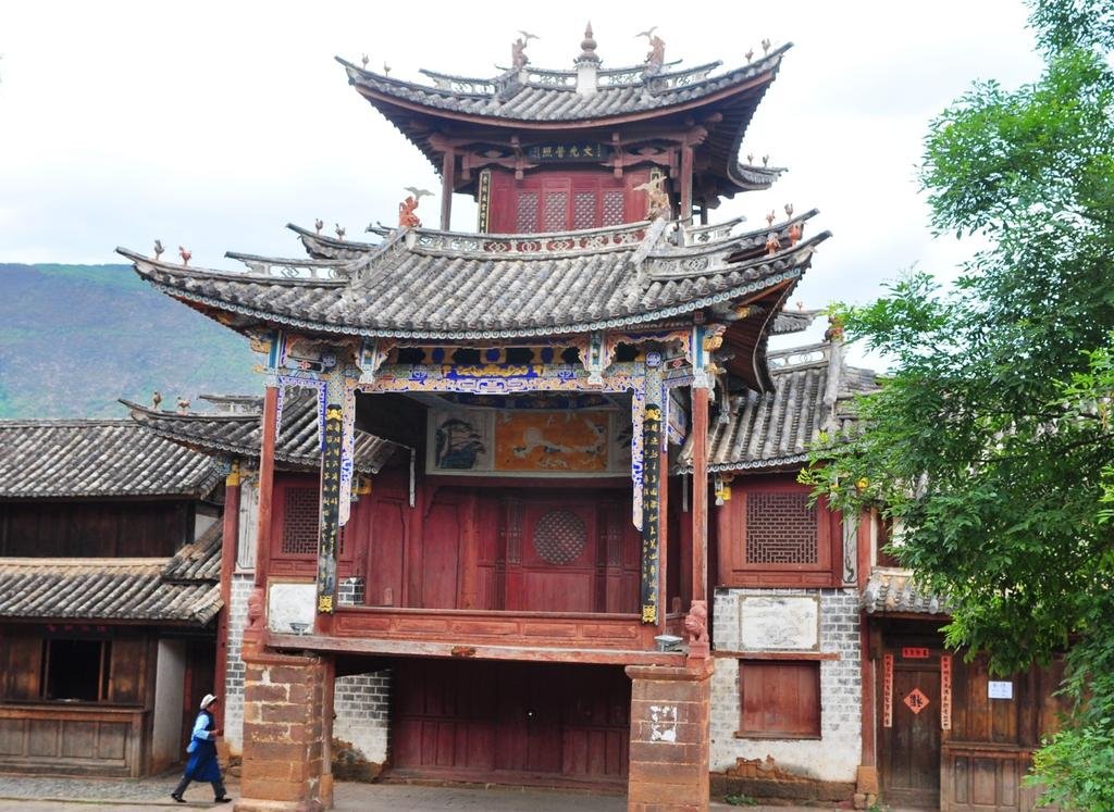
Shaxi is magnificently preserved as if its been frozen in time, it looks like a movie set
View attachment 17814
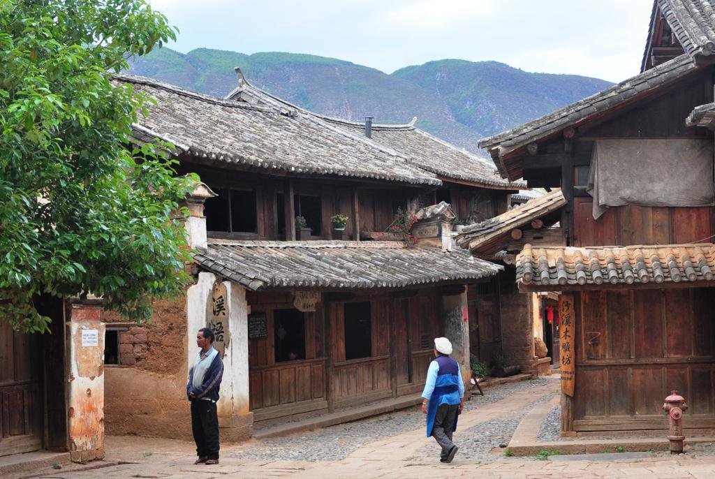
Mud brick construction still scatters the village
View attachment 17815
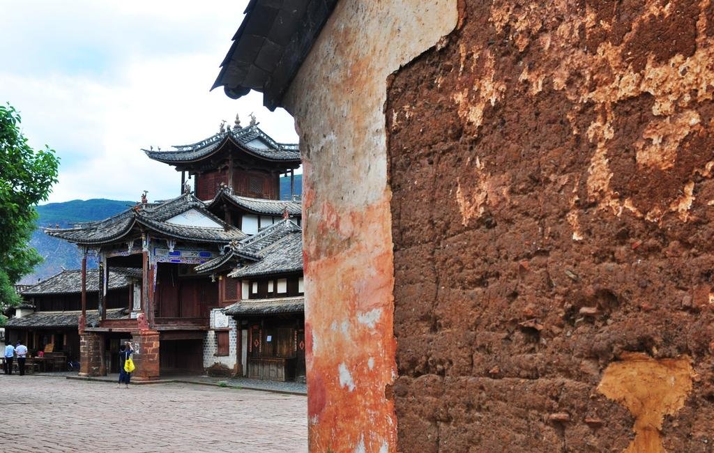
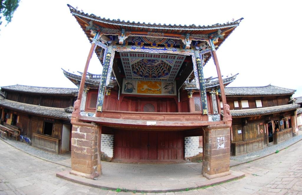
The preserved theater in the center of town
View attachment 17816
View attachment 17817
View attachment 17818
View attachment 17819
View attachment 17820
View attachment 17814

Mud brick construction still scatters the village
View attachment 17815

The preserved theater in the center of town
View attachment 17816

View attachment 17817

View attachment 17818

View attachment 17819

View attachment 17820

KTMphil
Senior member
bsacbob
Administrator (Retired)
- Joined
- Jul 1, 2012
- Location
- Chiang Rai
- Bikes
- Honda CRM-AR 250, Honda CRF 250-L, Suzuki V Strom XT 650 Honda XR250 Baja BMW F650GS
"then it dawned on me that they collect all the human waste and use it as manure in the fields" Remind me never to eat Chinese rice !!!
Great story and pictures Phil, keep um coming.
Great story and pictures Phil, keep um coming.
KTMphil
Senior member
"then it dawned on me that they collect all the human waste and use it as manure in the fields" Remind me never to eat Chinese rice !!!
Great story and pictures Phil, keep um coming.
I must admit, I did start thinking about it when I was eating their rice in their restaurant!
KTMphil
Senior member
KTMphil
Senior member
Early start today for Dali, looks as though we'll stay on the far (eastern side) of the lake in a village, I like leaving early.
- Joined
- Aug 15, 2012
- Bikes
- KTM 613 EXC, BMW R90S & Dakar, MZ250, Norton 16H, Honda - 500 Fs & Xs, DRZs, XLs XRs CRFs CT110s etc
"then it dawned on me that they collect all the human waste and use it as manure in the fields" Remind me never to eat Chinese rice !!!
Great story and pictures Phil, keep um coming.
I must admit, I did start thinking about it when I was eating their rice in their restaurant!
Hey... at least they collect it there. When I got stranded in southern Laos and was staying in a small village for 2 days, I couldn't see a toilet anywhere. With some sign language, I managed to make myself understood.... the guy just pointed to the rice field. Hmmmm.
KTMphil
Senior member
KTMphil
Senior member
Reed's superbly written account of our ride south to Shaxi
Shangri-La Here We Come - A Motorcycle Touring Blog from Chiang Mai, Thailand to the Tibet-China Border - Asian Motorcycle Tours - Thailand, Laos, Cambodia, Vietnam Motorcycle Tours
Post #10
Dateline: Saturday, June 8; 9 a.m.
Welcome to the “Shangri-La Here We Come” Blog.
Unlike my other posts I am writing this one in the morning because I fell asleep instantly immediately after dinner. I was so tired yesterday that I actually fell asleep on my motorcycle. It was on a straightaway, luckily, and I snapped out of my doze before I could crashed. In the next town I purchased and quickly downed two Red Bulls.
I have awoken to a beautiful morning in Shaxi at 2128 meters. The scene outside my guesthouse window is one of low mountains, the bluest of skies and scattered pillows of clouds.
Riding statistics to Shaxi:
Present location: Shaxi.
Riding distance from Weixi: 279 kms.
Driving (moving) time): 5:44
Moving average: 47.5 kph.
Highest elevation reached: 2889 meters
Total trip cumulative distance: 2848 kms.
Complete trip track shown below:
GPS track from Chaing Mai to Shaxi

Trip track to Shaxi shown below:
GPS track: Weixi to Shaxi

ENTER YESTERDAYS TRIP TRACK HERE
Tomorrow destination: Dali (for the 2nd time as we head southwards)
Approximate distance: 150 kms
Guesstimate driving time: 4 hours
Phil Gibbins is taking a ton of photos, way more than me. He is posting them online on his RideAsia.net rider forum. But this url changes daily. To see the photos from our latest day’s ride, you can view them at the following url:
http://www.rideasia.net/motorcycle-...-karpo-6-740-meters-22-113-a-9.html#post29852
Hello interested parties!
I do not know how long things can continue in this vein, but we enjoyed another fantastic ride, more fantastic roads, and we are staying in the most amazing place on this tour so far, Shaxi.
Shaxi is the only ancient Chinese city left pretty much untouched as it looked centuries ago. I am pasting the Wikipedia entry of the Shaxi below, as they describe Shaxi way better than I can:
Shaxi (Chinese: 沙溪) is a historic market town in Jianchuan County, Dali refecture, Yunnan province, China. It is located roughly halfway between Dali and Lijiang.
The Sideng market square of Shaxi was added to the World Monuments Watch List of 100 Most Endangered Sites in 2001.[1]
Shaxi started as a trading point for tea and horses during the Tang Dynasty (618 – 907). The prosperity of the town was at its height during the Ming and Qing dynasties (1368–1912).
It is probably the most intact horse caravan town on the Ancient tea route leading from Yunnan into Burma and Tibet[2] and is now being preserved through a cooperation between the Swiss Federal Institute of Technology Zürich (ETH) and the People’s Government of Jianchuan County.[3]
Nearby Shibao mountain contains Buddhist rock carvings and temples of over 1300 years old with, amongst others, images of the bodhisattva Guanyin.
The two main ethnic groups of Shaxi are the Bai and Yi people.
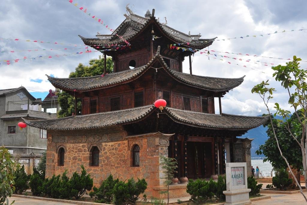
Shaxi building

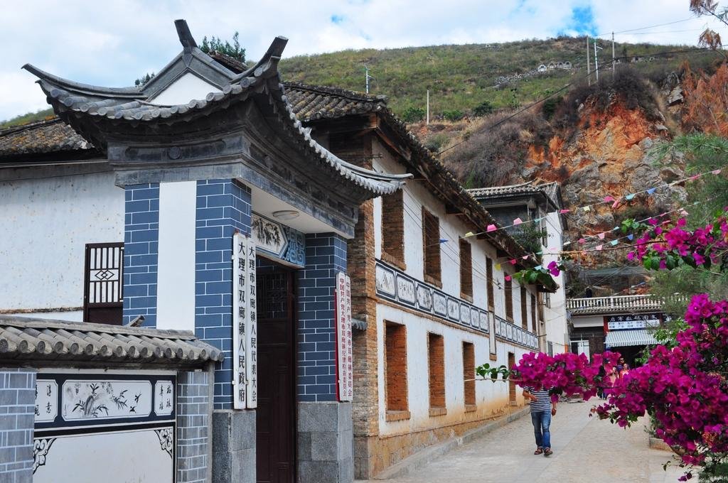
Shaxi alley

Shaxi main square


Yesterday’s first third of the ride was on the best sports bike-style road we encountered yet. The surface was in near perfect condition, traffic was light, and the bends were challenging and frequent. Unlike when we were deep in the Himalayas, where missing a turn would mean death, this morning we had no such fear tempering our riding fun.
The terrain we rode through was filled with karst limestone similar to what we are used to in Thailand and Laos, except here the karsts are much higher and way more massive
We followed a clear-running meandering river. It ran downhill all the way generally heading east-southeast from the top of the mountain ridge that separated the Mekong and Yangtze River basins.
After an hour, the stream we were following joined the Yangtze. We had to choose whether to ride on the west bank of the Yangtze which was the faster route on a main road, or the much quieter east bank. We chose the east bank.
It was another terrific road. Here the Yangtze was wide and gentle and rock and rapid free and ringed in all the way by a wall of karst mountains. The road was narrow and our shoulders were practically scrapping the farm houses on both sides. We weren’t riding through a landscape, we were a part of it.
Very rural. Very traditional architecture, exactly like what you would imagine what the Chinese countryside would look like. Better yet, take a look at Phil’s photos at this link.
http://www.rideasia.net/motorcycle-...-karpo-6-740-meters-22-113-a-9.html#post29852

When the land was open it was filled with farm fields of rice, corn, tobacco, and many other assorted crops. Every 10 ks or so we entered a small village. Our pace was slow because the road was narrow and windy, but also because wherever we pointed our eyes was a photo opportunity crying to be captured. Some signs of the Tibetan culture started to reappear, but nothing like before. The giveaways are the strings of prayer flags fluttering in the breezes.
We stopped in a small town and had another fantastic lunch.
Around 2 hours later we made a right turn at a junction and started climbing out of the Yangtze River basin. And this was the first bad road we hit on the tour. It was potholed and patched up with tar and there was quite a bit of slow-moving commercial traffic, especially uncovered dump trucks which were creating mini-dust storms in their wake. This road was not any fun at all and all our concentration was directed on passing the creeping lorries and avoiding oncoming ones that tried running us off the road.
But this is the last time we will ever take this road because a brand- new, limited-access, dead straight elevated highway is nearing completion to the north of this crap road.
An hour of this brought us to a junction. We veeered east then south, up and down over a series of low foothills and we finally arrived in Shaxi.
Unlike Daliang and Shangri-La this town hardly has any tourists. It is filled with local Bai and Yi ethnic groups living their daily life.
After another fantastic dinner, we returned to our guesthouse for a good, long sleep.
I have to wrap this blog up now because departure time is here.
So until tomorrow, Bye, bye.
Shangri-La Here We Come - A Motorcycle Touring Blog from Chiang Mai, Thailand to the Tibet-China Border - Asian Motorcycle Tours - Thailand, Laos, Cambodia, Vietnam Motorcycle Tours
Post #10
Dateline: Saturday, June 8; 9 a.m.
Welcome to the “Shangri-La Here We Come” Blog.
Unlike my other posts I am writing this one in the morning because I fell asleep instantly immediately after dinner. I was so tired yesterday that I actually fell asleep on my motorcycle. It was on a straightaway, luckily, and I snapped out of my doze before I could crashed. In the next town I purchased and quickly downed two Red Bulls.
I have awoken to a beautiful morning in Shaxi at 2128 meters. The scene outside my guesthouse window is one of low mountains, the bluest of skies and scattered pillows of clouds.
Riding statistics to Shaxi:
Present location: Shaxi.
Riding distance from Weixi: 279 kms.
Driving (moving) time): 5:44
Moving average: 47.5 kph.
Highest elevation reached: 2889 meters
Total trip cumulative distance: 2848 kms.
Complete trip track shown below:
GPS track from Chaing Mai to Shaxi

Trip track to Shaxi shown below:
GPS track: Weixi to Shaxi

ENTER YESTERDAYS TRIP TRACK HERE
Tomorrow destination: Dali (for the 2nd time as we head southwards)
Approximate distance: 150 kms
Guesstimate driving time: 4 hours
Phil Gibbins is taking a ton of photos, way more than me. He is posting them online on his RideAsia.net rider forum. But this url changes daily. To see the photos from our latest day’s ride, you can view them at the following url:
http://www.rideasia.net/motorcycle-...-karpo-6-740-meters-22-113-a-9.html#post29852
Hello interested parties!
I do not know how long things can continue in this vein, but we enjoyed another fantastic ride, more fantastic roads, and we are staying in the most amazing place on this tour so far, Shaxi.
Shaxi is the only ancient Chinese city left pretty much untouched as it looked centuries ago. I am pasting the Wikipedia entry of the Shaxi below, as they describe Shaxi way better than I can:
Shaxi (Chinese: 沙溪) is a historic market town in Jianchuan County, Dali refecture, Yunnan province, China. It is located roughly halfway between Dali and Lijiang.
The Sideng market square of Shaxi was added to the World Monuments Watch List of 100 Most Endangered Sites in 2001.[1]
Shaxi started as a trading point for tea and horses during the Tang Dynasty (618 – 907). The prosperity of the town was at its height during the Ming and Qing dynasties (1368–1912).
It is probably the most intact horse caravan town on the Ancient tea route leading from Yunnan into Burma and Tibet[2] and is now being preserved through a cooperation between the Swiss Federal Institute of Technology Zürich (ETH) and the People’s Government of Jianchuan County.[3]
Nearby Shibao mountain contains Buddhist rock carvings and temples of over 1300 years old with, amongst others, images of the bodhisattva Guanyin.
The two main ethnic groups of Shaxi are the Bai and Yi people.
Shaxi building

Shaxi alley

Shaxi main square


Yesterday’s first third of the ride was on the best sports bike-style road we encountered yet. The surface was in near perfect condition, traffic was light, and the bends were challenging and frequent. Unlike when we were deep in the Himalayas, where missing a turn would mean death, this morning we had no such fear tempering our riding fun.
The terrain we rode through was filled with karst limestone similar to what we are used to in Thailand and Laos, except here the karsts are much higher and way more massive
We followed a clear-running meandering river. It ran downhill all the way generally heading east-southeast from the top of the mountain ridge that separated the Mekong and Yangtze River basins.
After an hour, the stream we were following joined the Yangtze. We had to choose whether to ride on the west bank of the Yangtze which was the faster route on a main road, or the much quieter east bank. We chose the east bank.
It was another terrific road. Here the Yangtze was wide and gentle and rock and rapid free and ringed in all the way by a wall of karst mountains. The road was narrow and our shoulders were practically scrapping the farm houses on both sides. We weren’t riding through a landscape, we were a part of it.
Very rural. Very traditional architecture, exactly like what you would imagine what the Chinese countryside would look like. Better yet, take a look at Phil’s photos at this link.
http://www.rideasia.net/motorcycle-...-karpo-6-740-meters-22-113-a-9.html#post29852

When the land was open it was filled with farm fields of rice, corn, tobacco, and many other assorted crops. Every 10 ks or so we entered a small village. Our pace was slow because the road was narrow and windy, but also because wherever we pointed our eyes was a photo opportunity crying to be captured. Some signs of the Tibetan culture started to reappear, but nothing like before. The giveaways are the strings of prayer flags fluttering in the breezes.
We stopped in a small town and had another fantastic lunch.
Around 2 hours later we made a right turn at a junction and started climbing out of the Yangtze River basin. And this was the first bad road we hit on the tour. It was potholed and patched up with tar and there was quite a bit of slow-moving commercial traffic, especially uncovered dump trucks which were creating mini-dust storms in their wake. This road was not any fun at all and all our concentration was directed on passing the creeping lorries and avoiding oncoming ones that tried running us off the road.
But this is the last time we will ever take this road because a brand- new, limited-access, dead straight elevated highway is nearing completion to the north of this crap road.
An hour of this brought us to a junction. We veeered east then south, up and down over a series of low foothills and we finally arrived in Shaxi.
Unlike Daliang and Shangri-La this town hardly has any tourists. It is filled with local Bai and Yi ethnic groups living their daily life.
After another fantastic dinner, we returned to our guesthouse for a good, long sleep.
I have to wrap this blog up now because departure time is here.
So until tomorrow, Bye, bye.
KTMphil
Senior member
8th June, 2013 - Shaxi to Dali (eastern side of the lake)
On the way north we'd already passed through Dali's new city and stayed in the old city. On this kind of trip I hate staying in the same place twice unless its really necessary, so we planned to head for the town on the eastern side of the lake.
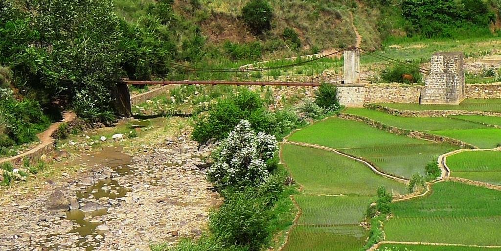
Late start, we'd all be working on the computers burning the midnight oil, so didn't get going until 1030am. the road E/SE out of Shaxi is a great ride, only 1 1/2 cars wide and sweeps through hills rather than mountains. A really unusual bridge on the way east out of Shaxi.
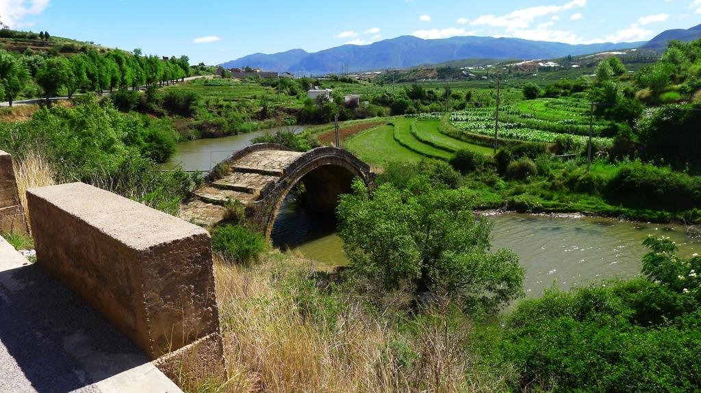
Looks like clean water is in abundance here
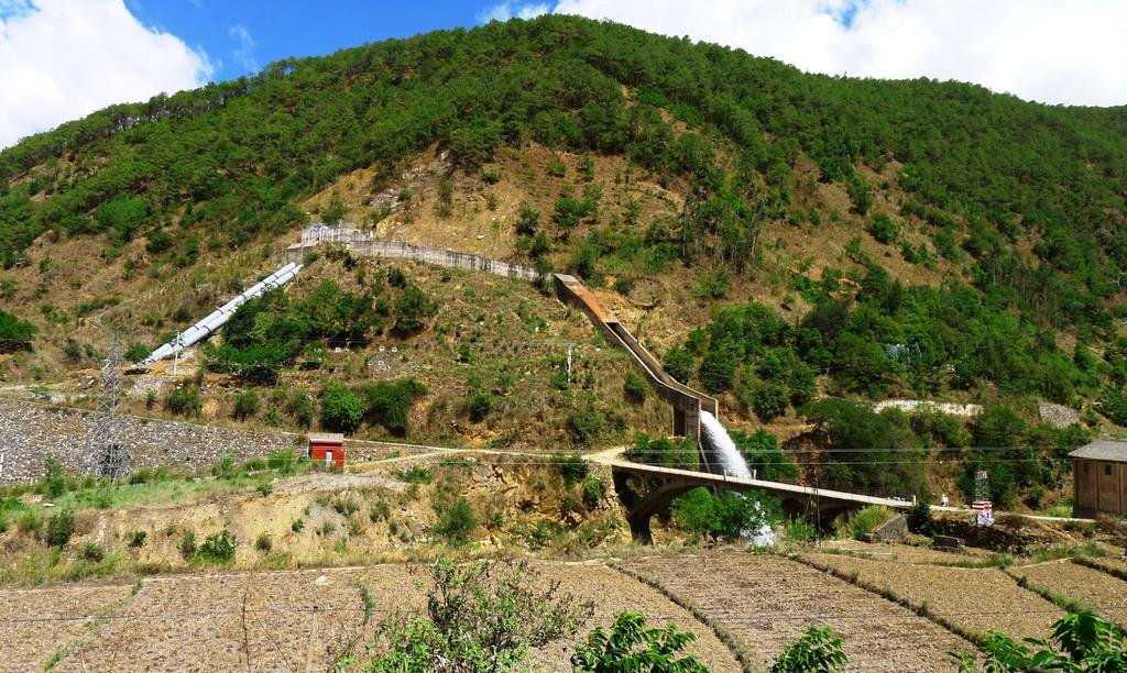
That's why everywhere was so green with no rain
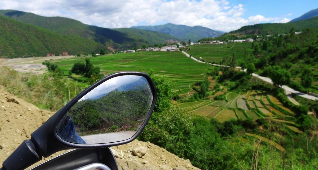
On the way north we'd already passed through Dali's new city and stayed in the old city. On this kind of trip I hate staying in the same place twice unless its really necessary, so we planned to head for the town on the eastern side of the lake.
Late start, we'd all be working on the computers burning the midnight oil, so didn't get going until 1030am. the road E/SE out of Shaxi is a great ride, only 1 1/2 cars wide and sweeps through hills rather than mountains. A really unusual bridge on the way east out of Shaxi.

Looks like clean water is in abundance here

That's why everywhere was so green with no rain


KTMphil
Senior member
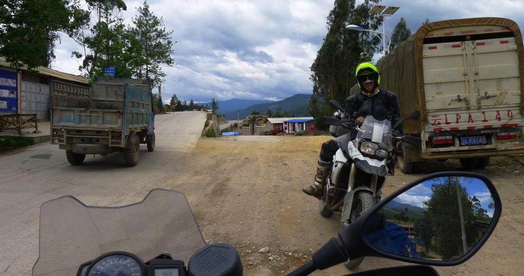
The usual chaos when entering a small town, here NW of Dali approaching G 214
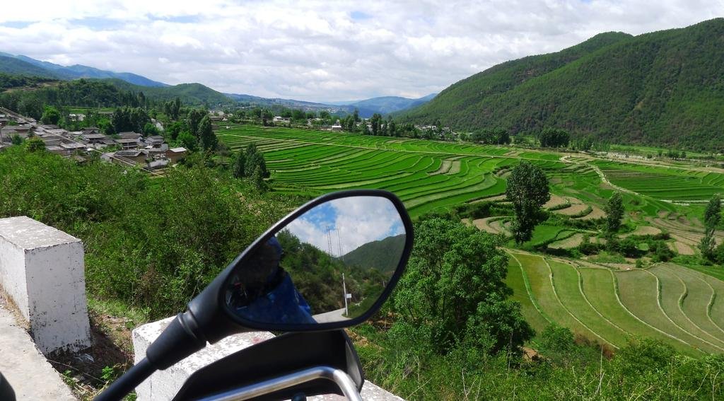
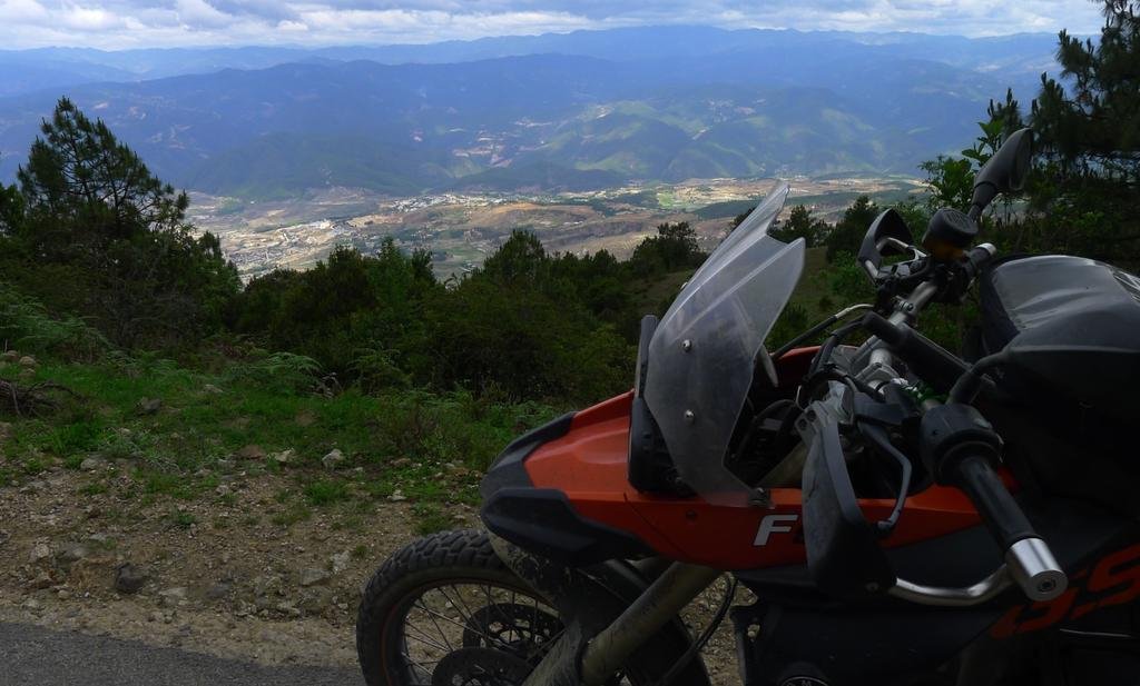
So now we leave the Yangtze river valley and ride over the top of the ridge-line to the east to get towards Dali, we climb to around 3,000 meters, temperature drops to 13C
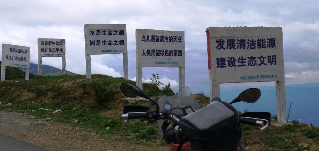
Can you see the para-glider in the photo below? (middle top)
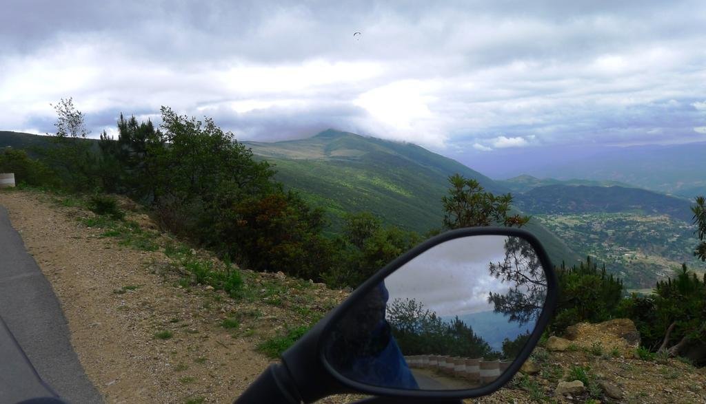
Wasn't expecting to see him in China at 3,000 meters in the middle of nowhere
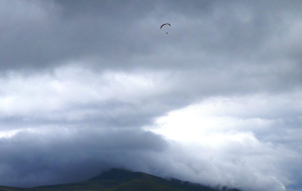

So now we leave the Yangtze river valley and ride over the top of the ridge-line to the east to get towards Dali, we climb to around 3,000 meters, temperature drops to 13C

Can you see the para-glider in the photo below? (middle top)

Wasn't expecting to see him in China at 3,000 meters in the middle of nowhere

KTMphil
Senior member
KTMphil
Senior member
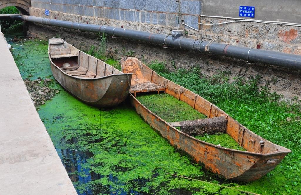
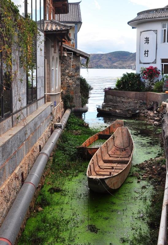
Back on G 214 highway, now only about 40km to the lake to the east of Dali's old town
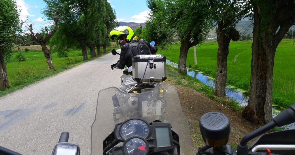
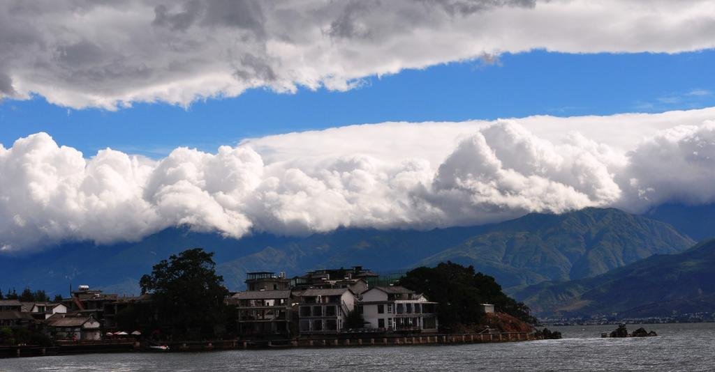
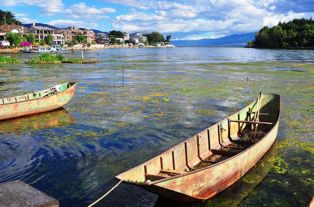
Around the north side of the lake (Dali) and into the big town on the eastern side of the lake
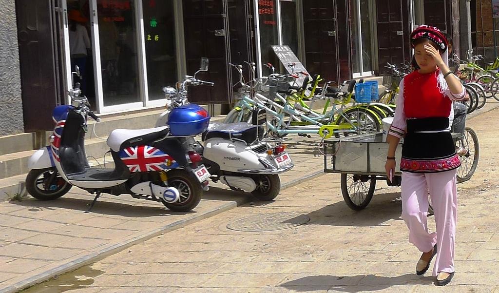
The 2nd fanciest hotel in town on the eastern side of the lake, rooms range from 490 Yuan to 1,200 Yuan per night
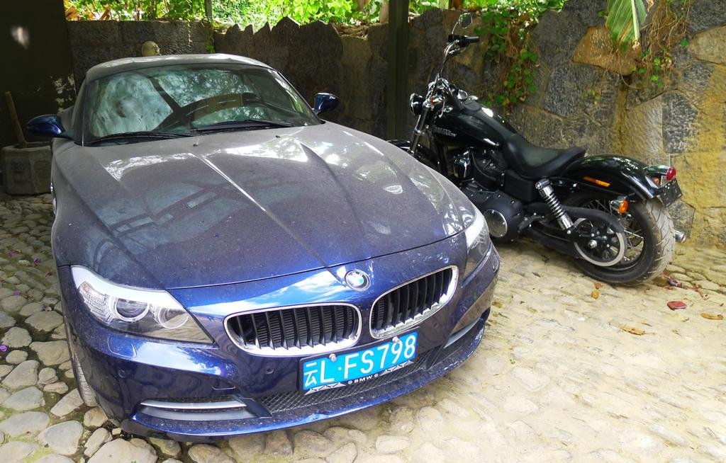
Some young trendy guys staying there
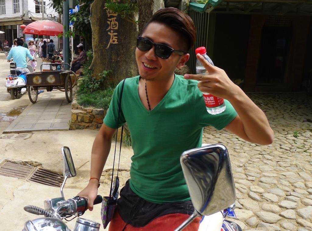
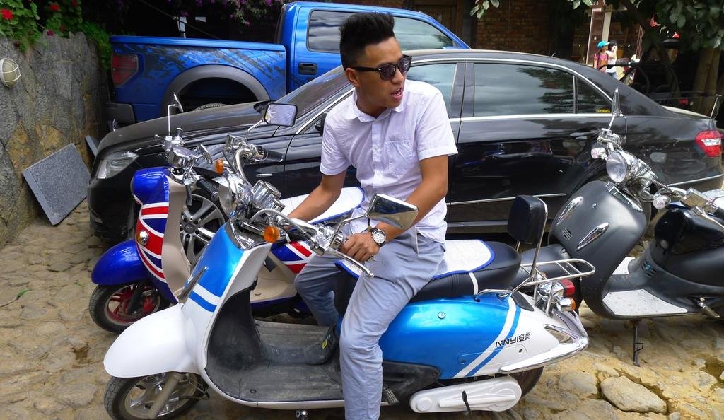

Around the north side of the lake (Dali) and into the big town on the eastern side of the lake

The 2nd fanciest hotel in town on the eastern side of the lake, rooms range from 490 Yuan to 1,200 Yuan per night

Some young trendy guys staying there


KTMphil
Senior member
KTMphil
Senior member
KTMphil
Senior member
KTMphil
Senior member
Tomorrow Dali south to Kunming - more to come.......
KTMphil
Senior member
Reed's next literal installment, this one wirting about our ride from Shaxi to Dali yesterday:
Post #11
Dateline: Saturday, June 8, midnight.
Welcome to the "Shangri-La Here We Come" Blog.
Present location: Dali Lake, eastern shore
Riding distance from Shaxi: 151 kms.
 GPS Track from Shaxi to Dali Lake
Driving (moving) time): 3:47
Moving average: 40 kph.
Highest elevation reached: 3030 meters
Total trip cumulative distance: 2999 kms.
Complete trip track shown below:
 Cumulative track from Chiang Mai start to Dali Lake
Tomorrow destination: Kunming (for the 2nd time as we head south)
Approximate distance: 340 kms
Guesstimate driving time: 7 hours
Phil Gibbins is taking a ton of photos, way more than me. He is posting them online on his RideAsia.net rider forum. But this url changes daily. To see the photos from our ride to Dali Lake, you can view them at the following url:
http://www.rideasia.net/motorcycle-...karpo-6-740-meters-22-113-a-10.html#post29906
Hello Interested Parties,
Another excellent day in the saddle, but for the first time, not the entire ride.
We started out at 10:30 a.m. This was late for us, but we had a shortish day ahead and our energy stores were running low.
We backtracked south out of magical Shaxi on the road we rode in on for around 45 ks. Parts of this road was wonderful, other parts not so great because of commercial traffic and a broken up road surface. Our biggest road hazard besides the usual farm animals and slow-moving tractors were a fleet of overloaded dump trucks that were tough to pass on this narrow road, but were also intolerable to drive behind. The drove so slowly, especially on the upgrades and their loads of fine sand was wafting off their back ends like a dust storm, plus they were spewing out thick diesel exhaust fumes.
At 45 ks we turned eastwards up a large mountain ridge that forms the eastern wall of the Yangtze River basin. The road was called either Rt. D-89 or O-89 as written on the kilometer markers. The road surface changed regularly and intermittently from good asphalt to rotten rocky raw road bed and was, by far, the worst surface conditions we experienced on the tour, but nothing that gave our BMW's any difficulty. (The locals love our BMWs and pronounce them as Bore Ma. They completely have given up on trying to pronouncing the 'w'.)
This was a big-ass mountain and the road itself (not counting the road surface) and views were superb. We topped out at 3030 meters, the temperature touched 16C, and I needed to don my sweatshirt. There were hundreds of hairpin turns and below is a gps screen shot of one section of this road:
 GPS screen shot from ride to Dali Lake
The ride down the eastern side of the mountain was equally outstanding and so were the views. The weather was overcast and a few sprinkles freckled my face shield.
Then we jumped on a road which we traveled northwards on earlier on the trip and stopped for one of the best meals so far in a halal Chinese restaurant.
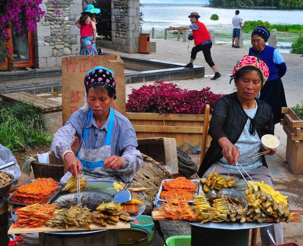
Instead of staying in Dali town as we did on our way up, we drove along the eastern shore of Dali Lake to a charming lakeside down which is attracting an artsy, high-end crowd. Expansion here is in full-swing.
After checking into our hotel and showering, we took a stroll and ended up on the lakeshore esplanade filled with restaurants, wine bars, coffee shops, souvenir shops, and that sort of touristy stuff. This was another "wow" moment for Phil, George, Jah, and myself because the view across the lake and the mountain we just drove down is a scene that I will never forget.
(Don't forget to check out Phil's photos at:
http://www.rideasia.net/motorcycle-...karpo-6-740-meters-22-113-a-10.html#post29906
Tomorrow is going to be a long ride back down to the capital of Yunnan Province, Kunming but it will be mostly on highway. From there George will fly back to Hong Kong, and Phil, Jah, and myself will work out a plan of action for riding through southern Yunnan Province on our return to Chiang Mai.
Now here are some of my personal cultural impressions of China:
I lived in Hong Kong from 1990-95 and travelled inside it extensively by motorcycle and for business. And, man, has it changed in the interim. Back then, it was dirty and garbage-strewn. Anything that was being built was always left in some degree, unfinished. Not a penny was spent on decor, styling, or finishing. There were few cars and millions of bicycles. There wasn't a single highway. The Chinese would stare at us foreigners like we just disembarked from a spaceship from Mars.
This has completely changed. (Or maybe things are totally different in Yunnan compared to the rest of China.)
Cars are everywhere, bicycles are few. Small mcs and scooters, especially electric scooters, are extremely popular. Luxury cars abound. I've never seen so many Porsche Cayenne's and Cadillacs. All the Chinese tourists are walking around with expensive cameras and lenses hanging from their necks, many of them the most expensive cameras and lenses produced. Everyone is friendly, and helpful, and courteous, and curious about us, especially when we are by our mcs dressed in our riding gear.
Public bathrooms are still hideous, some of the time, compared to all of the time in the old days.
In the old days I hated to go into China. Now I am having the greatest of times. I'll have to see about the rest of the country because I hear there is some excellent riding up in Chengdu.
Until tomorrow, Bye, bye.
Post #11
Dateline: Saturday, June 8, midnight.
Welcome to the "Shangri-La Here We Come" Blog.
Present location: Dali Lake, eastern shore
Riding distance from Shaxi: 151 kms.
 GPS Track from Shaxi to Dali Lake
Driving (moving) time): 3:47
Moving average: 40 kph.
Highest elevation reached: 3030 meters
Total trip cumulative distance: 2999 kms.
Complete trip track shown below:
 Cumulative track from Chiang Mai start to Dali Lake
Tomorrow destination: Kunming (for the 2nd time as we head south)
Approximate distance: 340 kms
Guesstimate driving time: 7 hours
Phil Gibbins is taking a ton of photos, way more than me. He is posting them online on his RideAsia.net rider forum. But this url changes daily. To see the photos from our ride to Dali Lake, you can view them at the following url:
http://www.rideasia.net/motorcycle-...karpo-6-740-meters-22-113-a-10.html#post29906
Hello Interested Parties,
Another excellent day in the saddle, but for the first time, not the entire ride.
We started out at 10:30 a.m. This was late for us, but we had a shortish day ahead and our energy stores were running low.
We backtracked south out of magical Shaxi on the road we rode in on for around 45 ks. Parts of this road was wonderful, other parts not so great because of commercial traffic and a broken up road surface. Our biggest road hazard besides the usual farm animals and slow-moving tractors were a fleet of overloaded dump trucks that were tough to pass on this narrow road, but were also intolerable to drive behind. The drove so slowly, especially on the upgrades and their loads of fine sand was wafting off their back ends like a dust storm, plus they were spewing out thick diesel exhaust fumes.
At 45 ks we turned eastwards up a large mountain ridge that forms the eastern wall of the Yangtze River basin. The road was called either Rt. D-89 or O-89 as written on the kilometer markers. The road surface changed regularly and intermittently from good asphalt to rotten rocky raw road bed and was, by far, the worst surface conditions we experienced on the tour, but nothing that gave our BMW's any difficulty. (The locals love our BMWs and pronounce them as Bore Ma. They completely have given up on trying to pronouncing the 'w'.)
This was a big-ass mountain and the road itself (not counting the road surface) and views were superb. We topped out at 3030 meters, the temperature touched 16C, and I needed to don my sweatshirt. There were hundreds of hairpin turns and below is a gps screen shot of one section of this road:
 GPS screen shot from ride to Dali Lake
The ride down the eastern side of the mountain was equally outstanding and so were the views. The weather was overcast and a few sprinkles freckled my face shield.
Then we jumped on a road which we traveled northwards on earlier on the trip and stopped for one of the best meals so far in a halal Chinese restaurant.
Instead of staying in Dali town as we did on our way up, we drove along the eastern shore of Dali Lake to a charming lakeside down which is attracting an artsy, high-end crowd. Expansion here is in full-swing.
After checking into our hotel and showering, we took a stroll and ended up on the lakeshore esplanade filled with restaurants, wine bars, coffee shops, souvenir shops, and that sort of touristy stuff. This was another "wow" moment for Phil, George, Jah, and myself because the view across the lake and the mountain we just drove down is a scene that I will never forget.
(Don't forget to check out Phil's photos at:
http://www.rideasia.net/motorcycle-...karpo-6-740-meters-22-113-a-10.html#post29906
Tomorrow is going to be a long ride back down to the capital of Yunnan Province, Kunming but it will be mostly on highway. From there George will fly back to Hong Kong, and Phil, Jah, and myself will work out a plan of action for riding through southern Yunnan Province on our return to Chiang Mai.
Now here are some of my personal cultural impressions of China:
I lived in Hong Kong from 1990-95 and travelled inside it extensively by motorcycle and for business. And, man, has it changed in the interim. Back then, it was dirty and garbage-strewn. Anything that was being built was always left in some degree, unfinished. Not a penny was spent on decor, styling, or finishing. There were few cars and millions of bicycles. There wasn't a single highway. The Chinese would stare at us foreigners like we just disembarked from a spaceship from Mars.
This has completely changed. (Or maybe things are totally different in Yunnan compared to the rest of China.)
Cars are everywhere, bicycles are few. Small mcs and scooters, especially electric scooters, are extremely popular. Luxury cars abound. I've never seen so many Porsche Cayenne's and Cadillacs. All the Chinese tourists are walking around with expensive cameras and lenses hanging from their necks, many of them the most expensive cameras and lenses produced. Everyone is friendly, and helpful, and courteous, and curious about us, especially when we are by our mcs dressed in our riding gear.
Public bathrooms are still hideous, some of the time, compared to all of the time in the old days.
In the old days I hated to go into China. Now I am having the greatest of times. I'll have to see about the rest of the country because I hear there is some excellent riding up in Chengdu.
Until tomorrow, Bye, bye.
Captain_Slash
Community Manager
- Joined
- Jun 28, 2011
- Bikes
- BMW 310GS Honda Wave 125 Honda MSX 125
then it dawned on me that they collect all the human waste and use it as manure in the fields" Remind me never to eat Chinese rice !!!
I must admit, I did start thinking about it when I was eating their rice in their restaurant!
Waste not want not
KTMphil
Senior member
KTMphil
Senior member
| Thread starter | Similar threads | Forum | Replies | Date |
|---|---|---|---|---|
| R | Tours all over the road | China Ride Reports | 0 | |
|
|
A tour through China with no guide | China Ride Reports | 160 | |
|
|
Thailand to Shangri-La bike tour 7-21 April 2012 | China Ride Reports | 1 |


