Ready to go

schrauberklaus

Senior Member
Joined
Oct 15, 2014
Location
Phuket
Bikes
XR600,XR400,XR280,XR250,CRF250L
DSCN0513_zps6cee7524.jpg


The next 6 weeks I will be with the CRF again a round Thailand .
Tomorrow morning from Phuket to Khao sok, then go to Chaiya and up the coast to Hua Hin and from there over to Kaeng Krachan.

From there, continue northwards to Sangkhla Buri, loop back and take the ferry over Srinagarinda direction Si Sawat and further north, Tak, Um Phang, back Mae Sot, Mae song, Mae Hong Son, Pai.
Around Christmas then in Chiang Mai.

anyone driving in the same direction ?
 
It sounds like you will be having a fun trip, I am in Nan until sometime in January so if you reach here let me know
 
I'll be exploring the Ban Thung Seua Thon area (between Sangkhaburi and the ferry over the Srinagarinda lake) this weekend and taking the route up to Mae Sot (through out via Suphanburi and Uthai Thani)and then down to Umphang over next week. Beyond that I've yet to decide where I'll be going. Need to be back in BKK by the 3/4 January so depending on time, I may continue on up to Mae Hong Son.

By by the looks of things our routes appear very similar. I'm leaving BKK Friday PM and staying in Sai Yok Friday night. Let me know what you are up to.
 
Day 1
GpxViewer

7 o'clock everything secure
DSCN0518_zpsdfb75246.jpg


First stop south of Sarasin Bridge to check that the bags stay in place .
No more Beach Restaurants , everything gone.
DSCN0520_zpsf06e9719.jpg


Second Stop on the Road to Khao Sok , abandoned restaurant , overlooking the River .
DSCN0521_zpsc0a70970.jpg


No more Pics today , have already enough from the south.
Just driving on mostly empty roads . damn It ist that nice after the traffic on Phuket .
Dit 487 km on the roads i chose to Chumpon .
Not the shortest and not the fastest but the most empty roads .

Sit in a Bungalow 15 m from the beach and the CRF is parking direct in front of the door .
Nice and quiet after a excellent Seefood Dinner

@CraigBKK , same Bike , same idea.
we should meet . I'm going tomorrow to Kaeng Krachan Lake , maybe stay 2 nights , some places i want to check out .
So if you leave BKK on Friday Morning and you know the Roads you will take , let me know place and time or GPS position .

@Captain_Slash
Nan stand definitely on the Program this year , maybe after christmas .
I let you know , If we meet you must show me how to get the Tracks in a Webside .
 

Attachments

  • Day1.gpx
    1.2 MB · Views: 258
I'll be in the Thai restaurant very close to the 7/11 in Sai Yok Friday night from about 7pm (N 14.23085, E099.06372). After eating I'll make the short ride to the Nongchanok Guesthouse, close to Sam's Jungle Guesthouse (N 14.28640, E 099.00085). I usually stay there, 800THB.

a69d0e04648ce5d7691b0cf5c5bc716b_zps4a2b02e2.jpg

I know a few picturesque tracks around the lake we could explore in the morning before riding up to I Tong on the Burmese border if you haven't been there. Then a ride up to Sangkhlaburi for Saturday night. I'll contact Lee at the Blue Rock bar in Sangkhla to make sure he has stocked up on cans of strong Danish export beer :DD

Here's a video I made last month of the area:

 
Hi Craig

O.K. found the Position , second turn left on the 323 after Wat Pu Ta Khain .
Do you need to make a reservation in that Guesthouse?

Nice Video , you must be taller then me , if i put the Gopro in the Cheststrap i filming only my handlebar:umm:
 
Hi Craig

O.K. found the Position , second turn left on the 323 after Wat Pu Ta Khain .
Do you need to make a reservation in that Guesthouse?

Nice Video , you must be taller then me , if i put the Gopro in the Cheststrap i filming only my handlebar:umm:

No reservations needed. Turn you camera upside down and tilt it upwards to shoot less of the handlebars.
 
Hi Craig
O.K. thanks

Day 2
GpxViewer
Start a perfect day by leaving the bungalow resort at 7:30.
DSCN0527_zpsb6d76442.jpg


First Stop at Chumpon Raptor Center and Viewpoint .
DSCN0529_zpsb57d0cf3.jpg


Nobody there but everything open , nice Toilets:p
DSCN0534_zps2f1c3c00.jpg


Good view too , but spot only one raptor:?
DSCN0533_zpsa3b86960.jpg


After a short stop on one of the reservoir in that area
DSCN0539_zpsd279bea6.jpg


I decided to try some of the dirt roads through the Palm trees and find the Dirt Highway to Hua Hin
DSCN0545_zpsc295ba43.jpg

Goes on like this for nearly 45 km with hundred of trails left and right , mostly through Pinaple and Coconut fields.
See more Cows then Cars Today perfect.

That needs more Time , change of Plans , stay south of Hua Hin tonight .
So only one Day around Krachen Lake to meet with Craig on Friday.
 

Attachments

  • Day2.gpx
    969.7 KB · Views: 252
O.K. already a few days behind i try to follow up

Day 3
GpxViewer
i left the Beach south of Hua Hin seeing the ocean the last time for the next few weeks
DSCN0551_zpsa514758f.jpg


Going from there to highway 4 for Gas and then over the 1037 to the Pran Buri Dam . Over the Dam and around the north end of the Lake its paved , on the west side of the lake the unpaved
Part start and goes all the way to Ban Pa La-U with the exception of some meters of pavemend through some of the smaller villages .
Very remote Trail , left Pinapple fields with some highrise Lookouts , right a man made trench with elektric Fence and Loudspeakers on every second pole .
Behind the fence start directly the dence Forest of the Kaeng Krachan National Park and i can heare a few times wild elefants (i guess)

The Road paved and unpaved goes north and behind Ban Pakayor the unpaved Trail over the Mountain start . The GPS tells me i am on Highway 3410 and it looks like this
DSCN0561_zpsf38a3e50.jpg

DSCN0562_zpsaeeedf5a.jpg


So far there was no Checkpoint until the one near Huai hin lat Reservoir and the lonly Ranger there looks a little bit shocked as i show up on his Gate from the inside the National Park
Some holes in the Forest make me belive that also here wild Elefant crossing that way but there is no drivable Trail to Bypass the Main Gate in to Krachen National Park.

And a few Km away on the Main Gate into Krachen National Park it's still the same as 2 years ago , NO MOTORBIKES .

O.K. i Turn back and Drive over to the Krachan Reservoir and on the Way i think about what to do with the rest of the Day an decided to drive direct to Kanachaburi to meat with
CraigBKK on the Position he send me . One Day ahead off him give me a nice rest .

After a long (472 km ) and sometimes boring ride (3510) i arrive at (N 14.28640, E 099.00085).

Craig don't promise to much , nice place for 800 THB , very relaxing
DSCN0568_zps2ff95a3a.jpg
 

Attachments

  • Day3.gpx
    1.3 MB · Views: 244
Day 4
GpxViewer
A Day ahead of Craig i had some time to look around the area and found some nice unpaved forest roads that lead me to my first Suspension Bridge .
DSCN0577_zps85e2c0ec.jpg

(N14 20393 E98 56.257)
And direct access to the Kwae Noi River for some refreshment in the clean water .
DSCN0582_zpscdb0fa19.jpg


Next to this Wat
DSCN0574_zps9c10baad.jpg


The Road from there join the 323 next to the Hellfire Pass and from there back to the little resort for more relaxing until Craig arrive .
 

Attachments

  • Day4.gpx
    430.6 KB · Views: 239
Day 5
GpxViewer
Craig arrive the evening befor and we decided to explore the Area on the Kao Laem Reservoir where Craig know some very nice places.
DSCN0596_zps4cb7d6e5.jpg


The Gap in the Walls is the only enty to this Place.
DSCN0599_zpsa9f8029f.jpg


On the other side of the promontory its similar nice .
DSCN0603_zpsa6d1eaa4.jpg

Some local Pickup but nobody there , maybe they left with a boat .


Just finding the Way to that Places is not easy .

Link to the Video
https://vimeo.com/120243773#t=0s


But we had both a lot off Fun .

From the Lakeside we drive up the Mountain Road to Pivok for Lunch .
Endless Curves and Pottholes brings us to that small Village on the Border to Myanmar with a good view to the other side of the Border .
And a Lot of Weekend Tourists from Bangkok .
DSCN0622_zps60152081.jpg

DSCN0623_zps1de98f75.jpg

The Gaspipline from Myanmar run through here.
DSCN0626_zpsd907230c.jpg


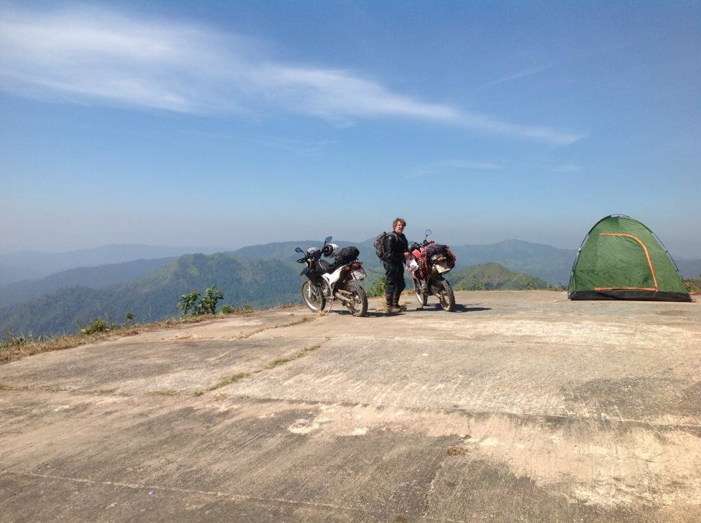
And not far away is something like a small Army defense Post (N14 40.305 E99 22.069) with a Toilet next to the Parking Lot and possibility for Camping
at 1025 m over Seelevel (windy) with great views
DSCN0630_zps05524497.jpg

DSCN0633_zpsb258af82.jpg

DSCN0635_zpse1b3fa7e.jpg


From there we go all the way back down the Mountain (when my rear break overheat) and up the side of the Reservoir to Sangkhlaburi for the night .

Same Problem here with the Weekend Tourists . Most accommodation fully booked , but we found a shit one for 1800 THB got a shower and head in to Town for Dinner.
 

Attachments

  • Day5.gpx
    1.5 MB · Views: 239
Day 6
GpxViewer
We left our noisy accommodation and take a Look what triggered the Tourist Run to Sangkhlaburi.
DSCN0646_zps4c3739a9.jpg


The wooden Bridge (left) is reopen after some years damage .

Then we left the Tourists behind and go south the way we came and turn at N14 56.496 E98 39.628) of the 323 dirction to the Ferry over the Srinagarindra Reservoir.
At (N14 52.647 E98 49.754) the pavement ends and we try to find a new way to the Ferry .
We go to the Loop heading first north , then south in the direction of the Ferry , but at N14 52.669 E98 56.958 we hit the dead end .
Craig (speak perfect Thai) talk to the locals , they confirm there is no way to the Ferry and we had to turn around .
Now we know why on this dusty Dirtroad is so much traffic .

Back at the Gasstation at (N14 53.397 E98 50.080) we get Fuel and a noodle Soup .
DSCN0652_zps253cc2c3.jpg

And continue to the Ferry over the known Dirtroad (again very very dusty )

After about 100 km of Dust we arrive at the Ferry .
DSCN0658_zps4b5788d1.jpg

and both tired and very dusty had enough dust for one day and we took the Ferry
DSCN0660_zpsbabdb58e.jpg

to the Si Sawat side where i know the Road is tarred

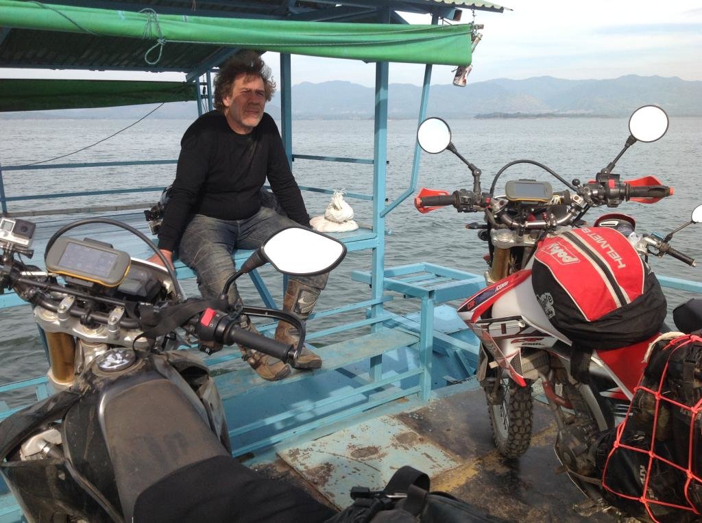
Ferry run only on demand if they have at least 5-6 customers Car 100 THB Bike 50 THB .
The 5 km over the Lake need 1 hour with the Ferry.

But in the Si Sawat area is no accommodation that we like to pay so we drive the 3199 down to N14 26.490 E99 07.859.
There we found a new (open in August) Guesthause / Coffeshop / Restaurant where we had a nice Dinner and got a very nice quiet Room for 1200 THB .
5 Rooms finish , 4 more under construction .
 

Attachments

  • Day6.gpx
    1.2 MB · Views: 257
Day 7
GpxViewer
Craig needs to be back in Bangkok the next Day . So we drive back up the 3199 , this time take the Ferry at Si Sawat that shorten the Mountain Road we drive the evening befor .
This Ferry cost 10 THB and need only 10 min.
DSCN0665_zps823a2fa1.jpg

Then further up the 3199 to the Junction to the Ferry from Yesterday .
Here i must say Goodby to Craig , he take the Ferry back to the dusty Side and i must go further north , today my target is Tak.

Thanks again to Craig for making the Guide and Interpreter and show me some Places i otherwise had not seen .

I drive further north over the 4041 to the intersection with the 3480 and then the 3480 further north .
All Maps show the 4041 along the Sinakharin Dam National Park is Dirt but thats not true .
It was paved 2 years ago (with some sections partly blocked by rockslides) now the Rock slides are removed and its a nice paved road with just a few potholes.
After 421 km i arrive at the Suan Sin Hotel in Tak .

Knowing it from 2 years ago i book 2 nights at 380 THB a night depend here is everything in 2 Min walking distance .
Bike parking in front of the room , room has everything i need (quiet,free WiFi) Lotus , Big C and a Bikewash ,Laundry, Restaurants and Bars just around the corner .
 

Attachments

  • Day7.gpx
    1.1 MB · Views: 259
Day 9
GpxViewer
After the usual Breakfast stop at a 7/11 in Tak i leave the Town and via the 12 drive to Mae Sot and further to Um Pang.
The 12 was early in the morning compleatly under a thick Cloud Cover and lets say very fresh .
And the Trucks drive there even more crazy then the Airport Taxis on Phuket .
Doing 75 km/h downhill i get past by a 30t Truck in a Curve on the opposite Lane with at least 100 km/h and cutting the next curve. Crazy .

After a warm up stop at the Viewpoint/Coffee Shop i arrive Mae Sot and was happy thats there the Sun was shining .
Depend i have to go back to Mae Sot tomorrow i dont waste time and head straight for Um Pang .

What a road , from normal Thai B Road to perfect paved to Gravel and Dirt , Potholes the size of a private swimming pool and filled with gravel or dirt
and up and down hundreds of meters. Thats not a Road thats a giant roller coaster more then 100 km long with more places that have a good view then Parking Spots .
At up to 1320m over See level there are to many places worth to take a pic. at one Point i stop with Pics and let the GoPro do the Work .

Hera just a few.
Shortly after Mae sot i found the access Road to a TV Tower that lead up the Hill , had to check it out.
DSCN0671_zpsde368136.jpg

DSCN0676_zps1f491580.jpg

A while later this place just 100m next to the Main road.
DSCN0682_zpsa6e935e9.jpg

Thararak Waterfall (N16 34.158 E98 41.665) no entry fee , nice new Toilet.
DSCN0681_zps7909c12e.jpg


Then further up the Mountain .
DSCN0688_zpse28fe8dd.jpg


Here i climb up to get a shot over the power lines , guess what ? after that Pic the battery was dead and the spare Battery down by the Bike.
DSCN0699_zpsa5186506.jpg

But i got the shot.
ec08506c-8d69-4ad1-87c3-d0d3f309df31_zps0956fe4a.jpg


The Road to Um Pang pass by the Umpieng refugee camp at over 1100 m , must be very cold in that huts.

DSCN0703_zpscbe2b7fb.jpg


That is a easy corner of that road even with the Gravel and Potholes .
013e220e-8d78-442e-8ece-8563bf5b1bf9_zps06224478.jpg

The 1090 could be close to the Loop in Numbers of Curves , did anyone ever count them .

So after endless Curves i arrive in Um Pang and look first for a Place to sleep .
The choise here is not so big and i want to make sure i get a room . Not that some Tourist Busses arrive later on .

After i had a Room at the Garden Hut i drive further down the 1090 and try to find the Thi Lo Cho Waterfall , but fail .
The Dirt Road end some where in the Forest no sign show where the Waterfall really is . On the GPS Position i can only see that there is a Canyon
under the Trees , but no water or Fall .

Further Down i found then the Doi Hua Mod Lookout at N15 57.645 E98 51.410
Nice Place . The Dirt road that lead to the Lookout is a little further down the Road from the GPS Pos.
On the End of the short Dirt trip is a Parking area with old Toilets and outgoing from the many old Campfires here do many Locals camping or just having a Party.
But the Lookout (Top of the Mountain give a great all around view.
DSCN0717_zps2b2bee1e.jpg


The Parking /Camping area
DSCN0708_zps473bbe1e.jpg

DSCN0707_zpsfba7f9e5.jpg


Base jumper will like that Place
DSCN0712_zps6416bbb1.jpg
 

Attachments

  • Day9.gpx
    1.7 MB · Views: 231
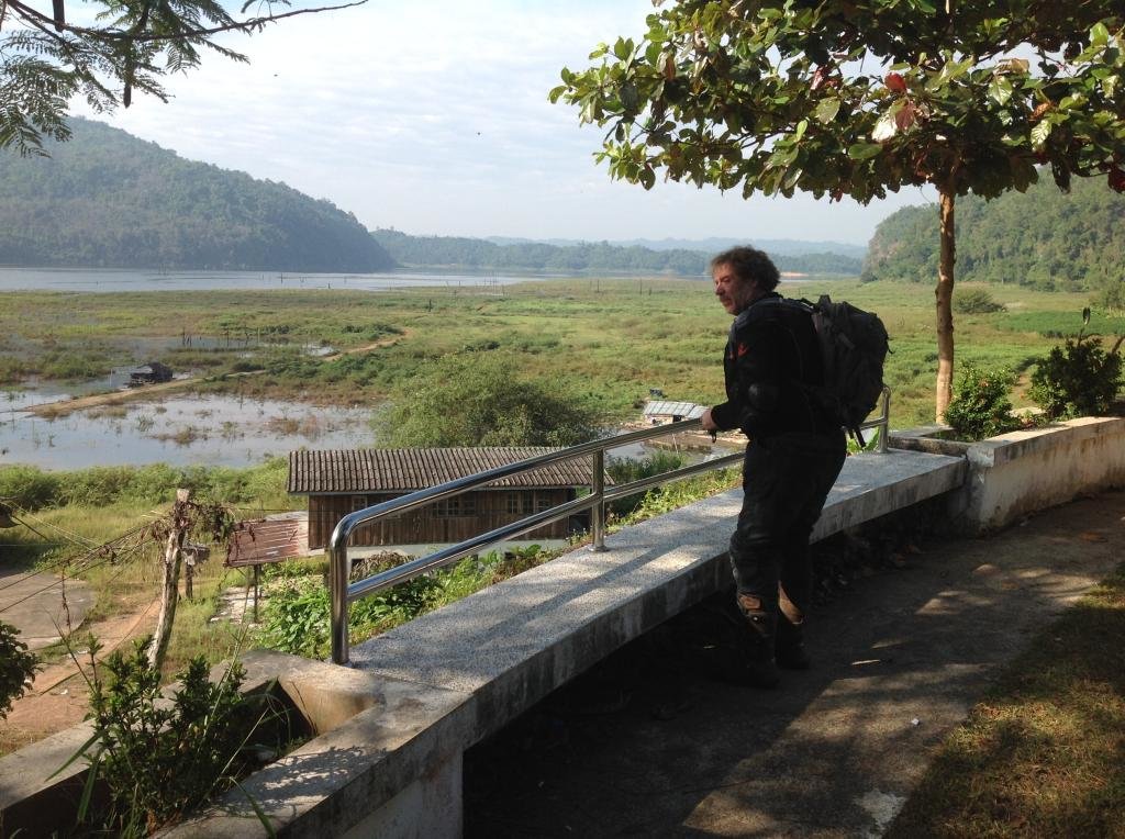
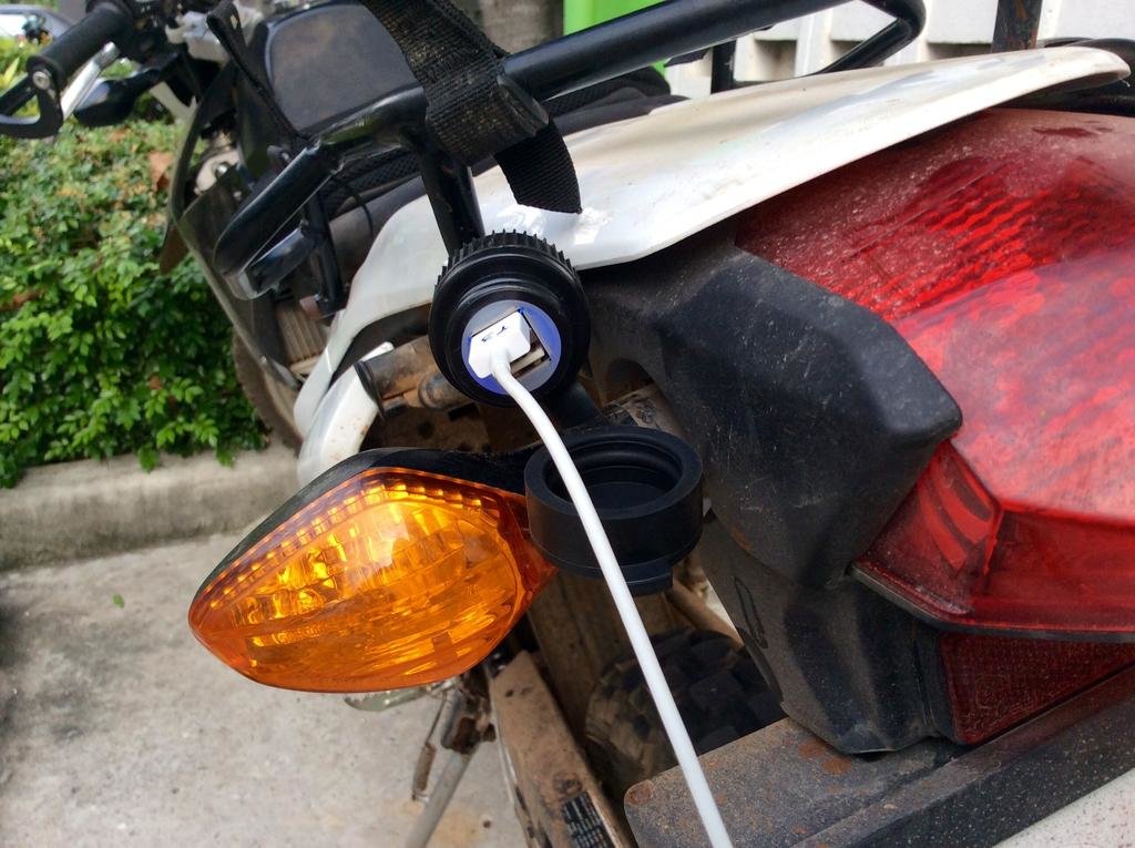
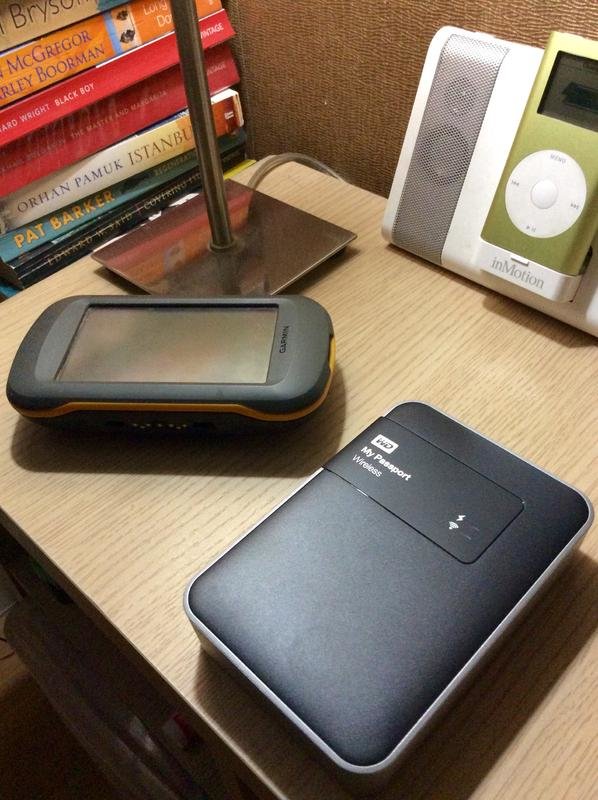
Successful day here in BKK. Had both my bikes serviced and installed my new USB charger to the CRF battery. Also transferred the media files from the weekend onto my new WD Passport drive directly using the integrated SD card slot.

image.jpg

image.jpg

I have some banking to do in the morning and plan to leave BKK by midday. Will spend tomorrow night in Ban Rai, Uthai Thani. Planning on arriving in Umphang at the weekend if you are still around.

I'll be looking here for some good recommendations :giving:
 
Enjoying this Klaus. :DD
Great pics.
Where did you find the tank bag?

Hi
Got this Tankbag years ago as freebe at polo Germany as i buy my Marushin Helmet , its a Helmet Backpack , just changed the Straps a little
 
Day 10
GpxViewer

The Garden Hut in Umpang was for 500 THB nicer from the outside then from the inside . Bett hard like the floor and the Bett sheets had seen better Days . In 1975 or so .
Noisy neighborhood , Lot of Chicken and horny cats.

So i left early .
Plan for today was , drive back to Mae Sot and try to find some access to the Farm roads through the valleys i see yesterday.
Sun was out at 8 o"clock and that promise a great Day .
But Plan and reality dosn't mach up .

Just 50 km out of Umpang i found a antique nail ,
DSCN0732_zpsb5e59a92.jpg

unfortunately in my rear tire.
DSCN0728_zps5bddaa7a.jpg

Got just back from dirt to paved road and felt immediately thats there is something wrong .

Tire was totally flat , not just a little bit , must be happen just a few m back as i drive back on the road .

So a little road side repair was on the Program.
DSCN0729_zps1d30790f.jpg


But unfortunately that nail had pierced the tube more than once , actually more then 40 times .
The flat tire must have slipped on the Rim .
So 2 hours and 11 patches later I had to admit that i can not fix that Problem on the Road , a new tube is needed .
But 50 km from Umpang and a little over 100 km fom Mae Sot its difficult to get a 18" tube .

So i stop a empty Pick up going to Mae Sot . The friendly Driver and his Friends in the next Pick up that came load the CRF on to the back
of his Pick up and drive us ( Me and the CRF ) on the back of his Car all the way back to Mae Sot directly to a Tire repair shop .

The view in to the valleys from the back uf the Pick up was great but i need both Hands to hold on , so no pics .

After a new tube was installed i was tired an Look for a Hotel , first Hotel i see , was J2 Hotel.
Looks good from outside and is as good from the inside .
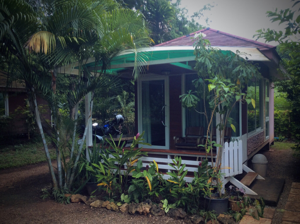
Nice Room , comfortable bed , 850 THB N16 43.054 E98 34.878 just 1 Year open
 

Attachments

  • Day10.gpx
    924.8 KB · Views: 227
Hi Craig

I think i stay here in Mae Sot (J2 Hotel until saturday morning .
Tomorrow look around Mae Sot .

Saturday then further north .

To go with you again to umpang cost me at least 2 Days , sorry .

Don't forget a Spare Gas Canister , its a long way .
And the Road is similar to the one we drive saturday around si sawan but more up and down .
i did about 25 km a hour with stops for pics , thats a 6 hour drive to Umpang .

I should arrive in Mae Sot Friday evening so maybe I will catch you before you travel north. Is there fuel on the road south to Umphang?

I'll pop into the J2 to see if you are there.
 
You will get fuel okay between Mae Sot and Umphang Craig
 
South of umpang? don't know i get not far enoug to see one .
Umpang has a few Gasstations , if you fill up befor going up the mountain then you will be fine , but if you add some extra km by driving in to the valleys
it can happen that you run out .
 
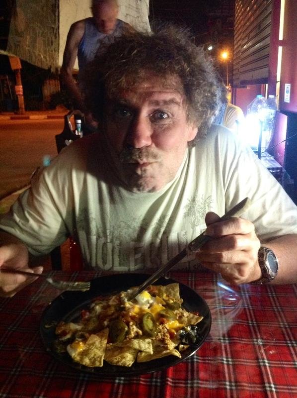
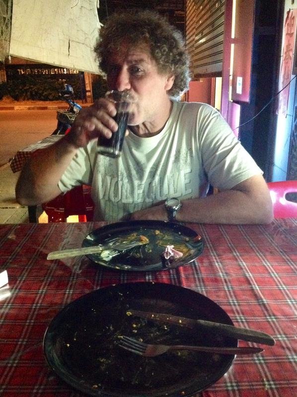
Dinner in the Canadian Kitchen, Mae Sot tonight, here's the starter, nachos - before and after...

image.jpg

image.jpg

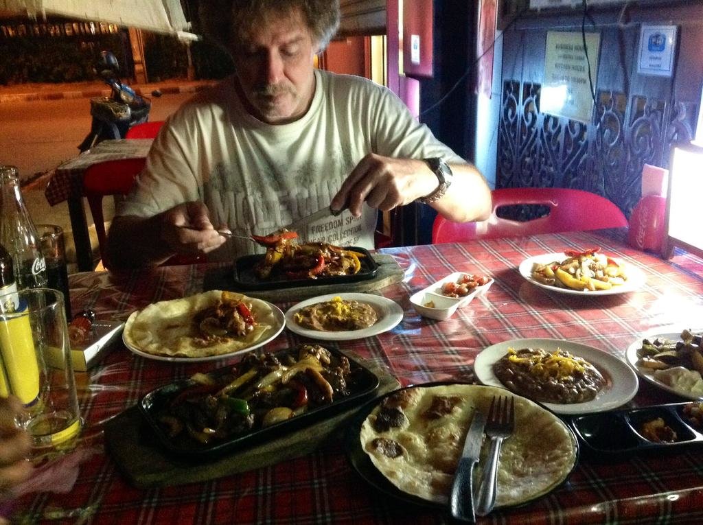
Finished off with the delicious sizzling fajitas...

image.jpg

Thanks for the tip Bob :applause:
 
That's a nicely set up CRF to ride in Thailand and also any parts of the SEA region. Most practical and economical for solo riding.:applause:

Looking forward for the lovely pics of the trip.
 
Day 11
GpxViewer
As you can see in Craigs Post 2 below we meet again in Mae Sot .
He arrive in the Afternoon and we had a nice coffee in the afternoon and a excellent mexican Dinner at the canadian restaurant .

In the Morning befor Craigs arrival i look around Mae Sot .
Find 2 Spots with access to the River and Border south of the official Border Checkpoint.

Looks like there is frequent Border crossing without any check .
DSCN0734_zpsc2652a51.jpg

DSCN0735_zps294c9235.jpg

DSCN0737_zps6346db51.jpg


The second Place is next to a Wat and the Stairs down to the River have a nice decoration.
DSCN0740_zps554bfcea.jpg

DSCN0741_zps144bddb9.jpg


East of Mae Sot i found a small Reservoir with a new Wat overlooking it .
DSCN0743_zpse1c2a559.jpg

but still under construktion.
DSCN0744_zps42e9402a.jpg


North of Mae Sot next to a Hot Spring the entrance to a Cave .
DSCN0745_zps3a1b0028.jpg


And on the Way back to the J2Hotel in Mae Sot i do some detours through the Farmland .
DSCN0753_zps8623d6ab.jpg

DSCN0752_zps36685416.jpg


Took a Shower in the nice J2 Room to wash the dust from the Farm roads down .
DSCN0754_zps7e0dc58c.jpg


and just as i want to go find new Tire Patches Craig pull into the parking lot .
 

Attachments

  • Day11.gpx
    754.8 KB · Views: 203
Day 12
GpxViewer
Say good by to Craig again depend we go in different directions .
I leave Mae Sot at about 8 o'clock fill my Tank to the Neck and head north on the 105 .

On some places its possible to take a look at the River .
DSCN0756_zpsac4d660b.jpg


But my first target was the Mae Moei National Park
The 6 km up to the Checkpoint the Road was bad , and i was thinking after the Checkpoint it get better depend tourists have to pay 120 THB for entry in to the NP
and from that money they maintain the Road .
What a mistake , after the checkpoint the road get worse. To call that a road is a choke .
The unpaved Tracks around srinakarin Lake are better .
50 % of the tared Road is only Pottholes in all kind of sizes shapes and deeps . No change to find a line to drive .
The shadow of the trees make it even more difficult to see them .
So i hoppel from Potthole to Potthole for 34 km up the Mountain . In steep sections the Trucks and Pickups have complett removed the tar and the Dirt is ground
to very fine Powder and this fine Dust cover all the trees and bushes along the Road. Locks shit all the Way .

But the View from up there is great .
DSCN0762_zps87047062.jpg

DSCN0759_zps5fbe31aa.jpg


On the Way up the Road passes a small Waterfall.
DSCN0766_zps2ca028a1.jpg

A second Waterfall i can not get to with the bike , and Parking and take a hike with my riding gear is out of the question .

So i check out the Viewpoints , great for Camping.
DSCN0771_zpsc6f427e2.jpg

DSCN0770_zps51bee07c.jpg


and hoppel down the Way i came .

Further north on the 105 i came on a stretch that was brand new and had perfect sweeps .
aa28b446-6d01-4e9b-9f01-4e748e0a40c3_zpsd208b194.jpg

DSCN0779_zps99eaebf3.jpg


But the Roadwork is not finish , after the new section the Roadwork just started to widen the road .
That meant 10 km of Dirt road fresh filled up and lose not compacted and wet , mean mud.
Down the valley you can see a part of that stretch.
DSCN0784_zps54c05807.jpg


After the Section under construction came about 40 km of bad road , needs some repairs to .
DSCN0772_zps139b2636.jpg


But i arrive without problems in Mae Sariang
DSCN0788_zps3e88150d.jpg


The Group of Bikes heading south on Vespas , a shadow and 300 ninjas will have fun on the Dirt .
 

Attachments

  • Day12.gpx
    1.6 MB · Views: 212
Day 13
GpxViewer
Leaving the not to mention Hotel in Mae Sariang at 7 o'clock and heading further north via the 108 to Mae hong son.

Took some detours over Farm roads , one with a nice crossing .
DSCN0790_zpsac79dabc.jpg


The 108 is compare to the 105 a nice road , so i was quickly in MHS .
A coffee at the 108 viewpoint .
DSCN0796_zpsda71faac.jpg


And a look to the so called River crossing to a long neck village .
DSCN0799_zpsadaef33c.jpg

Thats not for me .
DSCN0802_zpsd8335516.jpg


So i drive to the Piya Guesthouse and get there a nice Bungalow for 700 THB a night . Stay 2 nights and
spend the rest of the day looking aroung MHS and relaxing in front of the Bungalow .

Visit the Wat over MHS
DSCN0804_zps0ac60406.jpg

more for the view
DSCN0809_zps9c91d313.jpg

DSCN0810_zpsaf28deea.jpg

and just befor the Road to the Wat reach the first buildings see a more then 2 m long snake crossing the road .
Maybe there missing tomorrow a chicken .
 

Attachments

  • Day13.gpx
    1.1 MB · Views: 207
Great report and pictures happy you found the guest house, it probably one the best value for money places in town and close to walking street.
 
Day 14
GpxViewer
The Morning was a little misty .
DSCN0814_zps12a4f774.jpg


So i take it slow and drink a second double Espresso in front of my Bungalow be for i ride out of MHS.

On the North Thailand 7.0 Map i found a Road /Track/Trail that's not on the Thailand Streetmap12 and that's
interesting enough to try it out .
So i go north on the 108 just 2 km and then turn left to Nai Soi a little Village on this Road without number .
The North Thailand 7.0 Map show that this Road is turning to dirt for a few km and this stretch of Dirt meet then another
residential road that join to the 5011 at Ban Na Pa Paek

Sounds like a nice short trip of about 40 km to Ban Na Pa Peak with a little dirt in the middle .
Man was i wrong .

A few km after Nai Soi is a junction with a Road sign to a village in 6 km .
That was mixed concrete and Dirt wide enough for a Car .
It leads to that Bridge .

DSCN0830_zps7c022f8c.jpg

Nice little stream below.
DSCN0828_zps3cd69b53.jpg

And a tree wit a ladder next to it .
DSCN0826_zpsc18cd1eb.jpg

After 6 km as the Road sign had promise i came to a Village.
In that i need the help of the locals to find the Road out of the Village depend it was only 20 cm wide and hidden from bushes and trees .
This trail goes on for nearly 20 km , several 1m wide Wood/Bamboo bridges over streams and a 10 m wide / 40 cm deep crossing through
a stream .
DSCN0836_zpsb76bdd7e.jpg

One very steep slope with a curve goes direct over one of the 1 m wide bridges .
Slide , go to fast and miss the line and you will take a dive 2m down in the little stream .

Fortunately i walk first down the slope to check it out .
Halfway down you can see the CRF on top .
DSCN0835_zpsb4cb87c7.jpg


The view over the little valleys where the Farmers had there Fields was great .
DSCN0834_zpsa4e3a667.jpg

DSCN0838_zps59e173fd.jpg


Then the Trail get wider and up a mountain with huge bamboo Forest.
DSCN0840_zpse558905a.jpg

DSCN0839_zps1328fb8a.jpg

Looks like there was a machine up there to clean the track .

Got about 2 hours video with the Gopro be for the batteries was all dead .
Add some in the next days if i get a good wifi connection .


Link to the Video
https://vimeo.com/120860075#t=0s


More then 2 hours after the first village (there is another one and a view houses along the trail )
i reach Ban Na Pa Peak found the Ban Na Pa Peak Camp/Coffeshop for a Coffee.
DSCN0843_zpsae0fe9bc.jpg


And then drive further north to Ban Rak Thai.
DSCN0844_zpsd6c1f133.jpg


Had a delicious Pork knuckle Chinese style and a chat with two Thai riders from Bangkok.
DSCN0849_zpsc6dd9c13.jpg


be for i drive further north to the end of Thailand .
DSCN0852_zpsa93edca0.jpg

No Guard there , if i want i think i can make a run , no Gate and the Barbwire open .
DSCN0853_zps1d27dd37.jpg


But i like to stay , turn around and go south via the 5011 back to MHS
 

Attachments

  • Day14.gpx
    941 KB · Views: 227
Day 15
GpxViewer
I leave MHS at 9 o'clock and drive to Pai .
See the Road already to years ago , so don't look much around and enjoy the road .
Pai was , as it look overrun by mostly younger Tourists on Scooters not my taste so i go on to CM .
At arrival much traffic , The police had close some roads .
Go straight to Riders Corner where i still sit and try to upload the clips from Yesterday.
 

Attachments

  • Day15.gpx
    1.6 MB · Views: 211
Day 16

After i eat last night some dried mango snack i got a food allergy to that stuff and had to visit the Pharmacy.
My skin itched like hell and i had a rash all over my body .

Got some medicine and cream at 1 in the Morning , lucky it's here in CM with a open Pharmacy at this time .
Now o.k. so medicine helps but make me wake up late and dizzy all day .

So no much riding .

Just got the Bike cleaned (very clean at the Carwash by the Big C extra) and the Chain lubricated and Air Filter cleaned at Succsess Bike (N18 47.920 E98 59.408)
Little bit shopping and that was it today

Now i need to find a daytrip for tomorrow.
any suggestions?

Take it easy Klaus. Better off sticking to your usual diet of yoghurt, sandwich and cigarettes!:naughty:
 
Day 18
GpxViewer
I leave Riders Corner CM at 8 o'clock in the morning and ride via the 118 , 1035 , 120 to Nan .
Shortly after Nong Kaeo i turn left and ride though Farmland over a Road without number to connect with the 1251 , 1091.

All nice Roads i know now why guys on faster bikes like it .
First Coffee Stop at the Hot Springs .
DSCN0895_zps477c160c.jpg

DSCN0901_zps8acbe774.jpg

DSCN0904_zpsa0ab0301.jpg


later on a short stop in front of this guy
DSCN0907_zpsec4f7f3f.jpg


and the next stop at a waterfall next to the road .
DSCN0915_zps610ff559.jpg

DSCN0913_zpsfda762de.jpg


Over / behind a Police Checkpoint i found a Place for the next stop with a very good view.
DSCN0917_zps9d670b38.jpg

unfortunately can the camera not catch what i have seen.

Then closer to Nan a great Landscape .
DSCN0921_zpsdee2d0a7.jpg


From the 1091 i turn to the 4002 . This Road goes south and hit Dirt . Plan was to do a little Dirt and come from south to Nan.
But i did not know how steep the Tracks in this area are .
After 30 Min on steep paved road i stand on the end of the road and see the tracks going up the hill .
No way with all my Luggage on this Track for 25 Km to Nan .
So i turn around and go back to the 1091.
Got a nice video , that comes later .
DSCN0923_zpsc116d9ca.jpg

DSCN0929_zpsf9d7a643.jpg


Arriving in Nan it was not easy to get a room everything is fully booked .
After 2 hours cruising through Nan and checking many Hotels and guesthouses i found a room to my liking at sundra GH .
Just for 2 Nights , so if i want stay longer i have to found tomorrow another place .
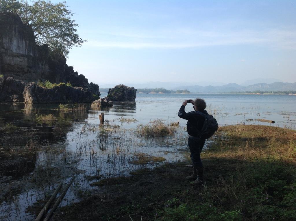
Meet Collin and some other Guys at Tonys place and Surprisingly, the Malaysian BMW rider i meet already at a coffee stop on the way to Pai .
 

Attachments

  • Day18.gpx
    1.7 MB · Views: 187
Back
Top Bottom