You are using an out of date browser. It may not display this or other websites correctly.
You should upgrade or use an alternative browser.
You should upgrade or use an alternative browser.
More trail links from Omkoi to B. Sop Khong / R 105
- Thread starter KTMphil
- Start date
KTMphil
Senior member
KTMphil
Senior member
KTMphil
Senior member
I think we both agree that the trails we just mapped, were the most beautiful and challenging so far in the Omkoi region

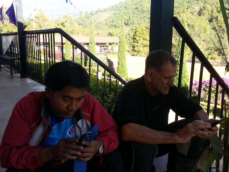
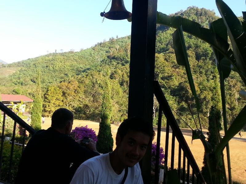
Coffee break on R 108

Then onto R 3017 towards Ban Sop Khong


Coffee break on R 108

Then onto R 3017 towards Ban Sop Khong

KTMphil
Senior member
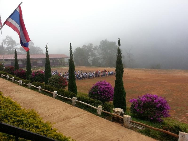
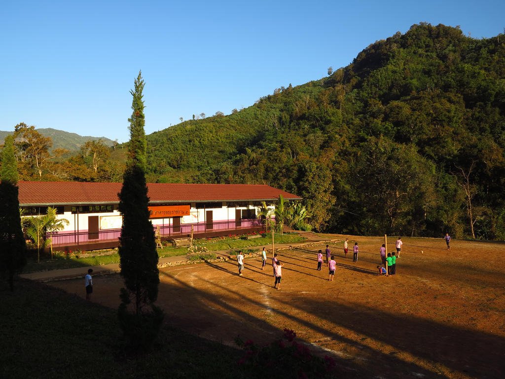
The school that we found has 600 pupils, about a third are borders


It looked like the perfect place for a child to be educated


It looked like the perfect place for a child to be educated

KTMphil
Senior member
Got the most new trail and waypoint data that we've ever got on this trip too

There was so much we found and so so much more to do, we've got it all documented ready for next time


There was so much we found and so so much more to do, we've got it all documented ready for next time

KTMphil
Senior member
KTMphil
Senior member
We manage to arrange some digs for the night

First time Mr Bailey says he's ever seen a Monk driving a car

Then get the sleeping arrangements all rigged up before dark

Some wild rice and omelette

A quick walk around the village, then off to sleep for a 0630am start


First time Mr Bailey says he's ever seen a Monk driving a car

Then get the sleeping arrangements all rigged up before dark

Some wild rice and omelette

A quick walk around the village, then off to sleep for a 0630am start

KTMphil
Senior member
0645am sawing some firewood before school


Safety first

Looks like they've done plenty


Safety first

Looks like they've done plenty

KTMphil
Senior member
A very chilly morning


& off we go mapping into the unknown


& off we go mapping into the unknown

KTMphil
Senior member
..........more to come
KTMphil
Senior member
Off into the unexplored, scattered settlements along the way

You always find a lot of the trails follow the river valleys, many of them not possible in the SW monsoon


More villages

Photo's: David Bailey

You always find a lot of the trails follow the river valleys, many of them not possible in the SW monsoon


More villages

Photo's: David Bailey
KTMphil
Senior member
Early morning moisture rising east of B. Sop Khong


KTMphil
Senior member
A new bridge underway to be finished before the rain starts. Note the unusual hand saw, looks like a specific design for cutting planks


The old footbridge in the same area


The old footbridge in the same area

KTMphil
Senior member
Lots of bulldust around making riding at the rear a pain and needing to keep some distance

Whenever you see riverbed terrain it often means it will be impassable in rainy season


This part was particularly nasty


Whenever you see riverbed terrain it often means it will be impassable in rainy season


This part was particularly nasty

KTMphil
Senior member
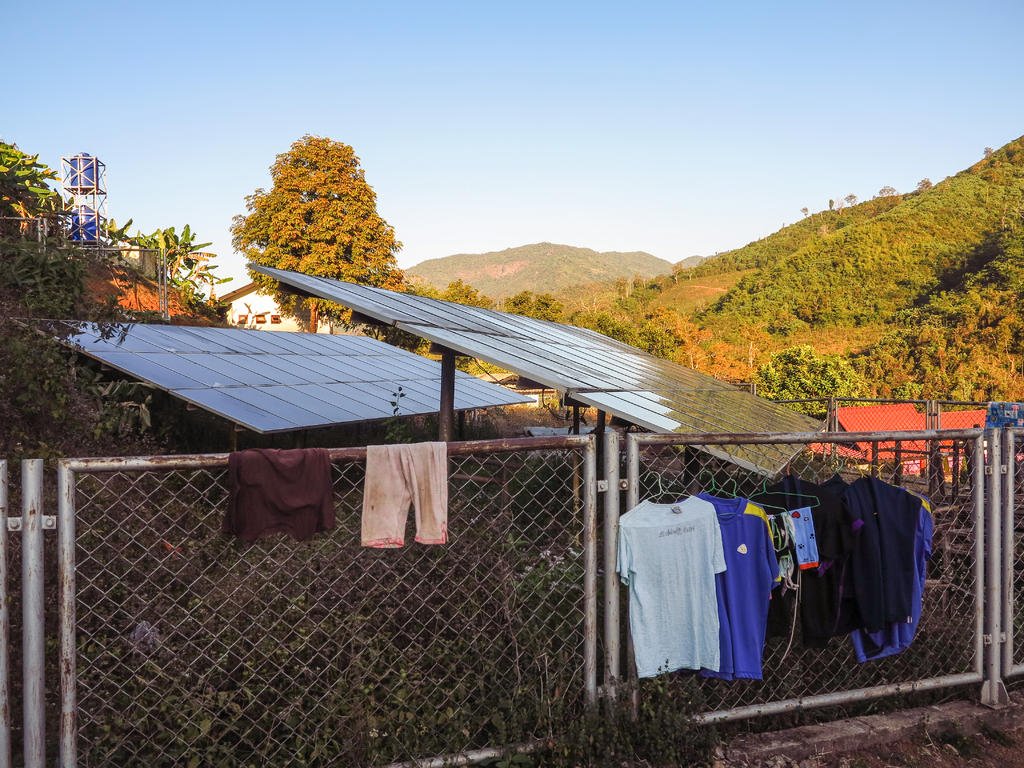
Quite astonishing to see where the remote areas that the missionaries got to, we were told these were from Norway


Above ground toilet exit, we presumed so that the waste can be used as fertilizer


Above ground toilet exit, we presumed so that the waste can be used as fertilizer

KTMphil
Senior member
Ban We Nam Pur


B. We Nam Pur School


B. We Nam Pur School


KTMphil
Senior member
A little startled, probably never heard a loud 2-stroke before


KTMphil
Senior member
Some more slippy-slidey riverbed stuff

Then back up into the remote hills, let's hope this goes through


.... more to come

Then back up into the remote hills, let's hope this goes through


.... more to come
KTMphil
Senior member
More villages to the east

They were not going to move

Scooted around them and up into the next remote settlement

A traditional Karen lady

More to come......

They were not going to move

Scooted around them and up into the next remote settlement

A traditional Karen lady

More to come......
KTMphil
Senior member
More switchbacks to the east, this is starting to look like it will go through to Omkoi - fantastic.

Lots of forks in the road & with a lot of this not visible from Google Earth, it meant a lot of u-turns, but it meant that we got a lot more covered and mapped out for future mapping trips

Fortunately, we managed to get through to Omkoi from B. Sop Khong on this new trail, felt real good to have another R 105/ R 1099 link up done. Omkoi Resort had rooms so everything was perfect, a great day.
Freezing in Omkoi, the fire was delicous


.....more to come

Lots of forks in the road & with a lot of this not visible from Google Earth, it meant a lot of u-turns, but it meant that we got a lot more covered and mapped out for future mapping trips

Fortunately, we managed to get through to Omkoi from B. Sop Khong on this new trail, felt real good to have another R 105/ R 1099 link up done. Omkoi Resort had rooms so everything was perfect, a great day.
Freezing in Omkoi, the fire was delicous


.....more to come
KTMphil
Senior member
Up the crack of Dawn, 0630am start we knew this was going to be a long day, a huge linkup with some nasty elavation, we'd asked the locals and we coudn't find anyone that said they'd been from Omkoi through to R 105 on the route we were about to try and map, this might be interesting


KTMphil
Senior member
The rewards of an early morning start

The views over to Doi Tong were spectacular


The views over to Doi Tong were spectacular


KTMphil
Senior member
Grading underway on some of the high traffic trails

We flag down some locals and try to find out whether this goes through or not, they don't know, we are none the wiser

A constant trickle of villages keeps us optimistic


We flag down some locals and try to find out whether this goes through or not, they don't know, we are none the wiser

A constant trickle of villages keeps us optimistic

KTMphil
Senior member
More villages, now pretty remote

I can't imagine living here in rainy season, walking out would be the only way for sure

We start to rise up to about 1,500 meters and we're above the late morning, rising moisture

A few more villages and even some concrete on the steep parts

Some more nasty rutted stuff

Bump into a couple of Karen locals perched at 1,500m. We found out why, they tell us from there, they can get a 1 bar phone signal from the other mountain.


I can't imagine living here in rainy season, walking out would be the only way for sure

We start to rise up to about 1,500 meters and we're above the late morning, rising moisture

A few more villages and even some concrete on the steep parts

Some more nasty rutted stuff

Bump into a couple of Karen locals perched at 1,500m. We found out why, they tell us from there, they can get a 1 bar phone signal from the other mountain.

KTMphil
Senior member
It them went kind of single track for a while, could this be the end?


KTMphil
Senior member
As we rise up, some amazing views

Sill pretty early, it looks beautiful


Sill pretty early, it looks beautiful


KTMphil
Senior member
Some more routing headaches, as this wasn't on google earth

Across the other side of the ridge and we could see forever


Across the other side of the ridge and we could see forever


KTMphil
Senior member
And then time for the decent, there was nothing at all in this steep, nasty middle section, it told us that in rainy season this is somewhere you cant get out of

It was like skiing down these powder cliffs, both wheels locked up

Then after several KM's, some concrete to aid farm access in the steep areas, there's a village coming for sure


The school at the entrance to Ban Chok Ae Phu

Traditional Karen scattered the village


It was like skiing down these powder cliffs, both wheels locked up

Then after several KM's, some concrete to aid farm access in the steep areas, there's a village coming for sure


The school at the entrance to Ban Chok Ae Phu

Traditional Karen scattered the village

KTMphil
Senior member
They seemed pretty surprised to see us


We're so far through now, that when we ask the locals if it goes through, we're getting timid yes's, things are looking up


We're so far through now, that when we ask the locals if it goes through, we're getting timid yes's, things are looking up

KTMphil
Senior member
Out of the village and back into the steep, dusty, ruts

After a while, we reach the village of Ban Bohl Lu

They seem more positive about the link up

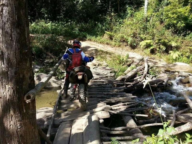
Lots of temporary stick bridges on this route that wont survive rainy season


Ready for road making


Could do with some here, this was nasty


After a while, we reach the village of Ban Bohl Lu

They seem more positive about the link up

Lots of temporary stick bridges on this route that wont survive rainy season


Ready for road making


Could do with some here, this was nasty

KTMphil
Senior member
We then had 10km of real hell, immensely rutted steep nasty trail

As usual the photo doesn't capture the gradient

This stick bridge didnt look too nice

My surveyor did a great job and gave it a green light


As usual the photo doesn't capture the gradient

This stick bridge didnt look too nice

My surveyor did a great job and gave it a green light


KTMphil
Senior member
KTMphil
Senior member
Into Ban Chee Bok Tee, not sure they'd ever seen western people before, maybe some Norwegian missionaries i suppose

Very unusual ethnic housing


Curious buffalo

We were trying to work out what she was making, the best we could come up with was something to hold fruit


Very unusual ethnic housing


Curious buffalo

We were trying to work out what she was making, the best we could come up with was something to hold fruit


KTMphil
Senior member
We were making good time on our estimates, things were looking good

Crystal clear day, the trail ahead could be seen for a long long way


A huge section in the middle of nowhere had been graded, we found out why later


More ruts and isolated villages

A washed away bridge with a temporary repair


Crystal clear day, the trail ahead could be seen for a long long way


A huge section in the middle of nowhere had been graded, we found out why later


More ruts and isolated villages

A washed away bridge with a temporary repair

KTMphil
Senior member
Back to the luxurious graded stuff for a while

This was why it was graded! A new road had been cut to replace this nightmare


This was why it was graded! A new road had been cut to replace this nightmare

KTMphil
Senior member
On the mountain to the west of Ban Chee Bohk Tee, a new Stupa is being built

They make their own bricks at the site


We were not sure if there was oil in the bottle as a release agent or just plain water


They make their own bricks at the site


We were not sure if there was oil in the bottle as a release agent or just plain water

KTMphil
Senior member
They picked the perfect spot for the Stupa


KTMphil
Senior member
It was starting to feel like we might be through the worst and we were over the "hump" in the middle that prevents this area from being a used road, it is nasty, once you've been there, you understand why it's not on any maps!
The way ahead

Into the very poor village of Ban Chok Ae Phu


Again very unusual housing

Check out the boy on the left. Mr. Bailey has been here getting on for 30 years and has never seen ethnic clothing like this, very unusual pants


The way ahead

Into the very poor village of Ban Chok Ae Phu


Again very unusual housing

Check out the boy on the left. Mr. Bailey has been here getting on for 30 years and has never seen ethnic clothing like this, very unusual pants


KTMphil
Senior member
Out of Ban Chok Ae Phu & ahead is looking good'

We got a bit lost here at first, there were several options all leading roughly in the direction we wanted to head, a bit of local knowledge saves a lot of benzine


All sorted and we're off


We got a bit lost here at first, there were several options all leading roughly in the direction we wanted to head, a bit of local knowledge saves a lot of benzine


All sorted and we're off


| Thread starter | Similar threads | Forum | Replies | Date |
|---|---|---|---|---|
|
|
Yet Another Jesus Trail Thread | Thailand Ride Reports | 5 | |
|
|
NO MORE 'WATER WARS' | Thailand Ride Reports | 8 | |
|
|
Mae Sariang no Boatrips anymore | Thailand Ride Reports | 6 | |
|
|
Sexy Pancake does the Bo Klua Loop (& more) | Thailand Ride Reports | 33 | |
|
|
More trail pioneering in the Omkoi region | Thailand Ride Reports | 90 |


