Mapping the unmapped Omkoi beauty

Two locals trying to move a huge concrete pipe alone


12220713986_94e0c3aacd_b.jpg


A bit of help and they got it done


12220519354_eee9a35265_b.jpg
 
Yeah but I am not sure if it is done in a constructive way as it looks like that the "competition between the players" is becoming increasingly unhealthy. As a result the division between the people interested in enjoying a ride in uncharted territory has become even worse in particular when I see statements like this on Facebook "..... ....... better stay the f@ck out of our way! *_^.

Personally I am so fed up with all the crap going on that I will have a very hard look at what is going on and may decide to pull out of mapping this area and possibly other areas as well.


Fortunately it looks like the the offending comments have been removed from FB, let's get back to the riding folks.

Nice pictures BTW Phil.
 
Last fuel stop before we're off into the unkown


12220075485_1e4b7cc2ac_b.jpg


We'd talked to the locals several times in this area and they confirmed there was a backway to Mae Long Noi, they seemed hesitant each to time confirm it, which normally means its a nasty trail with gradient


12229603963_343b46b9df_b.jpg
 
So off we go into the unkown ...still slippy in the shaded areas, looks like these areas might not ever dry out


12220070555_d4dc128dd3_b.jpg


David and Chuck down with no problems (real steep and slippy turn the bike off)


12220655106_8231504ae0_b.jpg
 
This one's a real steep one


12220649496_9ee8a07cd1_b.jpg


Everyone up without any drama's


12220050505_c9ff0d9b79_b.jpg


12220045295_38fb4c5ebc_b.jpg


I'd been having with my gear shifter coming loose the day before, tightened the end bolt and it seemed to solve the problem. About 10km in it come loose again, I try tightening the end bolt a little and it become loose, its sheared.


12220632176_bf0ca4d447_b.jpg


Not sure what gear its stuck in, tried needle nose vice grips on the remainder of the shaft, wouldn't budge, turns out it was jammed in 4th gear, getting out will be interesting.


1656151_652201421493055_62288727_n.jpg


Photo: David Bailey
 
Last edited by a moderator:
Lots of rpm's and lots of clutching, I managed to get the bike out in 4th gear, not sure if there's any clutch plate damage will check


The splines had almost completely worn off from the inside of the gear pedal


12220215663_537d65f21e_b.jpg


So, a lot of stones left unturned down there as we didn't finished what we had planned for this trip. It's good to see what interest we have sparked, looks like a lot of riders are now interested in following in our footsteps, its a fun area for sure!


Below - stuck in 4th gear for 300km back to Chiang Mai


12220432814_5ff4023137_b.jpg
 
Last fuel stop before we're off into the unkown


12220075485_1e4b7cc2ac_b.jpg


We'd talked to the locals several times in this area and they confirmed there was a backway to Mae Long Noi, they seemed hesitant each to time confirm it, which normally means its a nasty trail with gradient


12229603963_343b46b9df_b.jpg

Phil did you try that track north of the new concrete bridge ??
 
The splines had almost completely worn off from the inside of the gear pedal


12220215663_537d65f21e_b.jpg

Thats a real bummer early on in the trip
 
What a difference a month makes.
Here's Bob in the same spot on Christmas Day.

P1030420.jpg

Hey that's pretty spooky why was the picture taken by both in the exact same spot, handsome looking rider in the earlier shot though :lol3
 
Having 2 photos taken at different time in the same place of the same view means the NT GPS map, by unwritten law, now has to have a "scenic" waypoint icon at that spot.
 
What a difference a month makes.
Here's Bob in the same spot on Christmas Day.

P1030420.jpg

Having 2 photos taken at different time in the same place of the same view means the NT GPS map, by unwritten law, now has to have a "scenic" waypoint icon at that spot.
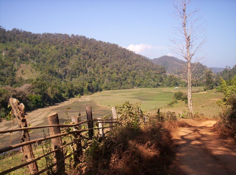

There was a fence there 4 years ago;

100_3383.JPG

Highly enjoyed this the ride report, thank you to all - though all the pictures and tracks are giving me violent travel pains whilst enduring a northern canadian winter. Explored the Omkoi area often and the Mae Ngao was one of my favorite rivers to fish.
 
This is too weird Kevin, four pictures, same location but i can't recall any good reason why Pounce stopped during our trip other than i was riding by.....
 
This is too weird Kevin, four pictures, same location but i can't recall any good reason why Pounce stopped during our trip other than i was riding by.....



5 from the same place at different times - this one was when Sallows tagged along


21126d1379071513t-omkoi-r-105-link-up-finally-completed-img_4934_edited.jpg
 
Last edited by a moderator:
Managed to drill the broken bolt out without damaging the threads, the 2 smoker all fixed, so back off to Omkoi with Mr Bailey in a couple of days to finish up the mapping.


ForumRunner_20140204_150206.jpg
 
All packed and ready for another mapping trip in the Omkoi region. 3 bottles of Mount Gay rum to leave in the pickup base for emergencies. Looks like we'll leave the pickup near Mae Long Tai & use that as a base to save coming in and out of the fun area.


12340578573_173f171e68_b.jpg


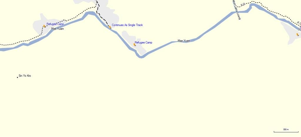
Looks like there's some really fun stuff south of the Sop Moei region to link up, we were looking at it today and it looks like it might go right through to Sop Moei, but we can't see how we get across the from the south yet.


mae yuam river.jpg
 
Found a young, hungry, guy at Chiang Mai University really interested in compiling some Omkoi trail trail data, let's see how he does!
 
All packed and ready for another mapping trip in the Omkoi region. 3 bottles of Mount Gay rum to leave in the pickup base for emergencies. Looks like we'll leave the pickup near Mae Long Tai & use that as a base to save coming in and out of the fun area.

12340578573_173f171e68_b.jpg


Looks like there's some really fun stuff south of the Sop Moei region to link up, we were looking at it today and it looks like it might go right through to Sop Moei, but we can't see how we get across the from the south yet.

View attachment 26316

Try from the So Baerakla Monastic Residence near N17.68992 E97.95528 as that seems to go through all the way (3 Karen villages and after that through the agricultural fields and then on to the Refugee camp and over the suspension bridge to the north side of the Yuam river.
 
Back
Top Bottom