Lone Rider
Blokes Who Can
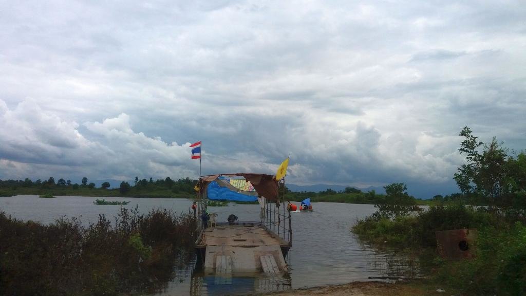
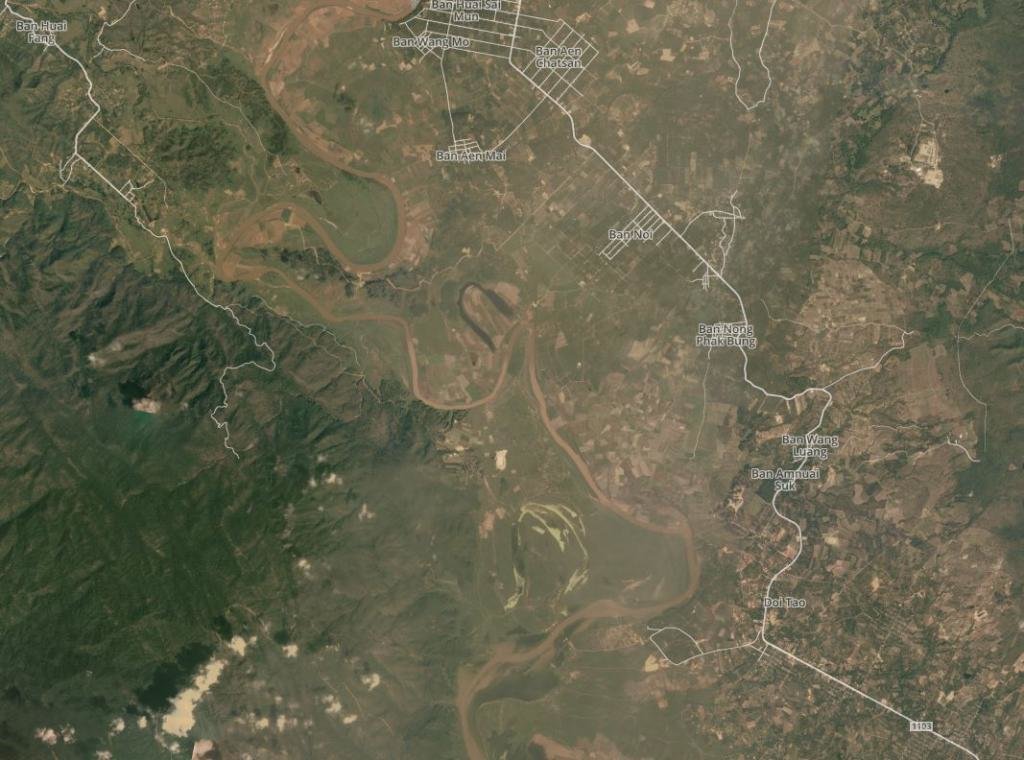
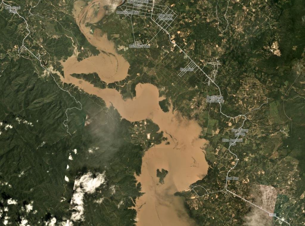
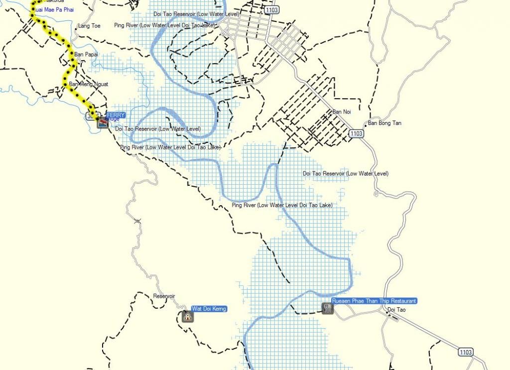
Went to Mae Sariang to meet Captain Slash to provide him with the latest updated GPS map for the North of Thailand as well as papermaps for the Mae Sariang area and on the way back I made some touristic stops at various places like the Thep Phanom Hot Spring, the Ob Luang gorge, the Doi Tao lake as well as various temples, etc. Just some pictures taken during the trip back as well as pictures taken the next day when I went back to the Doi Tao area but this time on the westside of the lake to check up on the waterlevel as well as looking at another temple.

A damp and grey day and it kept on drizzling basically for the whole day while on my way To Mae Sariang

Stayed at the Black Ant Coffee and Resort in Mae Sariang - still good but it starts showing its age or rather the lack of maintenance. Parking is a bit of a problem in Mae Sariang as the police seems to be active enforcing the no-parking rules so everyone tries to squeeze their cars behind the white lines

Just outside Mae Sariang a new bridge has been built to a small temple on a hill (coordinates N18.16095 E97.96198)


The Thep Narom Hotsprings (oN18.27107 E98.39625) on Rd. 1088 about 7 km. north of the junction with Rd. 108

Map of the Ob Luang area (copyright NorthThailandBirding.com) with the gorge as well as the trail along the prehistoric remains and rock paintings

Part of the Ob Luang gorge completely on the west side with the old bridge - cordinates N18.22233 E98.48196

The Ob Luang gorge proper with the new bridge - picture copyright Atma Seva

The Doi Tao Lake (N17.95475 E98.65836) or rather the Doi Tao plains with just 2 or 3 restaurants in the distance in the Ping river which feeds the Doi Tao lake. Basically all the shops, food stalls and the fish smokers were gone and, besides myself, there was only one other visitor

Another view of the Doi Tao Lake - the next day I went to the temple on top of the mountain range on the west-side of the Doi Tao lake


Some rock formations along the Ping River at N18.09333 E98.61007 just a biy off Rd. 4010 (Chiangmai Rural Road). I am not sure about the name though but it could be the Pha Wing Chu Cliff

There are lots of temples in this area as well as stupas built on top of the mountains. Wat Up Kaew (N18.09774 E98.58781) at the junction of Rd. 1012 with Rd. 4010


And a temple supported by Asom Teap Mongkol from Singapore with nice views over the surrounding area - coordinates N18.10236 E98.58903
Fast forward to the next day to the Phra That Doi Koeng (Kerng) temple (coordinates N17.95231 E98.60474) on the mountain range west of the Doi Tao Lake.


It is a long way up through the forest along a very bumpy 15 km. long dirt and concrete road. There were lots of very young monks but I did not see any older monk. The temple has a kind of military influence judging by the number of uniformed statues.

I was the only visitor to the temple - probably because it is a long way off and the in places steep and very curvy roads


The stairs up to the stupa


The views from the stupa to the south and part of the Doi Tao Lake.


The view towards the east with the reaturants and the Doi Tao service center. Not a lot of water but there is much more water than what was visible from the service center I was yesterday

Not to sure what to make of this - saw it along the road while coming down from the temple

Panoromic view from the stupa

A damp and grey day and it kept on drizzling basically for the whole day while on my way To Mae Sariang

Stayed at the Black Ant Coffee and Resort in Mae Sariang - still good but it starts showing its age or rather the lack of maintenance. Parking is a bit of a problem in Mae Sariang as the police seems to be active enforcing the no-parking rules so everyone tries to squeeze their cars behind the white lines

Just outside Mae Sariang a new bridge has been built to a small temple on a hill (coordinates N18.16095 E97.96198)


The Thep Narom Hotsprings (oN18.27107 E98.39625) on Rd. 1088 about 7 km. north of the junction with Rd. 108

Map of the Ob Luang area (copyright NorthThailandBirding.com) with the gorge as well as the trail along the prehistoric remains and rock paintings

Part of the Ob Luang gorge completely on the west side with the old bridge - cordinates N18.22233 E98.48196

The Ob Luang gorge proper with the new bridge - picture copyright Atma Seva

The Doi Tao Lake (N17.95475 E98.65836) or rather the Doi Tao plains with just 2 or 3 restaurants in the distance in the Ping river which feeds the Doi Tao lake. Basically all the shops, food stalls and the fish smokers were gone and, besides myself, there was only one other visitor

Another view of the Doi Tao Lake - the next day I went to the temple on top of the mountain range on the west-side of the Doi Tao lake


Some rock formations along the Ping River at N18.09333 E98.61007 just a biy off Rd. 4010 (Chiangmai Rural Road). I am not sure about the name though but it could be the Pha Wing Chu Cliff

There are lots of temples in this area as well as stupas built on top of the mountains. Wat Up Kaew (N18.09774 E98.58781) at the junction of Rd. 1012 with Rd. 4010


And a temple supported by Asom Teap Mongkol from Singapore with nice views over the surrounding area - coordinates N18.10236 E98.58903
Fast forward to the next day to the Phra That Doi Koeng (Kerng) temple (coordinates N17.95231 E98.60474) on the mountain range west of the Doi Tao Lake.


It is a long way up through the forest along a very bumpy 15 km. long dirt and concrete road. There were lots of very young monks but I did not see any older monk. The temple has a kind of military influence judging by the number of uniformed statues.

I was the only visitor to the temple - probably because it is a long way off and the in places steep and very curvy roads


The stairs up to the stupa


The views from the stupa to the south and part of the Doi Tao Lake.


The view towards the east with the reaturants and the Doi Tao service center. Not a lot of water but there is much more water than what was visible from the service center I was yesterday

Not to sure what to make of this - saw it along the road while coming down from the temple

Panoromic view from the stupa


