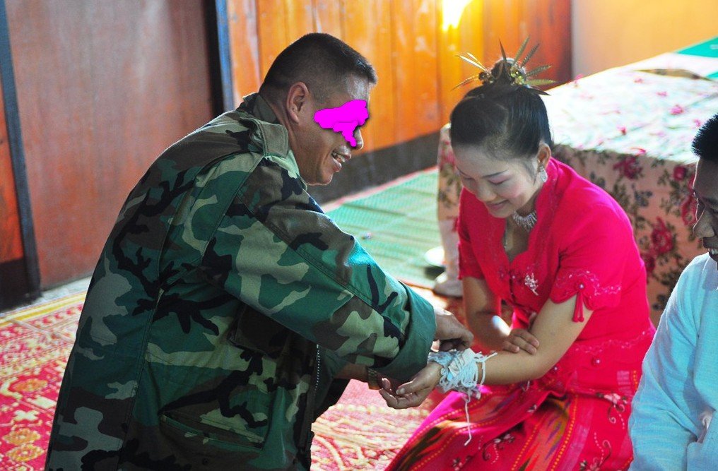
Shan Wedding in Loi Tai Leng, Shan State, Myanmar

KTMphil

Senior member
Joined
Jan 11, 2011
Location
Chiang Mai, Thailand
Bikes
2007 KTM 990 Adventure Suzuki DRZ 400
Shan Wedding in Loi Tai Leng, Shan State, Myanmar

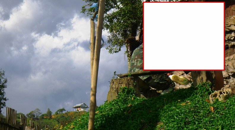
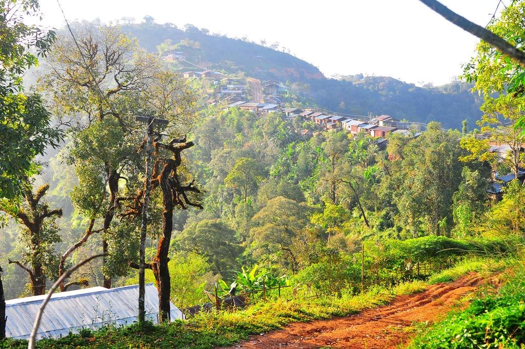
Just got back from a Shan State Army officer's wedding in Loi Tai Leng, Shan State, Myanmar, scenery up there is breathtaking.


6292060612_454c3d42c8_b.jpg


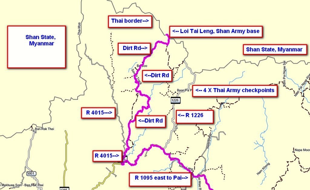
As there's a new command in charge of the Thai checkpoints, that has decided no foreigners are allowed across north from Thailand into Shan State, Myanmar, we had to find an alternative route to the Thai - Shan border, avoiding all but the last Thai military checkpoints.

6292071310_3cc05bacc3_b.jpg


FULL REPORT TO COME TOMORROW - JUST GOT BACK
 
We had been invited to a friends wedding who is 2nd in command at the Loi Tai Leng, Shan State ('Myanmar") , Tai Yai, rebel army camp. Initially, we were told that we could get permits for entry passed the Thai military checkpoints for this event. A day before leaving, after submitting passports & bike documents to the Thai military for approval, we were told that the would not be issued due to a new officer being in charge of the checkpoints & no foreigners would be allowed into the Shan State Army camp.

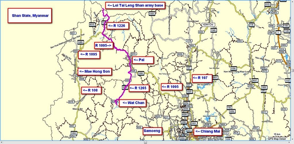
It was looking like we couldn't go but then we got a call from the Shan army camp & they gave us a route with village names that would by-pass all but the last Thai military checkpoints. I gave the village names to Auke to see if he could make sense of the village names & make a route, within an hour he had a route emailed back to me to the Loi Tai Leng, Shan State army camp. So Som & I decided to give it a try accepting that we may be turned back.

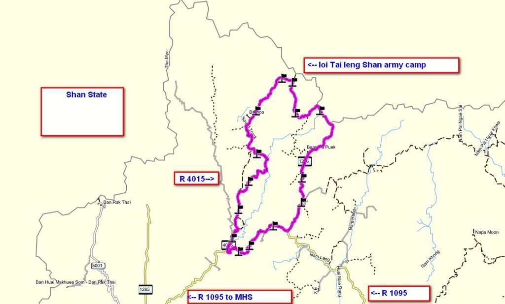
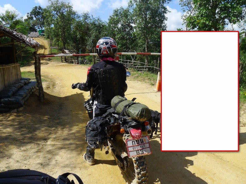
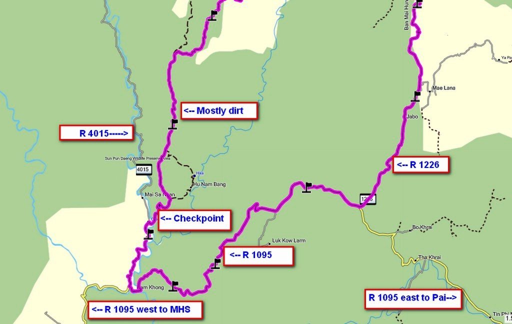
Below is the route west of Pai from R 1095 (Mae Hong Son loop road) north to Loi Tai Leng, Shan State army camp, that avoids most of the Thai military checkpoints. There was one checkpoint on the dirt road north but it was unmanned.


dirt to ltl.jpg

Map copyright © www.RideAsia.net - Permission needed to copy
 
Early start as we didn't know the state of the dirt roads above

6291557723_feafbc6ebf_b.jpg


Breakfast at the Pankled Coffee shop on R 1095 (Mae Hong Son loop road)

6292077916_bb011965af_b.jpg


6292076878_7d15b68751_b.jpg


6291556527_2548eff70f_b.jpg


Fuel station in Pang Mapha / Soppong, bumped into a bunch of guys on tour on Tony's Big Bike's rental bikes


6292076462_b8ab1f0f98_b.jpg


R 1095 is still in bad shape for sports bike, many potholes and quick repairs. It has some of the best views in Thailand.


6292076172_0c9ca071c1_b.jpg
 
To avoid the checkpoints north towards Loi Tai Leng, Shan State, from R 1095, take a right turn onto R 4015 as in the map above, then after 1KM take a right turn onto the dirt road.


file.php


Map copyright © www.RideAsia.net - Permission needed to copy


The dirt road was quite easy, very steep sections, but would be no problem for a pick-up.

6291555485_71922a6364_b.jpg


6291555075_4d5bc3654c_b.jpg


Having never been on this road before, some great new scenery

6291554871_5d3e0e5e22_b.jpg


The southern sections were very dry and easy

6292074750_6b3af969c5_b.jpg


As we got further north it was swampy in places

6292074338_689fa3a7c2_b.jpg


Places that didn't get the sun stayed greasy. Here a small settlement on the track north

6292074050_7af905b140_b.jpg


6291553409_9e55a970dc_b.jpg


Another small settlement further north

6292073730_26e67f0ce4_b.jpg
 
As we got further north, it got more and more rutted

6291552755_78cb00c8da_b.jpg


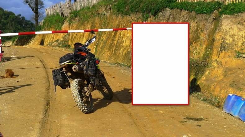
4KM from the Thai/ Shan State "Myanmar" border we could see the final Thai military checkpoint look-out


6291552537_55a6dd4de9_b.jpg


The last 4Km to the border are very steep and rutted, if wet it would be tough getting up here

6292072714_06f77d7001_b.jpg


Great views just before the border


6292071854_d7617a1b9a_b.jpg


6291551723_1f1da23ebe_b.jpg


We got to the final border Thai military checkpoint and the soldier in charge said there was no way we would be allowed in without a permit (which we didn't have), so things didn' look good.

6292070226_87b1709a17_b.jpg


...
adj 1.jpg


Som tried talking with the soldiers explaining we had been invited to a wedding, even showing the printed invitation cards - they didn't care


2.jpg
 
I managed to get hold of the Shan State army officer that was to be married, he said he would come down to the checkpoint and see if he could fix things

6291548759_fe19289344_b.jpg


We waited up in the Thai army checkpoint for him to arrive

..
3.jpg


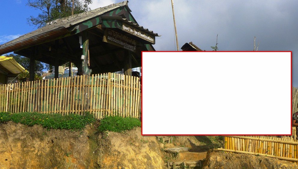
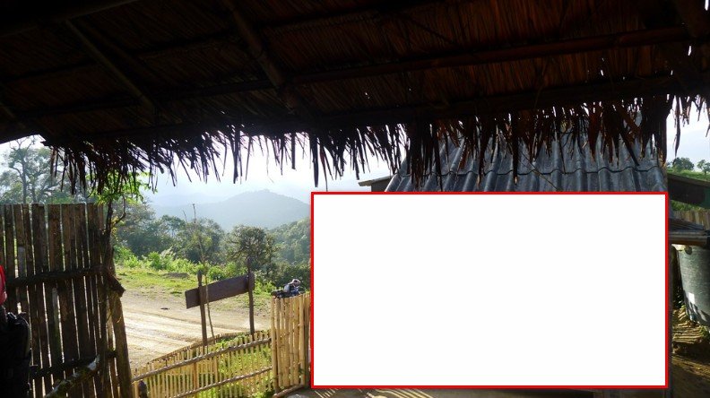
As you can imagine - great views from an army checkpoint

6292069240_1bcce939b9_b.jpg


6292069564_2b870d0bde_b.jpg


Housing at the Thai military checkpoint

6292068832_6db878a01d_b.jpg


Thai soldiers, with a look-out in the back ground


7.jpg


There we several donkeys at the Thai checkpoint, they told us they use them to haul water up from the stream 2Km below

6292068282_36f2407896_b.jpg


The Shan officer to be married came to the Thai, military checkpoint and after about 30 minutes managed to pursuade the Thai officer in charge to call his boss and ask for permission. We were given the ok for one night in Loi Tai Leng, but we were told this was the last time, pretty lucky.

The dirt road up to the Loi Tai Leng village was nasty as they had been some rain the day before. Here the Shan border checkpoint.

6292068000_70886a46b3_b.jpg
 
Now in Shan State , "Myanmar", as you can see the road still bad

6291546687_e2f6cb83c9_b.jpg


6292066652_f4171fbcfa_b.jpg


Finally there in the Shan army camp

6291545595_7dce7529b9_b.jpg


The Loi Tai Leng, Shan State, school in the right of the photo

6292065686_dc42832670_b.jpg


School

6292065452_bb0e7d05ce_b.jpg


Loi Tai Leng army base and pick-ups arriving with people attending the wedding ceremony

6291544565_e11ffd92c7_b.jpg


6291544181_3d37c68fa0_b.jpg


We were assigned on of the soldier houses to sleep in. we rigged up a hammock as a mosquito net, they said there were no mosquito's there but we weren't sure

6292062738_6beefd1ce8_b.jpg


Toilet was pretty high up, might be a challenge in the middle of the night after some Laos Khow.

6291542081_59f7486b25_b.jpg


Cooking for 100 people at the wedding

6291543483_7c6e7a159a_b.jpg


Shan State rebel army officer that was to be married the next day

6292063232_6fcce32abb_b.jpg


We were given these tasty roasted beans to eat, never had them before

6292063002_36bda27fae_b.jpg
 
At 0500am the next morning there apparently was a "shaming" ceremony. where pupils from the school are paraded through the main street and shamed for smoking etc.... We could here the chants in the distance but didn't get up to see it.

The wedding ceremony started about 0615am the next morning


6292061862_102cee85ed_b.jpg


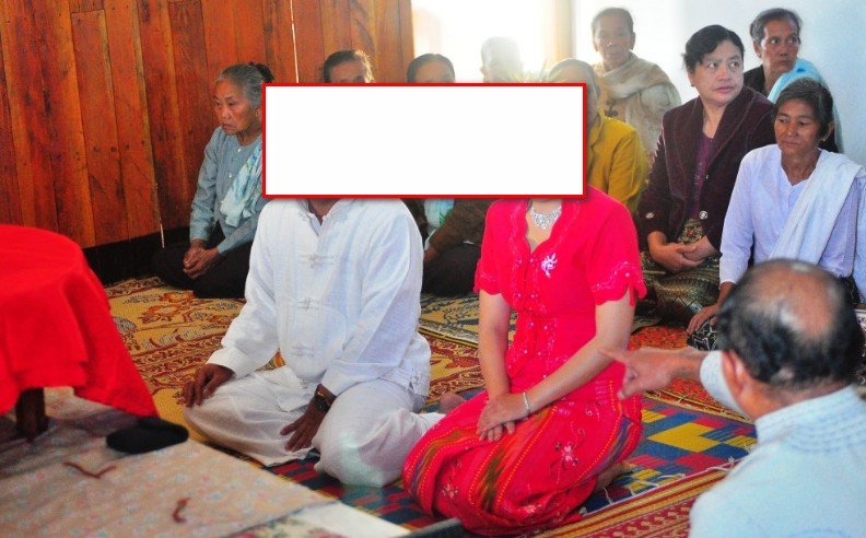
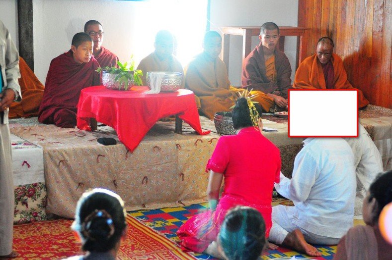
Som said it was completely different from a Thai ceremony. It lasted about 3 hours, with monks and Army officers doing presentations. We felt very honored to be invited.


Views from Loi Tai Leng army village


6292061468_678a624dbb_b.jpg


6291540723_41d9cffe89_b.jpg


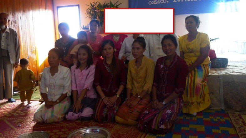
Women at the wedding in traditional Shan dress (even Som on the right)

...

4.jpg


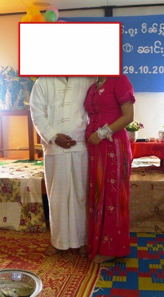
The happy couple

5.jpg

The NGO "Partners", has contributed a lot here, to the right of the photo below, you can see the dorms. they have built for the school children.

6292059156_bb8182fb32_b.jpg


Views out across Shan State, as you can see not a village in sight

6291538573_afcc084e3d_b.jpg


After the ceremony was finished we headed back south into Thailand & took the more eastern road south that goes passed 4 Thai military checkpoints. The clay had dried out from the rain 2 days before which was a blessing

6292058754_ff9fe90c19_b.jpg
 
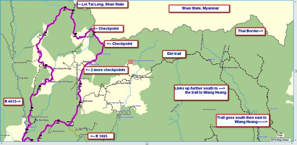
This was the route we took south which hooks up onto R 1226 ( & from Pai the backway back to Chiang Mai discussed later)


ltl - wat chan.jpg

Map copyright © http://www.RideAsia.net - Permission needed to copy


To clarify, the western road is the dirt trail we took north to Loi Tai Leng, Shan State & the eastern road is the road we took south which has all the checkpoints

ltl loop.jpg

Map copyright © http://www.RideAsia.net - Permission needed to copy


This route south into Thailand is MUCH harder than the route that we came up on. It's steeper and much more rutted.

6291538277_962b5540b2_b.jpg


6292058350_6131bb57e9_b.jpg


6292058110_8e686fcc3f_b.jpg


The checkpoints are all now very serious with the new Thai commander, they all seemed quite shocked to see us coming south as they had not seen us go north ( we went up on a different road)

6.jpg


More steepness & ruts


6291536837_093ac5376f_b.jpg


6291536567_04ed560a91_b.jpg


Onto the north end of R 1226 - beautiful scenery

6291535917_c15eba298b_b.jpg


More checkpoints (glad we didn't try to come up this way)

8.jpg


R 1226

6291535153_5233514b3f_b.jpg
 
1,000's of Shan people live in Thailand in the area around R 1226, here a Shan Wat (temple) on the way south on R 1226

6292055360_bcd3a09167_b.jpg


R 1226 has some dirt sections , most of the tarmac sections are good except for a few that have rain erosion

6292055230_7dc43a6798_b.jpg


Lunch in Pai at Pai Country

6291534611_7627bcc889_b.jpg


Our Malaysian friends might be interested to know that Muslim food is available right opposite Pai Country restaurant in Pai

6291534305_bdabe78ebd_b.jpg


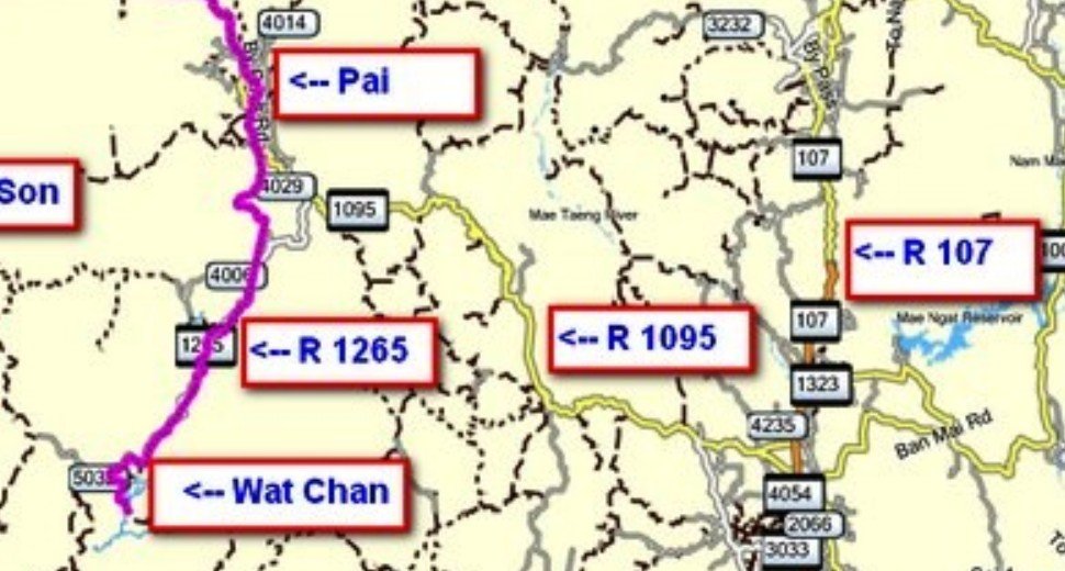
We then decided to take the backway back to Chiang Mai via Wat Chan & Samoeng


Below is a map from Pai to Wat Chan

pai -wat chan.jpg

Map copyright © www.RideAsia.net - Permission needed to copy


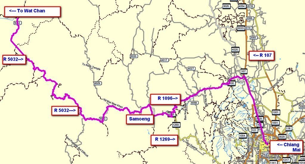
Below is a map from Wat Chan to Chiang Mai

wat chan - cnx end.jpg

Map copyright © www.RideAsia.net - Permission needed to copy
 
The road from Pai - Wat Chan - Samoeng - Chiang Mai, has roughly 50-60km of unmade dirt/ unmade sections, most are very easy

6292054230_2605473d7f_b.jpg


There were some damp rutted areas, all could have been passed in a pick-up

6292053796_87e27be201_b.jpg


About 42km west of Samoeng, construction is underway to seal more of the road

6291530757_677d17fa9c_b.jpg


There is also some very cute brick tiled road on the way east to Samoeng on this route

6292050652_707349440f_b.jpg


Got home in the dark about 7.30pm, was a thoroughly enjoying couple of days.
 
Great report and even greater pictures - at this time of the year everything is clear and no dust around to "black out" the sky. Happy that the road up to Shan State on the west side did not pose any serious problems. I haven't been there myself but got the tracks from James and "Dirty" and knowing their preferences for being really "off the beaten track" I wasn't sure if you guys could get through.
 
Auke - the western route we took north, as you indicated there was one checkpoint just east of the turn off from R 4015. This was not manned at this time which was good for us, i've marked where the checkpoint is in larger print below.

checkpoint.jpg

Map copyright © www.RideAsia.net - Permission needed to copy


Lone Rider said:
Great report and even greater pictures - at this time of the year everything is clear and no dust around to "black out" the sky. Happy that the road up to Shan State on the west side did not pose any serious problems. I haven't been there myself but got the tracks from James and "Dirty" and knowing their preferences for being really "off the beaten track" I wasn't sure if you guys could get through.
 
Great trip Phil, seems like you took the road we planned to take last time (all dirt).
Congratulations to Som for riding that long and in the mud, it certainly wasn't easy :)
 
I'm turning as green as the countryside.
That was a very cool trip to do.
Thanks Phil
 
Sorry to miss this one, looks you had some challenging trail to ride... and great culture. Nice!!
 
Great report Phil and you're most fortunate to see that area while it remains unique.
Impressed with Som's effort through the muddy ruts.

Will keep an eye on the forum for any news of a change in entry restrictions.
Hmm, new Commander.... tea money ?
 
bill said:
Will keep an eye on the forum for any news of a change in entry restrictions.
Hmm, new Commander.... tea money ?

Not sure if tea money will help - to me it looks like that the new commander was appointed when the new government came in and considering that big brother (now residing in Dubai) was quite close to the Government in Myanmar, a change in policy could have taken place viz-a-viz Shan State. Where the previous government wanted to open the area for tourism - the Thai Tourism Authority was promoting this area - this opening up policy now may have been reversed. Hope that my views are wrong but it looks like the opposite as I was told that a nurse who went there quite often to help with medical issues was also not allowed to go there anymore by the Thai men in green.
 
Some more detail on the area west of Wiang Heang west towards Loi Tai Leng, Shan State.

I've marked where the 4 checkpoints are that you will run into on the easterly road (R 1226) north to Loi Tai Leng area. Also on the left side of the map are the trails that can link Wiang Heang to R 1226/ Loi Tai Leng.

Max & Alex USA did this trail during torrential rain and got through (Wiang Heang to R 1226 dirt trail)


wh to ltl.jpg


Map copyright © www.RideAsia.net - Permission needed to copy
 
Some photo's from the big camera

A beautiful Shan girl at the army base

6294389594_66b8abccf6_b.jpg


The Shan wedding ceremony


10.jpg

9.jpg


Traditional house


6293863229_5e984e387a_b.jpg


LTL Village

6293863083_c5ec048858_b.jpg


6294389156_83e864d291_b.jpg
 
LTL village

DSC_0302.jpg


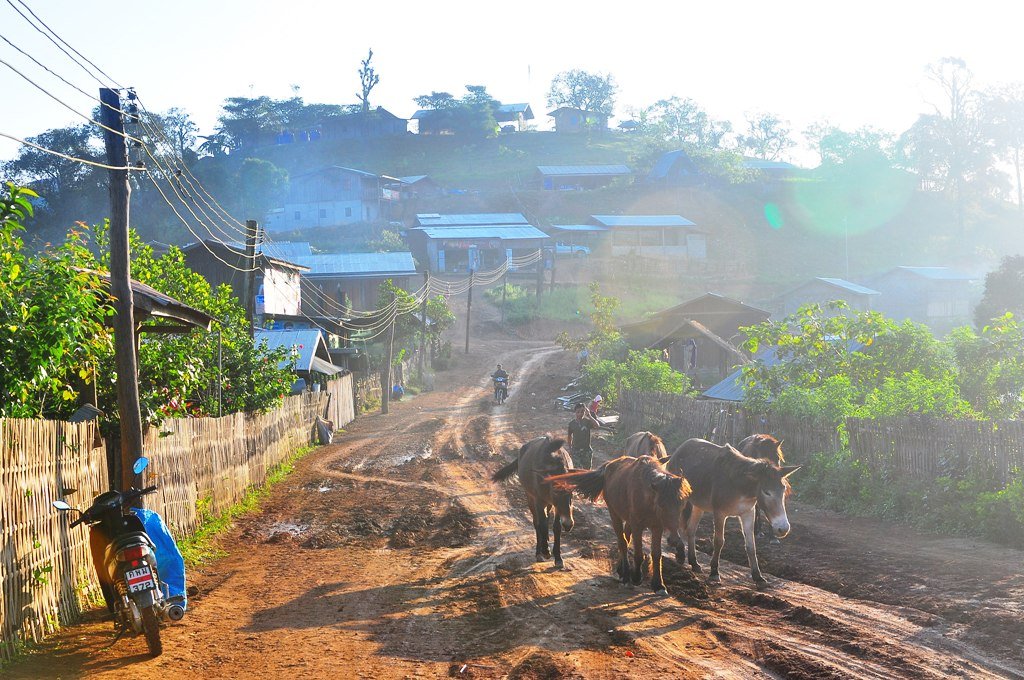
Donkeys for hauling produce & water in LTL village


DSC_0288.jpg


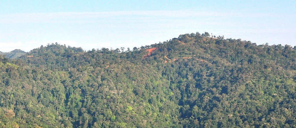
Looking north into Shan State, "Myanmar" - they tell us this is as far north as the dirt trails go, basically to a military look-out post approx. 3 km north of LTL army base

2011-10-30_164751.jpg
 
A good report and pictures there Phil, I must try that dirt road out on the KLX somewhen
 
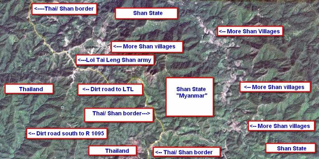
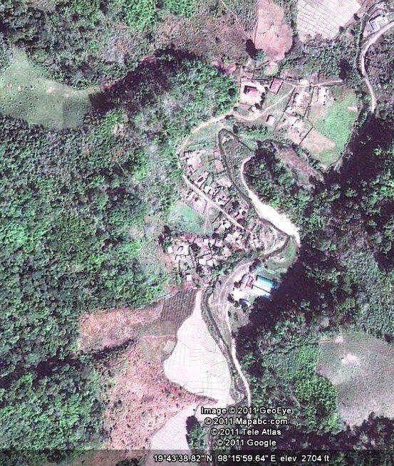
It's interesting looking at google earth around the Loi Tai Leng Thai/ Shan border area as there are many other small settlements in Shan State. If you look to the left side of the photo you can see where several villages are in Shan State.

ltl other villages.jpg


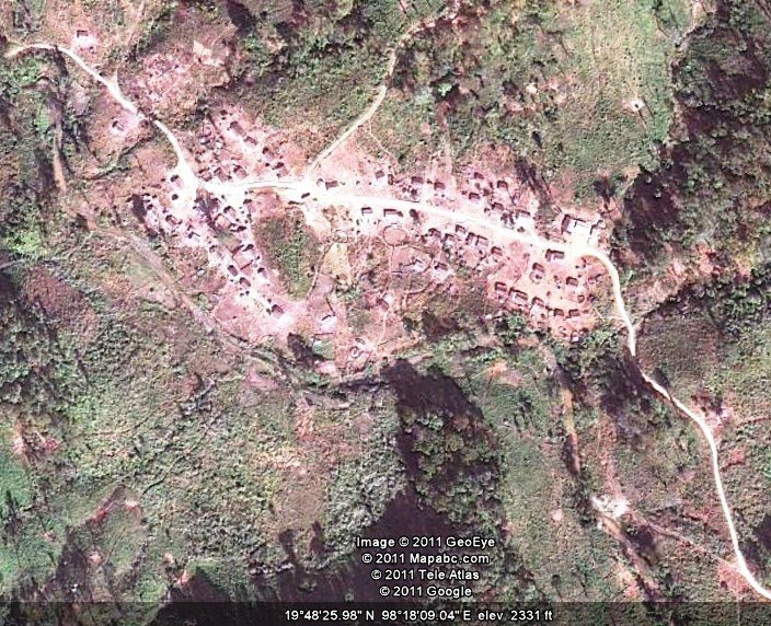
Below photo is zoomed in on one of the Shan villages, GPS co-ords are at the bottom of the picture


shan village east of LTL.jpg
 
If you look around in Google earth, there's a bunch of villages north east of Loi Tai Leng, Shan State, all with trails going to them --- if only they would let us trail ride there, a whole new world of virgin trails.


shan village.jpg
 
KTMphil said:
If you look around in Google earth, there's a bunch of villages north east of Loi Tai Leng, Shan State, all with trails going to them --- if only they would let us trail ride there, a whole new world of virgin trails.]

Not sure if you should do that even if it were allowed. While the Myanmar army may be quite far away, there are other Shan break-a-way factions and these may be less friendly and/or more trigger happy than the Shan people you have met.
 
Awesome pictures, awesome trip Phil. Looks amazing,
And well done to Som for completing the trip aswell!
 
A few more photo's from the Loi Tai Leng, Shan State wedding


Traditional Shan elderly ladies

6300564389_db78ddd4de_b.jpg


Keeping the ladies out of the sun

6301097526_cba37ae4e0_b.jpg


6301097970_338bfa597d_b.jpg


School and dorms.

6300565747_e5fd51929f_b.jpg


Chok Dee

a12.jpg


Road in the army base

6300566005_3637807eaa_b.jpg


6300566403_c07ff582b9_b.jpg


6293864579_e5bb1a81c5_b.jpg


Many of the soldier's houses had these things that look like make-shift antenna's, maybe Delboy has an idea what they are?

6301099916_245a49f8f3_b.jpg
 
Looks like they have been using radioactive fertilizer on the surrounding flora!! wow what shades of green they have in Burma!!! :lol:
 
Stokes70 said:
Looks like they have been using radioactive fertilizer on the surrounding flora!! wow what shades of green they have in Burma!!! :lol:


Mr. Stokes if you moved on from that F4.5 "starter" lens to a F2.8 professional lens I could teach you to capture color like in these pichers.
 
Back
Top Bottom