CraigBKK
Senior Member
The plan for this trip was to explore the western side of Route 323 around Sai Yok, the area between the Burmese border and the Kwai Noi River. The OSM map shows a track to the border, which I would follow to see if I could take me all the way. That would be my starting point, beyond that I'd just play it by ear. As you can see, I didn't get very far...
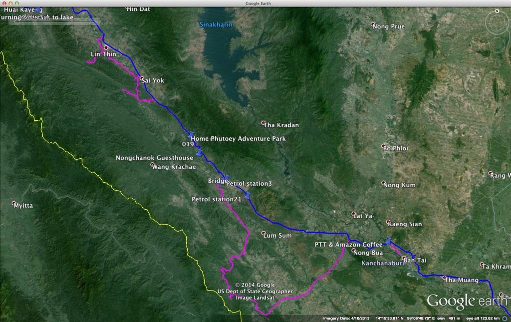
As well as seeing how far the track would take me I was also testing a few new goodies sent to me from the UK: the Chesty camera mount from GoPro, a new Gopro helmet mount and a pair of Held Air n' Dry gloves, all of which you can see in the short video I made of the day's ride (Direct link for iOS users: Sai Yok, Kanchanaburi | Sep 2014 [HD] on Vimeo).
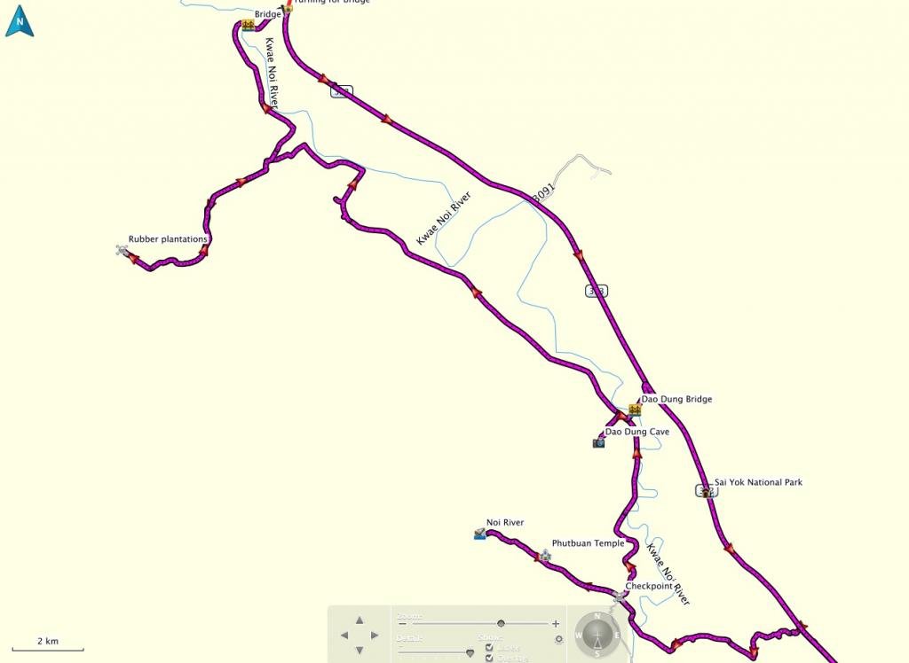
The OSM track goes as far as a army check point, then rears off to the left. That track is currently impassable. The actual track continues straight ahead after the check point until it reaches the Noi River. Here I turned back.
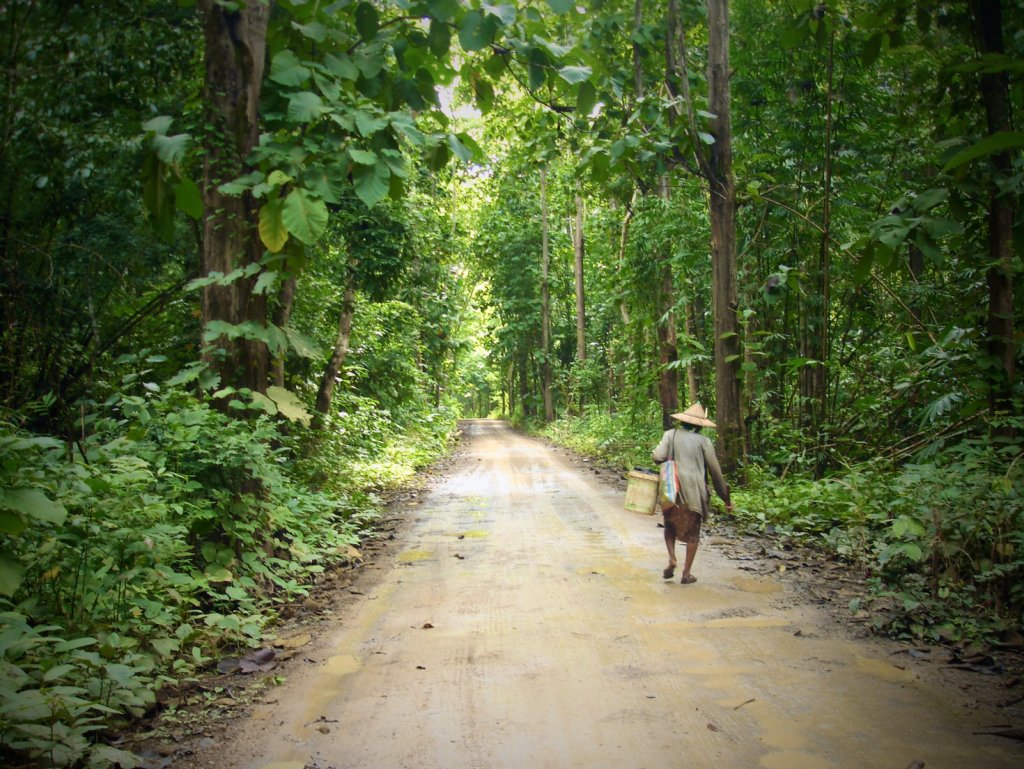
While parked an setting up my GoPro on the tripod an old woman appeared from the forest right where I had stopped. I asked her what she had been collecting. She opened up the cloth covering a basket to reveal beautiful green winged beans. Before I had a chance to ask for a photo she was off down the track.
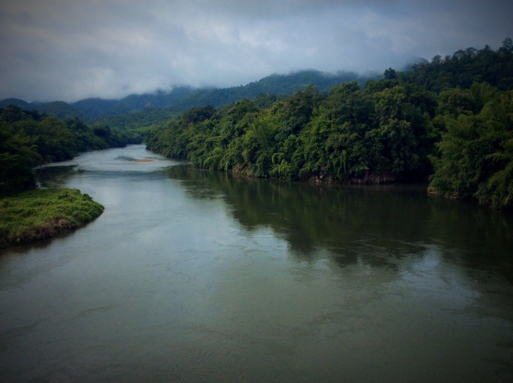
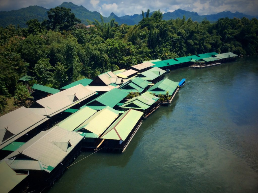
There are several bridges over the Kwai Noi River, not shown on the OSM map. Some of which have raft resorts and/or restaurants beside them.
Much of this area is used for farming, especially rubber, with rolling hills acting as a picturesque backdrop.
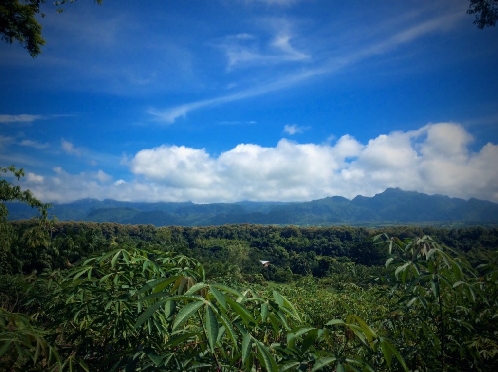
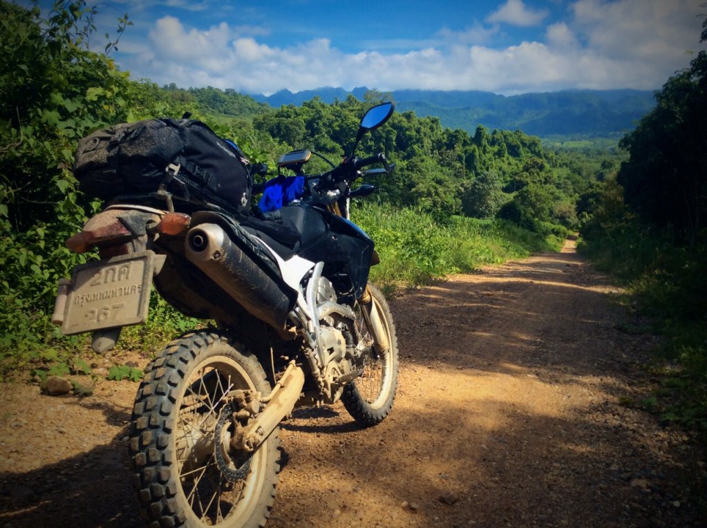
The scenery is not as dramatic as found further north in the province, but nevertheless makes a pleasant escape from the capital.
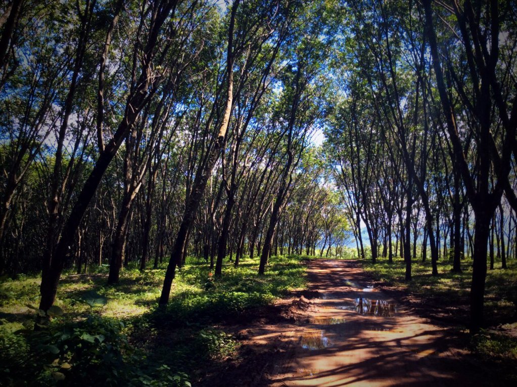
I followed one track through rubber plantations until my rear tyre became clogged and began slipping all over the place. Eventually my rear wheel became stuck in a tiny hole in the track and was a real bugger to get out (bottom right of the photo). Every time I tried to push or pull the bike my footing just gave way and I slipped back.
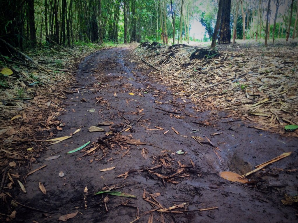
Being in a rubber tree plantation meant I was surrounded by mosquitoes, adding to my frustration. Eventually I freed the bike by using the side stand as a fulcrum. But I'd had enough and again turned around.
Crossing the Dao Dung bridge leads you to a small turning to the cave of the same name. It's a 500m hike up the hill through jungle to reach the cave. A caretaker will escort you, carrying a torch. He also turns the lights on in the cave. Interesting, but I've seen more impressive and larger caves in Europe, the walk, just after midday and in my riding gear almost killed me.
I lunched opposite the entrance to the Sai Yok National Park before following the 323 down to Sai Yok Yai and the waterfall. I spent the afternoon following the unpaved tracks from Sai Yok Yai down to Ban Phu Nam Ron and the official Thai - Burmese border crossing. On the OSM map these tracks are not joined but in fact are connected. I really enjoyed this two-hour ride; it reminded me of some parts of Laos for some reason. Not challenging, even in the wet season and beats taking the less scenic and busier 323 back to Kanchanaburi town.
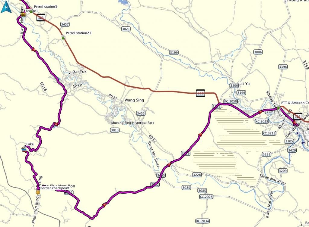

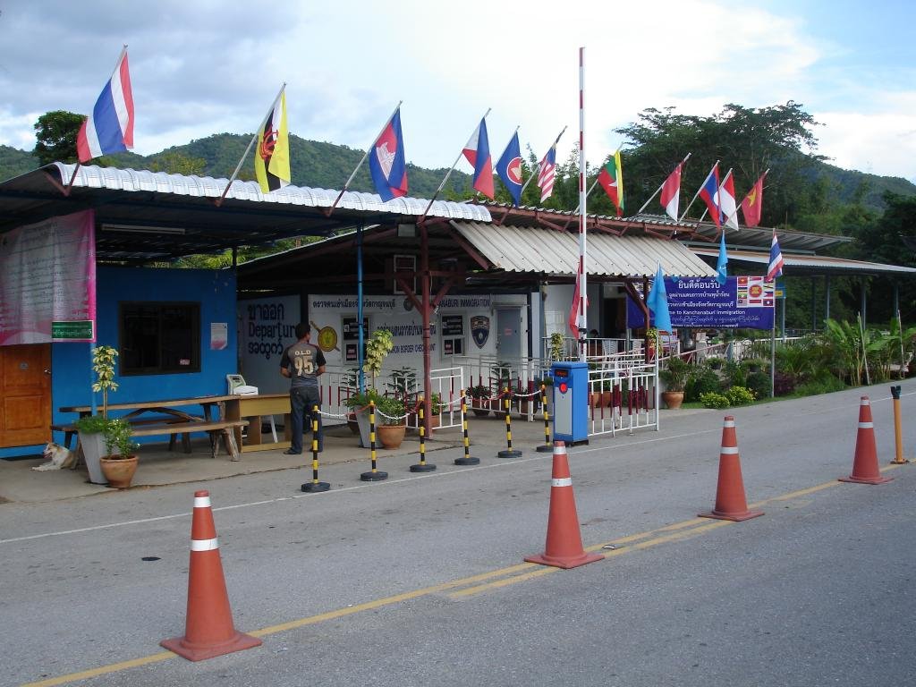
From the border check point it's just over an hour's ride to Kanchanaburi town on the new paved road. I made it there just after 6pm as the rain began.

As well as seeing how far the track would take me I was also testing a few new goodies sent to me from the UK: the Chesty camera mount from GoPro, a new Gopro helmet mount and a pair of Held Air n' Dry gloves, all of which you can see in the short video I made of the day's ride (Direct link for iOS users: Sai Yok, Kanchanaburi | Sep 2014 [HD] on Vimeo).
The OSM track goes as far as a army check point, then rears off to the left. That track is currently impassable. The actual track continues straight ahead after the check point until it reaches the Noi River. Here I turned back.

While parked an setting up my GoPro on the tripod an old woman appeared from the forest right where I had stopped. I asked her what she had been collecting. She opened up the cloth covering a basket to reveal beautiful green winged beans. Before I had a chance to ask for a photo she was off down the track.

There are several bridges over the Kwai Noi River, not shown on the OSM map. Some of which have raft resorts and/or restaurants beside them.


Much of this area is used for farming, especially rubber, with rolling hills acting as a picturesque backdrop.


The scenery is not as dramatic as found further north in the province, but nevertheless makes a pleasant escape from the capital.

I followed one track through rubber plantations until my rear tyre became clogged and began slipping all over the place. Eventually my rear wheel became stuck in a tiny hole in the track and was a real bugger to get out (bottom right of the photo). Every time I tried to push or pull the bike my footing just gave way and I slipped back.

Being in a rubber tree plantation meant I was surrounded by mosquitoes, adding to my frustration. Eventually I freed the bike by using the side stand as a fulcrum. But I'd had enough and again turned around.
Crossing the Dao Dung bridge leads you to a small turning to the cave of the same name. It's a 500m hike up the hill through jungle to reach the cave. A caretaker will escort you, carrying a torch. He also turns the lights on in the cave. Interesting, but I've seen more impressive and larger caves in Europe, the walk, just after midday and in my riding gear almost killed me.
I lunched opposite the entrance to the Sai Yok National Park before following the 323 down to Sai Yok Yai and the waterfall. I spent the afternoon following the unpaved tracks from Sai Yok Yai down to Ban Phu Nam Ron and the official Thai - Burmese border crossing. On the OSM map these tracks are not joined but in fact are connected. I really enjoyed this two-hour ride; it reminded me of some parts of Laos for some reason. Not challenging, even in the wet season and beats taking the less scenic and busier 323 back to Kanchanaburi town.


From the border check point it's just over an hour's ride to Kanchanaburi town on the new paved road. I made it there just after 6pm as the rain began.


