Riding through Bangkok, whats the best way?

buksida

Member
Joined
Jul 17, 2013
Location
Prachuab, Thailand
Bikes
CB500F
I need to take my new CB500F for its first service this weekend which means a trip from the south up to Bangkok (Phuket is the same distance but too wet this time of year).

Does anyone have experience riding through Bangkok? Can I take a bike onto Route 9 (Kanachanaphisek Road)? Or do I have to go through the city? Where is the best place to cross the river?

The Honda Big Wing shop is in Lad Phraow.
 
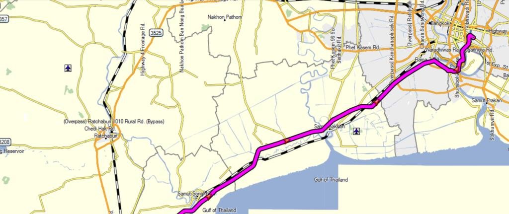
Coming northbound towards Bangkok, in Garmin Mapsource, if you use the parameters of no toll roads, this is what it gives you for fastest route into Bangkok.


nth to bkk.jpg


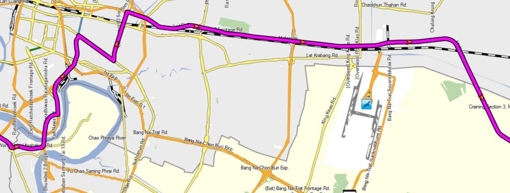
This will take you passed Suvarnabhumi Airport, but on a bike you might want the Bang Na Expressway thats just south of Suvarnabhumi Airport.


r 9 bkk.jpg
 
Looks like you have to take a ferry then for that route, since the bike isnt allowed on the express ways.

Was thinking of crossing the Rama 7 bridge north of the city and following Wong Sawang Rd into Rachadaphisek Rd looping round the top to join up with Lad Phraow Rd - anyone done this route?
 
How about going on a mission and find out if there is a road built here? Looking at Google earth with some wishful thinking it kind of looks like they are building a road. If not you should be able to drive around the gap on dirt roads. Then the ferry over to Samut Prakan and Srinakarin up to Lat Phraow.
 
Thats a little south of where I need to go (Big Wing is north east BKK). Just found out that my mates GPS needs to be plugged in at all times so its either cancel the trip, find a GPS that has batteries or use the phone and Google maps to navigate!
 
This would be the complete route. Observe that I have not driven it. I do not know if the ferry runs or not.
 
Thats a little south of where I need to go (Big Wing is north east BKK). Just found out that my mates GPS needs to be plugged in at all times so its either cancel the trip, find a GPS that has batteries or use the phone and Google maps to navigate!


Do you have coordinates for Big Wing?

Phone and google maps should be fine.
 
Yes, I've been there before (13.805950, 100.616781) - its just trying to find the least problematic roads skirting round the north of the city. Also don't know which bridges a bike can cross, which roads are one way, where you can/can't turn right etc.

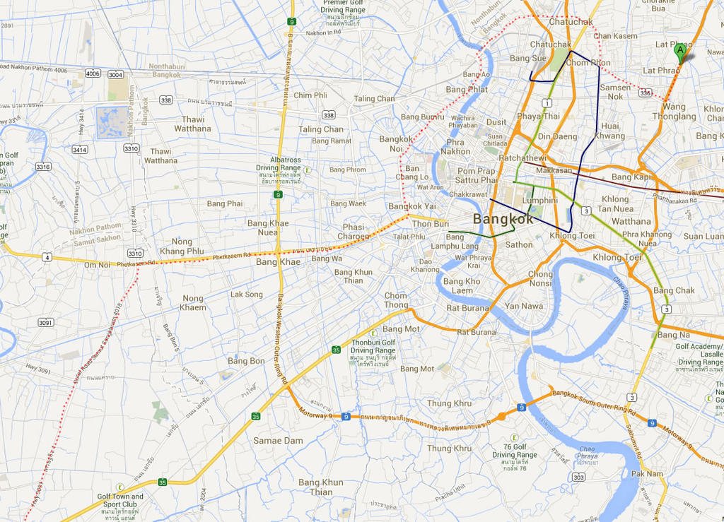
Here is the plan coming from the south: Take the 3091 off Route 35 at Samut Sakhon (or Route 9 off 35), turn right onto Petchkasem Rd (Route 4), turning left onto Santiwong Rd, over Rama 7 bridge, into Rachadaphisek Rd, turn left onto Lad Phrao Rd, then left again onto the road that runs below the Chalong Expressway, BigWing is about 3km down this road.

route.jpg
 
Yep, the 5 southernmost bridges are most convenient for anyone coming from the south - can't cross any of them, hence the ride around north. Have also been told that Petchkasem Rd is a construction site for the BTS extension so will have to avoid that also.

Maybe a long wet ride to Phuket for the service would be preferable!
 
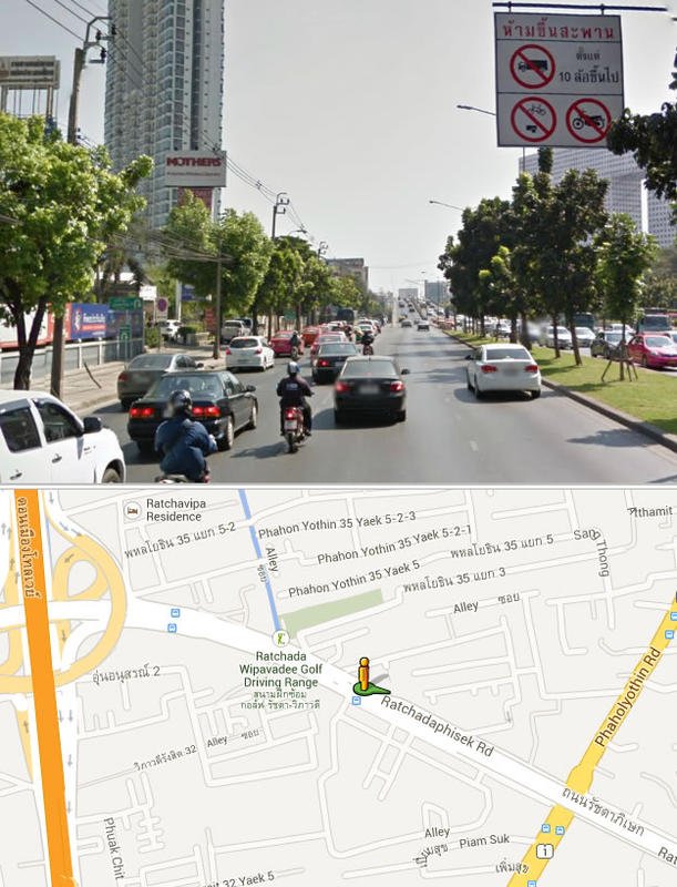
Doing a bit of Street Viewing for my route and notice a lot of these:
sview.jpg

Does anyone actually take notice or do bikes go over them? What is the fine if you're nabbed at the other end?
 
Yep, no problems there. The worse bit was Santiwong Rd which is a construction site, down to one lane in many places and gridlocked all day.

Went over all those overpasses too, no problem on a bike that is travelling faster than most of the cars!
 
Back
Top Bottom