questions about roads in laos

FritzTheCat

Junior Member
Joined
May 15, 2017
Location
somewhere on this planet earth
Bikes
Honda CRF 250 Enduro
could not find informations! - we drive also motorbike into laos - but next trip will be again by car!
want to drive with our 4x4/AWD-mazda cx-5 the following route next februar 2018:
crossing the bridge from chiang khong to houay xai/laos - then mekhongriver up to kapok-city - opposite golden triangle thailand - then follow the mekhong river upstream.
just made the boat-trip to guan-lei in sipsongpanna/china - the guide from mekhong travel tours in maesai told me, that there should be now a road all the way up to xiengkok!
anyone can confirm?! - he told me, that this road is not yet paved (april 2017).
from xiengkok to savannakhet click for the routing on google maps
https://goo.gl/maps/6wbwPcB5wcn
or is there another road from phongsali towards pak nam noy?
how is the road from nong kiaw to muang khoun?
how is actually the road 1D towards savannakhet?

thanks - it is my first post in this forum!


could not find informations! - we drive also motorbike into laos - but next trip will be again by car!
want to drive with our 4x4/AWD-mazda cx-5 the following route next februar 2018:
crossing the bridge from chiang khong to houay xai/laos - then mekhongriver up to kapok-city - opposite golden triangle thailand - then follow the mekhong river upstream.
just made the boat-trip to guan-lei in sipsongpanna/china - the guide from mekhong travel tours in maesai told me, that there should be now a road all the way up to xiengkok!
anyone can confirm?! - he told me, that this road is not yet paved (april 2017).
from xiengkok to savannakhet click for the routing on google maps


https://goo.gl/maps/6wbwPcB5wcn
or is there another road from phongsali towards pak nam noy?
how is the road from nong kiaw to muang khoun?
how is actually the road 1D towards savannakhet?

thanks - it is my first post in this forum!


Ok, i will try to answer some of your questions. There is a trail from Houay Xai to Xieng Kok which is generally graded but a good chance in Feb parts may be blocked by landslides etc. Xieng Kok to Pongsali is paved but from Xieng Kok to Muang Sing expect the road to be pot holed, the junction of the 13N heading north on the 1830 to the 1B is graded gravel and paved there after.

Muang Khua to Oudomxai is fully paved but pot holed, Oudomxai to Nong Khiew is beautifully paved up to the Pakmong junction to luang Prabang, after its a bit rough in places to Nong Khiew

The rest of your route is fully paved as far as i can see but expect some construction works after the rainy season

I am sure Auke (lonerider) can give some more detailed information as he is in Laos at the moment

Most of your route is already covered in various trip reports in the Laos section.​


OK, I will reply later once I have a better Internet connection.
 
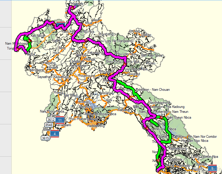
OK, here is a bit more. I generally agree with Bsacbob so just a few alternatives shown in the picture in green. If the road along the Mekong north of Houayxay is blocked by landslides, an alternative may be to take Rd. 3 for about 50 km. and then head north to Meung District which links up with your route a bit south of Ban Xiengdao.

An alternative of Rd. 1D can be the offroad option at Khoune District to head further east to Mock District and then southeast to Ban Chomthong where the offroad part links again with Rd. 1D

Your route does not indicates that you go straight from the junction of Rd. 1D with Rd. 8 west to Rd. 13 South. A nice side-trip is a visit to the Konglor Cave at Ban Nahin and from there head east again to Ban Lak Xao and then take Rd. 1E to Rd. 12 which is a much nicer option then the boring Rd. 13.

From Thakhaek to Savannakhet you can also the road along the Mekong (paved road) which is a more pleasant ride than Rd. 13.

Capture.PNG
 
OK, here is a bit more. I generally agree with Bsacbob so just a few alternatives shown in the picture in green. If the road along the Mekong north of Houayxay is blocked by landslides, an alternative may be to take Rd. 3 for about 50 km. and then head north to Meung District which links up with your route a bit south of Ban Xiengdao.

thanks for this - yes we tried already more then 2 years ago (2nd january 2015/2558) by car from houay xai to xiengkok - after 60 kms offroad of this best we arrived late in MUANG MUENG - we met a thaigroup with bicycles - they arrived from xiengkok - they told us and showed us photos, it was even diffcult for them to do this offroad-trail - no chance by car - so we turned back the other day the same road.

http://walkmeter.com/2dcc719c4ebb1330/Car-20150102-0820

http://walkmeter.com/2dcc719c4ebb1330/Car-20150103-0948

An alternative of Rd. 1D can be the offroad option at Khoune District to head further east to Mock District and then southeast to Ban Chomthong where the offroad part links again with Rd. 1D

thanks for this - we did already also by car more then one year ago! missed the right-turn in MOUANG KHOUNE ;-( - but it was for us and our friends a big adventure with an almost new car...! some parts like a dry river...! with big stones etc.!

http://walkmeter.com/2dcc719c4ebb1330/Car-20160212-0817

Your route does not indicates that you go straight from the junction of Rd. 1D with Rd. 8 west to Rd. 13 South. A nice side-trip is a visit to the Konglor Cave at Ban Nahin and from there head east again to Ban Lak Xao and then take Rd. 1E to Rd. 12 which is a much nicer option then the boring Rd. 13.
From Thakhaek to Savannakhet you can also the road along the Mekong (paved road) which is a more pleasant ride than Rd. 13.

thanks also for this - these roads we know already - my wife is afraid to visit caves...! ;-(

http://walkmeter.com/2dcc719c4ebb1330/Car-20160213-0814
 
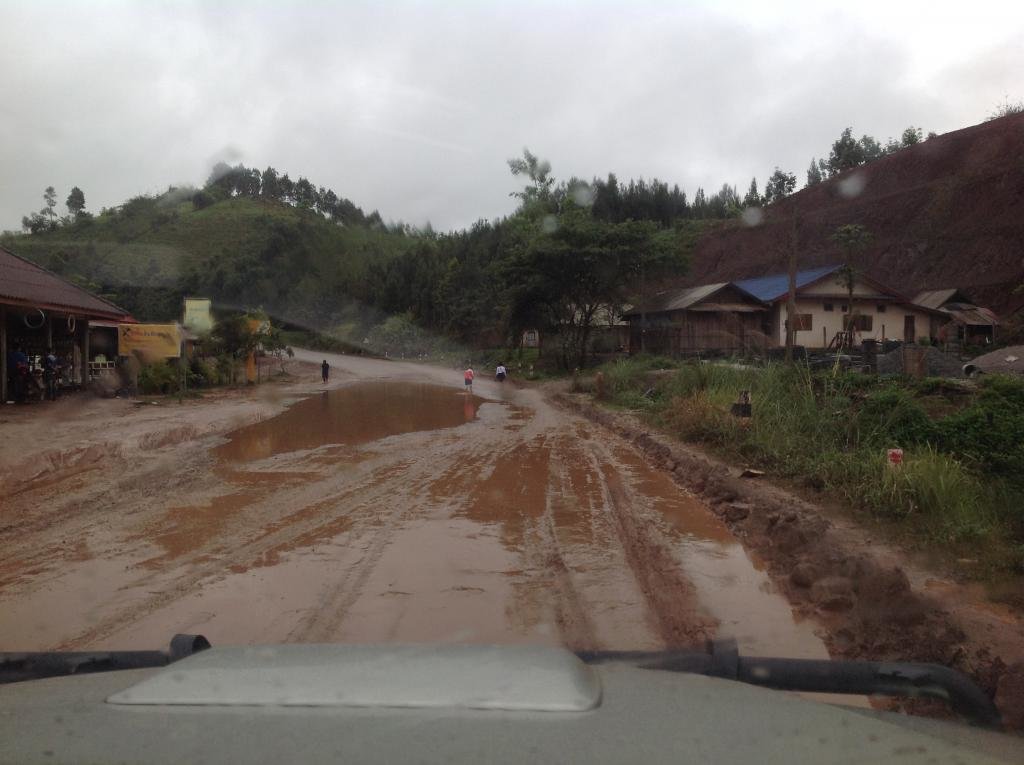
R3 around the Luang Namtha area & east of Luang Namtha is in a terrible mess with resurfacing work underway. It's the worst i've ever seen it.
 
Yes, they have been working on it for some time - this picture is from January this year - so by February/March next year it should be ready even though in Lao PDR things generally move slow but not that slow :lol:

IMG_1726.jpg
 
Back
Top Bottom