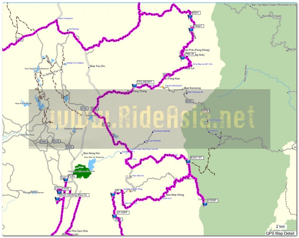
New trails around Mae ON with JB2112

KTMphil

Senior member
Joined
Jan 11, 2011
Location
Chiang Mai, Thailand
Bikes
2007 KTM 990 Adventure Suzuki DRZ 400
New trails around Mae ON with JB2112


We'd been meaning to do some scouting in Mae On for a while, JB had poked around pretty good already, so we knew where we wanted to go. CLICK ON THE MAP TO ENLARGE IT
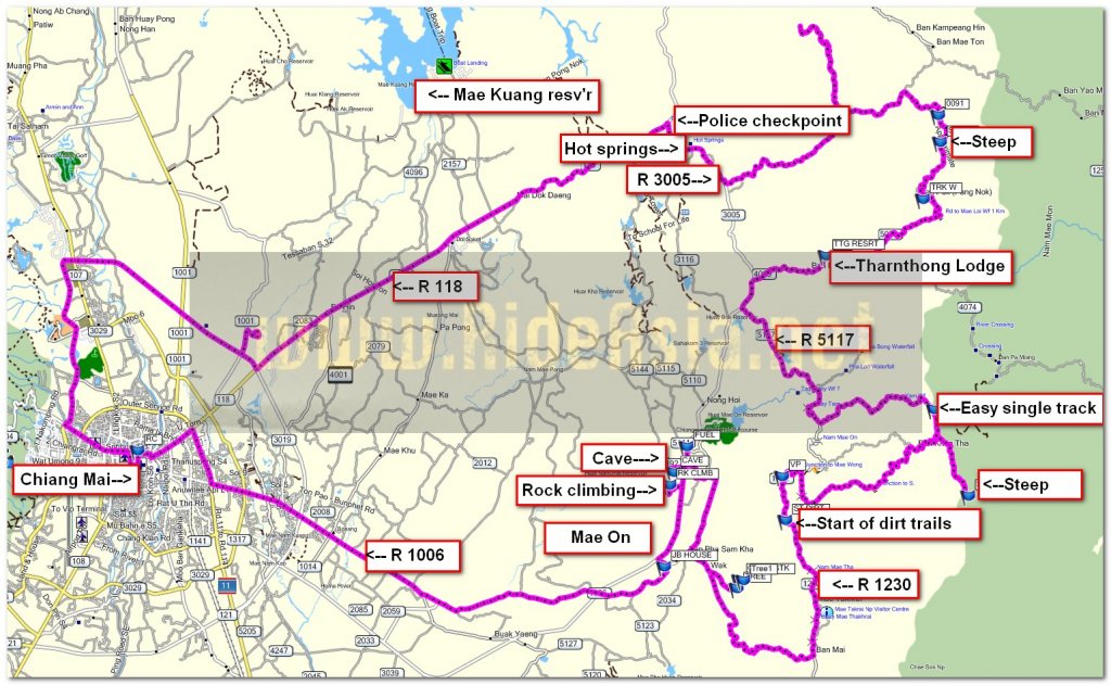

route all.jpg


1st stop was a look at the rock climbing area in Mae On, looked very popular with the Thai's


7187653152_176bc9a90a_b.jpg


7187663744_1109354b11_b.jpg


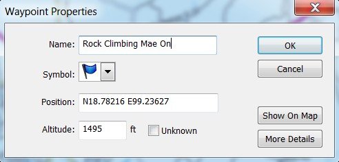
If you want to go see this the co-ords are below:


rock climb co ords.jpg
 
Reasonably clear day in the beginning of the rainy season

7187664030_276a8e8fdf_b.jpg


Next stop on the way to the trails, the Muan On cave


7187663132_b9e5dd503a_b.jpg


7187663452_191e15aaa5_b.jpg


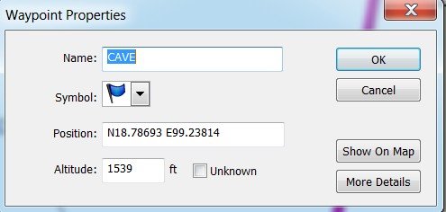
Muang On cave co-ords are in the link below, JB's been inside, says its worth the effort


muan on cave co ords.jpg
 
Then off into the trails around Mao On. It was nice that there had been some rain the ground felt soft and no dust

7187662850_c6f92b5c8d_b.jpg


The trail just west of Mae On was blocked by a huge tree, there were plenty more trails, so we turned back

7187662502_d08cf818b8_b.jpg


A huge new Wat being constructed in the same area

7187662024_3516bfac42_b.jpg


7187662204_63d50f5437_b.jpg


Then off up to the Mae On viewpoint on a gravel road

7187661754_911f881a9e_b.jpg


The viewpoint looks west, over the mountain in the distance you can see Chiang Mai on a clear day


7187660748_7d169a9e63_b.jpg


Beautiful. traditional farm in the valley

7187660188_5ff089edd2_b.jpg


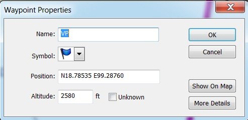
Co-ords of the view point are below

vp co ords.jpg
 
This then joined up with some more trails, interesting to see Burmese signs this far inland from the border

7187659868_d337017ce2_b.jpg


Lady taking a breather

7187659480_55af1432ba_b.jpg


Even came across some Thai's out trail riding on some vintage bikes, looks like they were headed south towards Lampang

7187659172_4fa8f295c9_b.jpg


This trail went north-south on a ridge-line that was the Lampang/ Chiang Mai province border. Looked like it hadn't been used for a while, leaves covered the center of where the track would be


7187658900_3944f8f4e9_b.jpg
 
Lunchtime - and the Tharnthong Lodge was near by - if you haven't been here this place is a must try


7187658614_82d199466d_b.jpg


They do have a good website:

http://tharnthonglodges.com/main/


The place has a really relaxing feel about it and is beautifully kept

7187653488_fae2111f63_b.jpg


7187657002_38cb889372_b.jpg


Food was good, 4 lemon shakes, tom yum soup, fried rice and some steamed rice was 475 Bht for 2 people


This is the owner'

7187657996_32c32aaaf1_b.jpg


JB

7187657830_38e65c6273_b.jpg


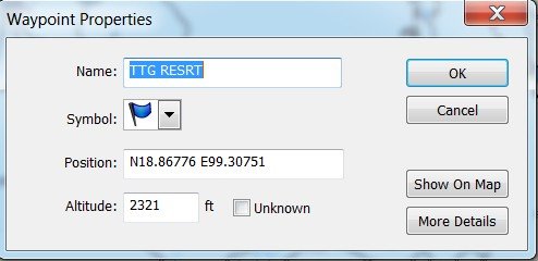
GPS co-ords of the Tharnthong Lodge


Tharnthong lodge  mae on.jpg
 
Back on the black top towards R 118 and the rice crop is an amazing green now after the rains

7187654278_9d97265005_b.jpg


7187653910_080ab7f031_b.jpg


You can't beat scouting in a new area, where you don't know what's around the next bend, a great day out.
 
KTMphil said:
New trails around Mae ON with JB2112

1st stop was a look at the rock climbing area in Mae On, looked very popular with the Thai's

I am not sure if it is the official name now, but the climbers call it the Crazy Horse Buttress. The Muang On Cave is just around the other side..
 
KTMphil said:
The trail just west of Mae On was blocked by a huge tree, there were plenty more trails, so we turned back

7187662502_d08cf818b8_b.jpg


A huge new Wat being constructed in the same area

7187662024_3516bfac42_b.jpg

Between these two points is a 6-km trail I have hiked before. It leads from the Mae On side near the Mae Tha Krai Park Checkpoint 1 gate up and over the ridgeline to the new Buddha at Mae Tha. I am guessing this trail is the old road they used to use before they built the 1229. It certainly is shorter! I can email you the trail gpx file if you want to give it a go. That fallen tree is just the beginning.
 
Re: New trails around Mae On with JB2112

Yes sir, great day out there today. I really wanted to check out a new trail I had spotted that started at 18.80144, 99.35798. It follows the ridgeline (Chiang Mai / Lampang border) nearly perfectly. We reached a steep bit and turned back, but looking at the GPX track file I want to give it another go as I think we missed a turnoff. This would be a super trail if it follows the ridgeline all the way to the Superhighway (11).

As neither of us had been up there, we finished the day by heading up to see what was around Jungle Flight. It is definitely remote. Next time I want to find the road up to the 1252 from near here, and possibly the 118.

Sorry, not so many trail photos.

All in a day's ride
1.jpg


2.jpg


Trail behind Flight of the Gibbon. Although mostly tarmac that last bit you see in the distance is a gnarly little dirt trail that rises 300 meters or so in less than a kilometer.

3.jpg


The boys

P1020457.JPG


P1020455.JPG


P1020459.JPG


Tharnthong

P1020464.JPG


Rice paddy

P1020468.JPG
 
Very nice; thank you JB and Phil.
That little Temple in the hills look enticing.
I've been to that Lodge restaurant before (on the AT) and met the owner.
He has groups of Thai coffee conisuers visit from time to time.

I must learn how to incorporate Google Earth maps into my stories; maybe a tutorial at Riders one night?
 
Nice report and great pictures, haven't been on this track for a while, brings back forgotten memories of the past.
 
You 2 must of had a great time up there.

Brilliant images from you both, happy smiley faces ;) & thanks for visiting the viewpoit, I take it you found my GeoCache ???

Ally
 
Ally said:
You 2 must of had a great time up there.

Brilliant images from you both, happy smiley faces ;) & thanks for visiting the viewpoit, I take it you found my GeoCache ???

Ally


JB hunted around the rock on the VP for it!
 
2wheels said:
I must learn how to incorporate Google Earth maps into my stories; maybe a tutorial at Riders one night?

Ron,

About Google Earth images:

Load gpx file into Basecamp or the like. Choose a nice bright color for your track.
Choose "View in Google Earth."
Play around with the 3 tools on the upper right side of GE to get the view you want.
Get image shot with SnagIt or similar program.
Done. Repeat as necessary.

But a meal at the Corner sounds great!
 
Looks like a good fun ride in dry sunny weather, I bet theres still a few interesting trails to find out that way
 
Went back and checked out the Muan On cave

file.php


Not promoted at all but very impressive - you don't need the "guide". its all lit


7202209548_863608cffe_b.jpg


Note the people sizes down in the middle

7202210624_126d237cdc_b.jpg


7202210258_d2ef8080b9_b.jpg


7202208368_978065bf0c_b.jpg


7202210404_f1226e0126_b.jpg


7202208076_b583775756_b.jpg
 
Pretty cool little mountain: People climbing outside and crawling inside.
There are wild monkeys here as well. I have seen them twice near the parking area.
 
The TharnThong Lodge's waterfall in HDR

7202204924_9c65b3d22e_b.jpg


& messing around with shutter speeds 1/8th of a second was the longest shutter speed that would work in the bright sun


7202202864_2534f8c787_b.jpg


7202199598_e6bdd489f8_b.jpg


7202198574_df1e0f74e0_b.jpg


7202197216_4c7f9375dc_b.jpg


7202197086_7f7dc300f5_b.jpg
 
Photos of trail along the ridgline (CNX/Lampang border)

I went back to see if we had missed a trail following the ridge line proper to the south. Unfortunately I did not find a trail, but I got some photos of the trail to the last stop about 3km in or so. I also did not get a chance to explore toward Chae Son through the mountains as it started RAINING, HARD! I got soaked.


The start of the trail along the ridgeline from another trail that links two villages.
P1020470.JPG


P1020471.JPG


Photos along the trail.
P1020472.JPG


P1020473.JPG


P1020474.JPG


P1020475.JPG


P1020476.JPG


P1020477.JPG


P1020478.JPG


P1020479.JPG


P1020480.JPG


P1020481.JPG


P1020482.JPG


End of that line for me
P1020483.JPG


P1020485.JPG


Gorgeous view. Now I see the rain approaching. Outta here!
P1020488.JPG


P1020489.JPG
 
Jb

That looks like a nice trail, must have been cool in the shade of the trees?

Ally
 
Back
Top Bottom