I did the 1082 from Tha Wang Pha via Ban Sop Khun to Ban Santisuk in Ban Luang.
Along 1082 I saw a lot of new farmland to the south and decided to check it out.
There is a lot of tracks from Google Earth, not reliable here. Some from OSM but not complete.
I decided to start from the south side of the mountain in Ban Santipap.
The first day I explored the eastern tracks and the valley to the east.
I found 2 not mapped tracks that took me all the way to 1082.
The next day I explored the western tracks and found a unmapped track that took me to the western valley and on to 1082.
GPX files at the end.

The missing 1172 is a mystery to me. Some locals say there is no trail through. Some locals say there is fallen trees. Some locals says there is a landslide that took a large part of the trail. Will get a chainsaw, some buddy's and check this out later.
However in TourismThailand.org - The official travel information website for tourists visiting Thailand I found this about 1172. Can anyone shed some light on this road?
Doi Pha Chi FromNan, take Highway No. 1091 for 40 kilometers until reaching Ban Luang district and take Highway No. 1172 to Ban Phi Nuea to Doi Pha Chi for 30 kilometers. Doi Pha Chi was once a stronghold of communist insurgents, whose equipments such as the electricity generator and water pipes still remain in the area.

These are two dead ends. Google maps is full of tracks here, but not in the real life. Maybe in a few years.

This is just south of 1082 and linking up the eastern valley with 1082. A couple of hundreds metre was a bit steep, but no real problem. Not even with worn down tyres.

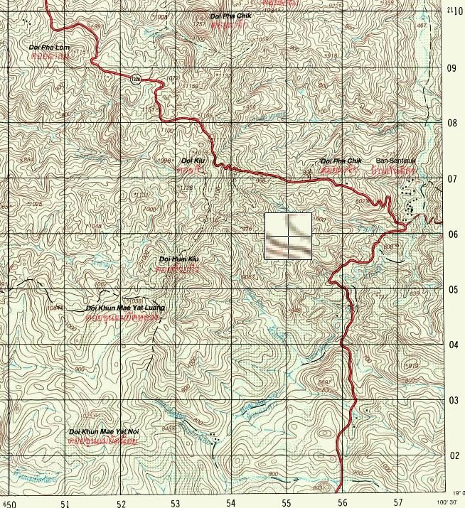
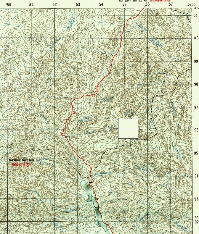
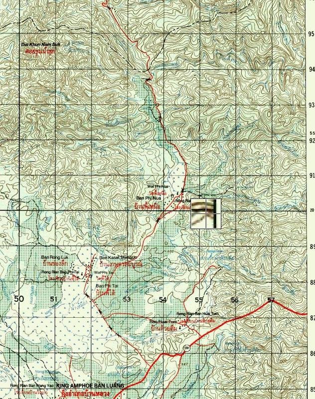
This is from Aukes map.

This is the entrance to 1082.

Chinese money here to. This is on the road to Ban Santipap.

This is an interesting "intersection" more or less at the top of this mountain.
The trail to the right goes down to the eastern valley and either back to Tha Wang Pha or north to 1082.
The middle trail goes around the mountain top and turns westward and link up to the western valley and many trails take you to 1082.
The left trail goes west and I explored it a bit. Need to spend more time on that one, with buddy's as they become single trails and steep.

This is about how far I checked out the western/left trail.

High light of the day. Finding a place for lunch and a nap. Nice and cool breeze here and over looking the eastern valley.

Thanks to some rain the night before the haze was not too bad.

The dead end in the eastern valley. Eastern part.

I had a chat with a local here and shared a 7-11 sandwich with him. He did not speak one understandable word of Thai.
I forgot to take a picture of him.

This land slide served as a landmark in the eastern valley. 1082 is just above.

This is south of Ban Santipap. End of track too. But my worn down tyre stopped me from trying to push further on.

This is north of Ban Santipap. I stopped here but the track continued a bit further in to a steep valley. But with riding buddy's..next time.

Progress!

Into the western valley. This track and 1082 make a loop around the new farmland. On the ridges all the time.

I had a go on the east side of Nan past Ban Huai Huea but stopped here because of my worn down tyres.
This is not far from where I ended up in the stream the day before in Ban Santipap.

But I found a nice Lunch spot here too.

A few days later I came via Ban Santisuk and over to Ban Sop Khun. And followed the southern trail.
I forgot my camera this day. All pics from the GoPro. GPX at the end.

This is from a little detour i took. The trail goes on the top of the ridge.

New vast farmland to the north, and pristine jungle to the south. And these guys have gasoline and matches...

No sign of anyone trying to pass this fallen tree. No match for my Laos Jungle Machete. It deserves it's place on the bike.

A nice ride. Most of it in the shades. And this trial lead up to the trail I found a few days ago connecting Ban Santipap with the western valley.

GPX here.
https://dl.dropboxusercontent.com/u... April 2014/Nanthaburi westeren part.gpx?dl=1

Due to the USB on my Garmin stopped working, the rest of the GPX file is in one large GPX file covering most of my riding in this area.
https://dl.dropboxusercontent.com/u...i April 2014/Nanthaburi incl 8 April.gpx?dl=1
The riding is not too complicated here. There is no food or water available unless you go to the outskirts of the valleys.
I will go back and spend more time there.
Would be nice if there is a real trail through 1172. The we will have "The Nan Loop".
Along 1082 I saw a lot of new farmland to the south and decided to check it out.
There is a lot of tracks from Google Earth, not reliable here. Some from OSM but not complete.
I decided to start from the south side of the mountain in Ban Santipap.
The first day I explored the eastern tracks and the valley to the east.
I found 2 not mapped tracks that took me all the way to 1082.
The next day I explored the western tracks and found a unmapped track that took me to the western valley and on to 1082.
GPX files at the end.

The missing 1172 is a mystery to me. Some locals say there is no trail through. Some locals say there is fallen trees. Some locals says there is a landslide that took a large part of the trail. Will get a chainsaw, some buddy's and check this out later.
However in TourismThailand.org - The official travel information website for tourists visiting Thailand I found this about 1172. Can anyone shed some light on this road?
Doi Pha Chi FromNan, take Highway No. 1091 for 40 kilometers until reaching Ban Luang district and take Highway No. 1172 to Ban Phi Nuea to Doi Pha Chi for 30 kilometers. Doi Pha Chi was once a stronghold of communist insurgents, whose equipments such as the electricity generator and water pipes still remain in the area.

These are two dead ends. Google maps is full of tracks here, but not in the real life. Maybe in a few years.

This is just south of 1082 and linking up the eastern valley with 1082. A couple of hundreds metre was a bit steep, but no real problem. Not even with worn down tyres.

This is from Aukes map.

This is the entrance to 1082.

Chinese money here to. This is on the road to Ban Santipap.

This is an interesting "intersection" more or less at the top of this mountain.
The trail to the right goes down to the eastern valley and either back to Tha Wang Pha or north to 1082.
The middle trail goes around the mountain top and turns westward and link up to the western valley and many trails take you to 1082.
The left trail goes west and I explored it a bit. Need to spend more time on that one, with buddy's as they become single trails and steep.

This is about how far I checked out the western/left trail.

High light of the day. Finding a place for lunch and a nap. Nice and cool breeze here and over looking the eastern valley.

Thanks to some rain the night before the haze was not too bad.

The dead end in the eastern valley. Eastern part.

I had a chat with a local here and shared a 7-11 sandwich with him. He did not speak one understandable word of Thai.
I forgot to take a picture of him.

This land slide served as a landmark in the eastern valley. 1082 is just above.

This is south of Ban Santipap. End of track too. But my worn down tyre stopped me from trying to push further on.

This is north of Ban Santipap. I stopped here but the track continued a bit further in to a steep valley. But with riding buddy's..next time.

Progress!

Into the western valley. This track and 1082 make a loop around the new farmland. On the ridges all the time.

I had a go on the east side of Nan past Ban Huai Huea but stopped here because of my worn down tyres.
This is not far from where I ended up in the stream the day before in Ban Santipap.

But I found a nice Lunch spot here too.

A few days later I came via Ban Santisuk and over to Ban Sop Khun. And followed the southern trail.
I forgot my camera this day. All pics from the GoPro. GPX at the end.

This is from a little detour i took. The trail goes on the top of the ridge.

New vast farmland to the north, and pristine jungle to the south. And these guys have gasoline and matches...

No sign of anyone trying to pass this fallen tree. No match for my Laos Jungle Machete. It deserves it's place on the bike.

A nice ride. Most of it in the shades. And this trial lead up to the trail I found a few days ago connecting Ban Santipap with the western valley.

GPX here.
https://dl.dropboxusercontent.com/u... April 2014/Nanthaburi westeren part.gpx?dl=1

Due to the USB on my Garmin stopped working, the rest of the GPX file is in one large GPX file covering most of my riding in this area.
https://dl.dropboxusercontent.com/u...i April 2014/Nanthaburi incl 8 April.gpx?dl=1
The riding is not too complicated here. There is no food or water available unless you go to the outskirts of the valleys.
I will go back and spend more time there.
Would be nice if there is a real trail through 1172. The we will have "The Nan Loop".


