Captain_Slash
Community Manager
- Joined
- Jun 28, 2011
- Bikes
- BMW 310GS Honda Wave 125 Honda MSX 125
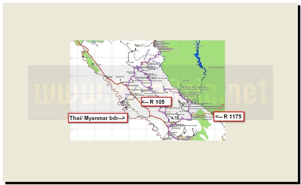
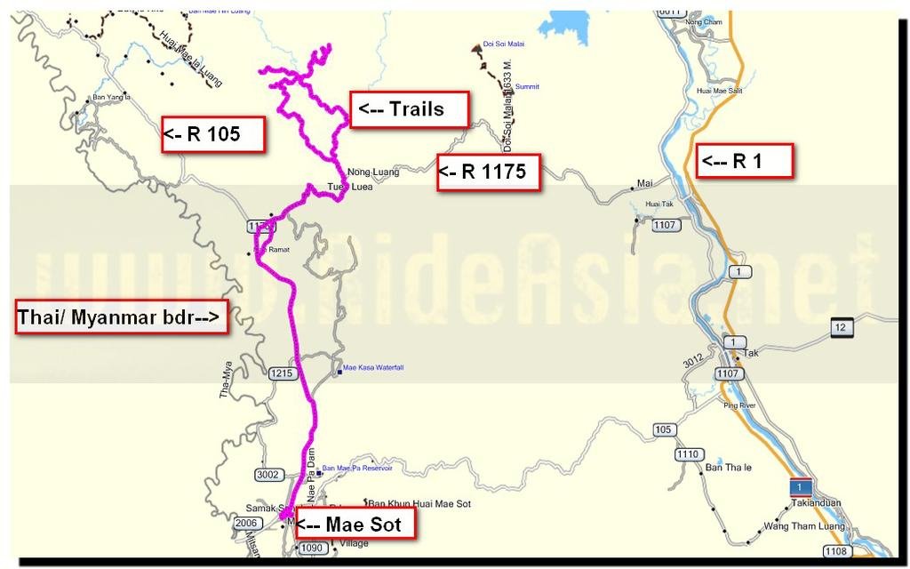
The route 105, 1175
Total distance 220 km

This trip took place yesterday but because Photobucket wasnt working properly its a day late appearing

I turn off the 1175 and just off it this tree is emitting a lot of smoke, its alight about 4 metres above the ground but no burning anywhere else around it.
I havent bothered listing the paved/dirt GPS waypoints today as this is the third ride along here and all new tracks today were dirt


I hope that saw is sharp as they have lots to do


They all get to do their bit


In a village at N17.16318 E098.58150 there is a fuel hand pump and here I take a turn to my right


Good views

But its a steep rocky track that provokes the fan on the KLX to working a lot today
A lot of wheel spinning on loose was encountered and I guess this accounted for the fuel light coming on after only 162 km which is probably my all time low


Now some lovely dust to ride through


I guess thats for drinking

I personally decline and stick to my bottled stuff


Finally I reach a village at N17.19460 E098.61114


Future bacon sandwiches relaxing


Back at the river this is how much progress has been made on a new building

That was this only the day before when I rode past, at this rate they should be moved in by tomorrow

I ride on and reach a village at N17.17103 E098.53259


I ride back towards the river then take a right

A small water crossing ahead

The bridge can be walked over but I think I will ride through


A village at N17.16048 E098.55643

I ride on and the view from up high looking back at the village


The end of the road and another village at N17.15729 E098.54385


I ride back to the previous village and take a right here hoping it will link up with a waypoint I left a few days ago


No bridge here so its a ride through

The track was heading in the right direction but now has me further away from my waypoint than I was five minutes ago

These were going to another village at N17.13139 E098.55399 but fortunately here a track starts that headed in the direction I wanted to go

I am closing in on my waypoint now

The stream I walked down to when I was here a few days ago.
Thats good now I know where I am and the way home plus finding a loop is always better then turning back

On the way back and the burning tree is blocking most of the road


A vegetarian pizza at Casa Mia tonight for 130 Baht
Get the gdb file from my website Ride reports - Thailand, Malaysia and UK
Total distance 220 km

This trip took place yesterday but because Photobucket wasnt working properly its a day late appearing

I turn off the 1175 and just off it this tree is emitting a lot of smoke, its alight about 4 metres above the ground but no burning anywhere else around it.
I havent bothered listing the paved/dirt GPS waypoints today as this is the third ride along here and all new tracks today were dirt


I hope that saw is sharp as they have lots to do


They all get to do their bit


In a village at N17.16318 E098.58150 there is a fuel hand pump and here I take a turn to my right


Good views

But its a steep rocky track that provokes the fan on the KLX to working a lot today
A lot of wheel spinning on loose was encountered and I guess this accounted for the fuel light coming on after only 162 km which is probably my all time low


Now some lovely dust to ride through


I guess thats for drinking

I personally decline and stick to my bottled stuff


Finally I reach a village at N17.19460 E098.61114


Future bacon sandwiches relaxing


Back at the river this is how much progress has been made on a new building

That was this only the day before when I rode past, at this rate they should be moved in by tomorrow

I ride on and reach a village at N17.17103 E098.53259


I ride back towards the river then take a right

A small water crossing ahead

The bridge can be walked over but I think I will ride through


A village at N17.16048 E098.55643

I ride on and the view from up high looking back at the village


The end of the road and another village at N17.15729 E098.54385


I ride back to the previous village and take a right here hoping it will link up with a waypoint I left a few days ago


No bridge here so its a ride through

The track was heading in the right direction but now has me further away from my waypoint than I was five minutes ago

These were going to another village at N17.13139 E098.55399 but fortunately here a track starts that headed in the direction I wanted to go

I am closing in on my waypoint now

The stream I walked down to when I was here a few days ago.
Thats good now I know where I am and the way home plus finding a loop is always better then turning back

On the way back and the burning tree is blocking most of the road


A vegetarian pizza at Casa Mia tonight for 130 Baht
Get the gdb file from my website Ride reports - Thailand, Malaysia and UK


