Lone Rider
Blokes Who Can
February 2018 trip with the Thai Lao Cambodia Brotherhood to visit 2 school projects in Xiengkhouang province sponsored by the TLCB,
Another trip with the TLCB at the end of a for me much larger trip to the south and central part of Laos - 5700 km. in 19 days. As usual the TLCB trip started again at Thanalaeng (Friendship Bridge 1) where I (with my truck) met up with the people who would be on this trip - Mac, Tim, Larry, Paul and "new-comers on a TLCB trip" Gill and Doug and our longtime friend and driver Somphou (with his van). The plan was to travel via Long Cheang and LS 20a for an overnight stay while on our way to Phonsavan.
The road from the Phou Bia mine at Ban Namgnon to Long Chaeng is being upgraded


The Sayphasert GH (Contact Mr. Xaysamone at 020-22140000) - Coordinates N19.10527 E102.92494

The wat which was built during the war by General Vang Pao is, after having been standing empty for many years, now again "alive" with monks and novices living at the wat.

The hospital which was built during the war and abandoned after the war has been replaced by a Health Center just to the east of the old hospital
Early morning in Long Chaeng at the runway of LS 20a

Looking to the east

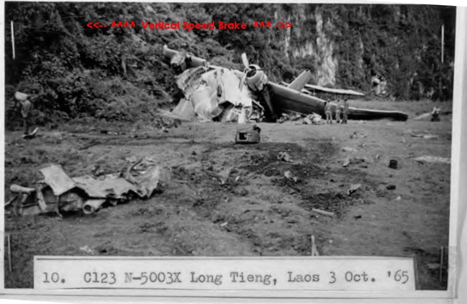
and looking to the west with the "vertical speed brake" karsts at the end of the runway


Long Chaeng during the war and in 2016 as seen from Sky Line ridge
An early start as they are upgrading the road which runs from Long Chaeng to Xam Thong. As a result, the road is only open before 8 o'clock in the morning, between 12 and 1 in the afternoon and after 5 o'clock in the afternoon

A short stop at Xam Thong where the TLCB in the past has provided a new roof as well as cement for the floor for the local school


During the war Xam Thong was one of the places where supplies were stocked (rice, etc.) to be provided to local villages in the north of Laos. The only things left from that period is the concrete floor of the warehouse visible just in front of the school building and parts of a chimney of one of the housing units which now are gone.


Part of a chimney still standing near the school
 air america chalet chimney by Auke Koopmans, on Flickr
and a similar chimney used in housing units in 1969 in Xam Thong
Road sign for a new track called road 5A which is a kind of shortcut to bypass Long Chaeng and Xam Thong - coordinates on the South side: N19.09405 E102.99942 near Ban Louangphanxai - North side: N19.20410 E103.01753


The remains of a PT 76 amphibious tank destroyed during the war - coordinates N19.32472 E103.14364
To be continued
Another trip with the TLCB at the end of a for me much larger trip to the south and central part of Laos - 5700 km. in 19 days. As usual the TLCB trip started again at Thanalaeng (Friendship Bridge 1) where I (with my truck) met up with the people who would be on this trip - Mac, Tim, Larry, Paul and "new-comers on a TLCB trip" Gill and Doug and our longtime friend and driver Somphou (with his van). The plan was to travel via Long Cheang and LS 20a for an overnight stay while on our way to Phonsavan.
The road from the Phou Bia mine at Ban Namgnon to Long Chaeng is being upgraded


The Sayphasert GH (Contact Mr. Xaysamone at 020-22140000) - Coordinates N19.10527 E102.92494

The wat which was built during the war by General Vang Pao is, after having been standing empty for many years, now again "alive" with monks and novices living at the wat.

The hospital which was built during the war and abandoned after the war has been replaced by a Health Center just to the east of the old hospital
Early morning in Long Chaeng at the runway of LS 20a

Looking to the east

and looking to the west with the "vertical speed brake" karsts at the end of the runway


Long Chaeng during the war and in 2016 as seen from Sky Line ridge
An early start as they are upgrading the road which runs from Long Chaeng to Xam Thong. As a result, the road is only open before 8 o'clock in the morning, between 12 and 1 in the afternoon and after 5 o'clock in the afternoon

A short stop at Xam Thong where the TLCB in the past has provided a new roof as well as cement for the floor for the local school


During the war Xam Thong was one of the places where supplies were stocked (rice, etc.) to be provided to local villages in the north of Laos. The only things left from that period is the concrete floor of the warehouse visible just in front of the school building and parts of a chimney of one of the housing units which now are gone.


Part of a chimney still standing near the school
 air america chalet chimney by Auke Koopmans, on Flickr
and a similar chimney used in housing units in 1969 in Xam Thong
Road sign for a new track called road 5A which is a kind of shortcut to bypass Long Chaeng and Xam Thong - coordinates on the South side: N19.09405 E102.99942 near Ban Louangphanxai - North side: N19.20410 E103.01753


The remains of a PT 76 amphibious tank destroyed during the war - coordinates N19.32472 E103.14364
To be continued


