Ally
Well-known member
Some people might think it boring to travel down the 108 from Hang Dong to Hot & then visit Doi Tao & back via the 106 but to be honest, this route, the scenes along the way and how I feel doing the fast stretches & nice curves on a decent bike is for me just perfect.
That’s why I do this route so often. It’s good to see the positive developments in various small villages along the way, roads being improved, standards of living rising and noting the environmental changes both good & bad.
Doi Tao is a major landscape area, with uninterrupted views of the entire Ping valley. The valley at this location is often completely flooded but at this time of year, on the cusp of the rainy season, the river Ping is simply contained within a mature narrow meandering channel. If you look at the google map for this area, you can see a wide body of water. That is quite misleading.
Chom Thong

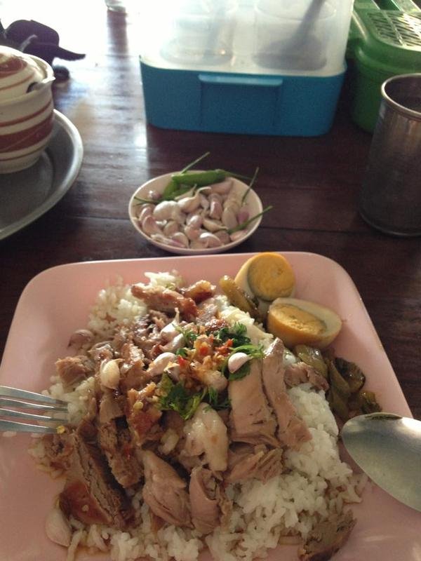
Delicious lunch in Hot

Doi Tao carpark entrance showing a view across the valley

The herd taking a break in the shade

The water in the middle is the narrow Ping River zoomed in

Zoomed out
When flooded, typically in late rain season (August onwards) the water can come up to where I am standing.


Doi Tao temple has seen a lick of paint

Mot Dang yuut yuut !

A new cafe yen shop has opened near the junction of the Doi Tao loop & the 1103
N17.95436 E98.67855

Back to the 1103 & heading east towards the 106 I stopped at Wat Phra Phutthabat Ta-Mo
N17.97162 E98.81631


Further along the 1103
Wat Huai Nam Un
N17.99642 E98.84601


Up on the mountain behind is a Buddha image - currently they are creating a stepped pathway up to it. I need to go back soon as from below, it looks quite amazing up there.


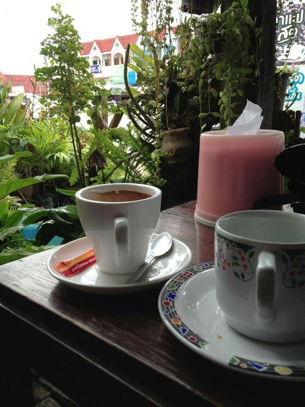
Finally the small coffee shop across the road from the 7/11 in Ban Hong is doing cookies & coffee!

After leaving Ban Hong, this temple is up the mountain to the right, giving a good view across the valley & over the town.
Wat Huai Pang Kha
N18.31211 E98.83069


The clouds were closing in on me, it was time to head for home.

GpxViewer
Ally
That’s why I do this route so often. It’s good to see the positive developments in various small villages along the way, roads being improved, standards of living rising and noting the environmental changes both good & bad.
Doi Tao is a major landscape area, with uninterrupted views of the entire Ping valley. The valley at this location is often completely flooded but at this time of year, on the cusp of the rainy season, the river Ping is simply contained within a mature narrow meandering channel. If you look at the google map for this area, you can see a wide body of water. That is quite misleading.
Chom Thong

Delicious lunch in Hot

Doi Tao carpark entrance showing a view across the valley

The herd taking a break in the shade

The water in the middle is the narrow Ping River zoomed in

Zoomed out
When flooded, typically in late rain season (August onwards) the water can come up to where I am standing.


Doi Tao temple has seen a lick of paint

Mot Dang yuut yuut !

A new cafe yen shop has opened near the junction of the Doi Tao loop & the 1103
N17.95436 E98.67855

Back to the 1103 & heading east towards the 106 I stopped at Wat Phra Phutthabat Ta-Mo
N17.97162 E98.81631


Further along the 1103
Wat Huai Nam Un
N17.99642 E98.84601


Up on the mountain behind is a Buddha image - currently they are creating a stepped pathway up to it. I need to go back soon as from below, it looks quite amazing up there.


Finally the small coffee shop across the road from the 7/11 in Ban Hong is doing cookies & coffee!

After leaving Ban Hong, this temple is up the mountain to the right, giving a good view across the valley & over the town.
Wat Huai Pang Kha
N18.31211 E98.83069


The clouds were closing in on me, it was time to head for home.

GpxViewer
Ally

