KTMphil
Senior member
Day 2 - mapping south east of Mae Sariang
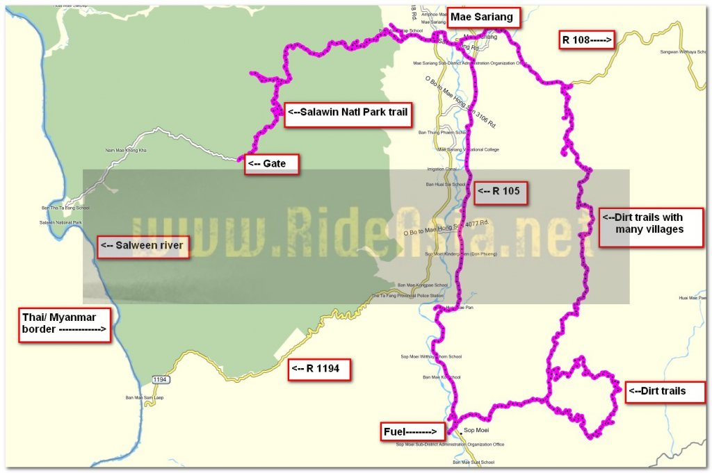
This was the first time i'd ridden south east of Mae Sariang (south of R 108 & east of R 105) - it might hold the most spectacular views i've ever seen trail riding, on par with Laos.
Photo of the day - a monk with the KTM 300 overlooking the Mae Yuam river, south of Mae Sariang

The area south east of Mae Sariang looked like an area that would have lots of unexplored trails. From google earth, I found what looked like a trail leading to R 108, 6km from Mae Sariang, so I waypointed it and used it as an entry point.
This is 500 meters south of R 108, the entry point to the trails, looking good so far

As expected about 5km in (south of R 108), started to run into farm villages, with no utilities.

The trails were beautiful and flowing, manageable for 4 wheel drive farm pick ups

Caught this guy in mid-tree-removal, he was kind enough to make a path


This was the first time i'd ridden south east of Mae Sariang (south of R 108 & east of R 105) - it might hold the most spectacular views i've ever seen trail riding, on par with Laos.
Photo of the day - a monk with the KTM 300 overlooking the Mae Yuam river, south of Mae Sariang

The area south east of Mae Sariang looked like an area that would have lots of unexplored trails. From google earth, I found what looked like a trail leading to R 108, 6km from Mae Sariang, so I waypointed it and used it as an entry point.
This is 500 meters south of R 108, the entry point to the trails, looking good so far

As expected about 5km in (south of R 108), started to run into farm villages, with no utilities.

The trails were beautiful and flowing, manageable for 4 wheel drive farm pick ups

Caught this guy in mid-tree-removal, he was kind enough to make a path


