Hello all. I hope you are all well.
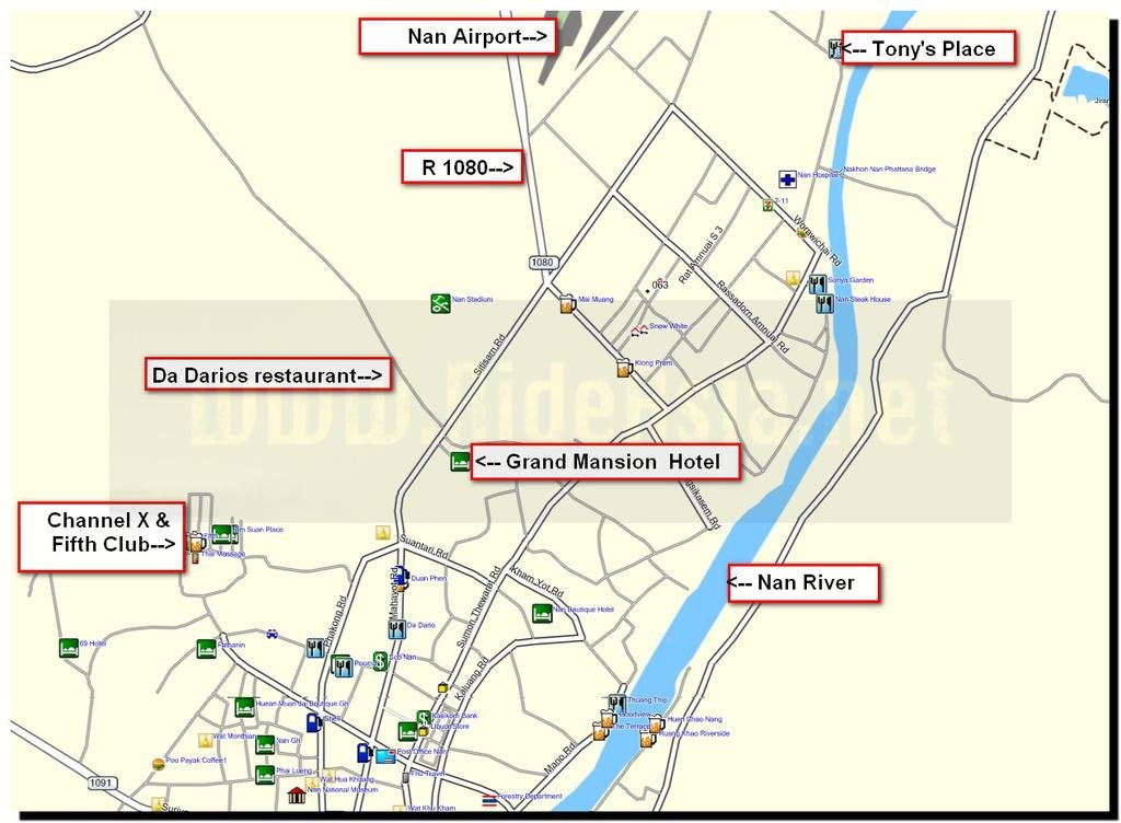
Reservation period for the BBQ on the 9th is closed now. For those who have said they will attend, the dinner will be held at Woraphat's place. If any of you do not know where that is, let me know and I will provide directions and a map.
Hopefully, you all have made your overnight reservations for Nan by now.
It appears that we will have several four wheel vehicles with us on this trip. Welcome, to some folks that aren't bikers but wish to go on some of the trips and who will be with us for the first time!
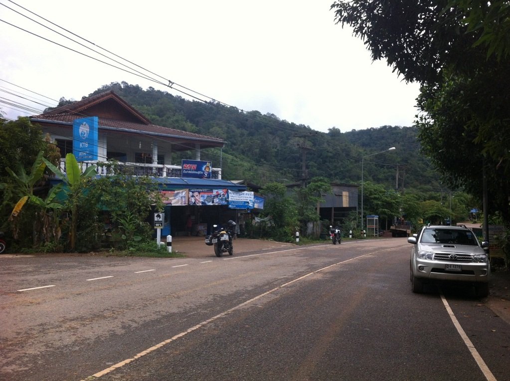
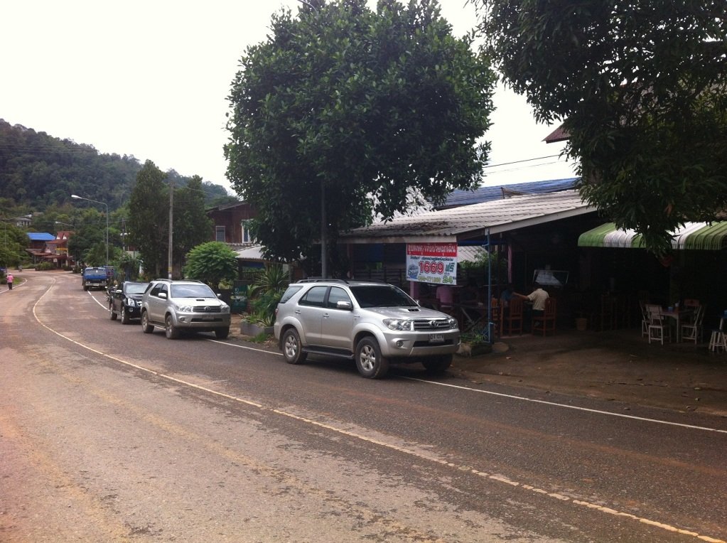
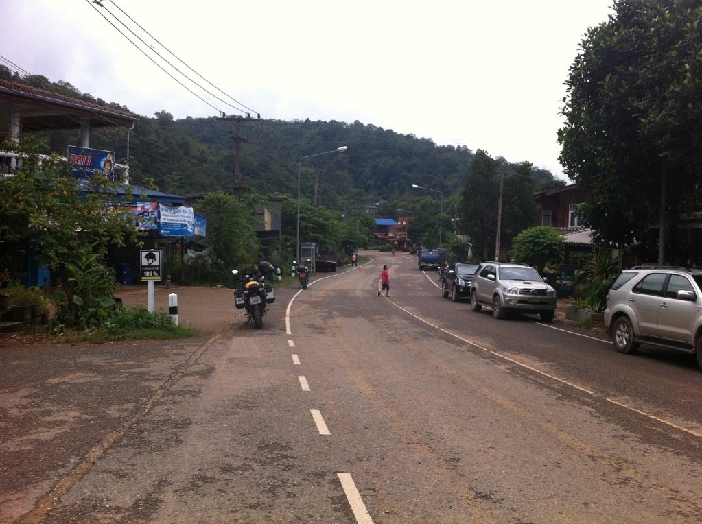
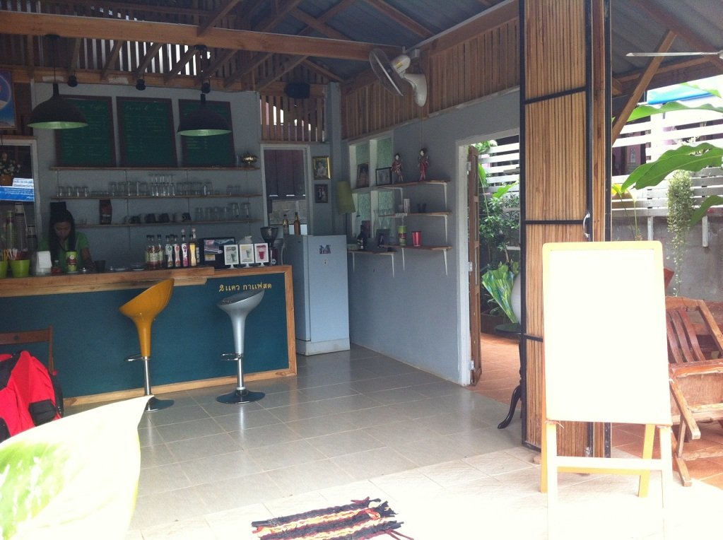
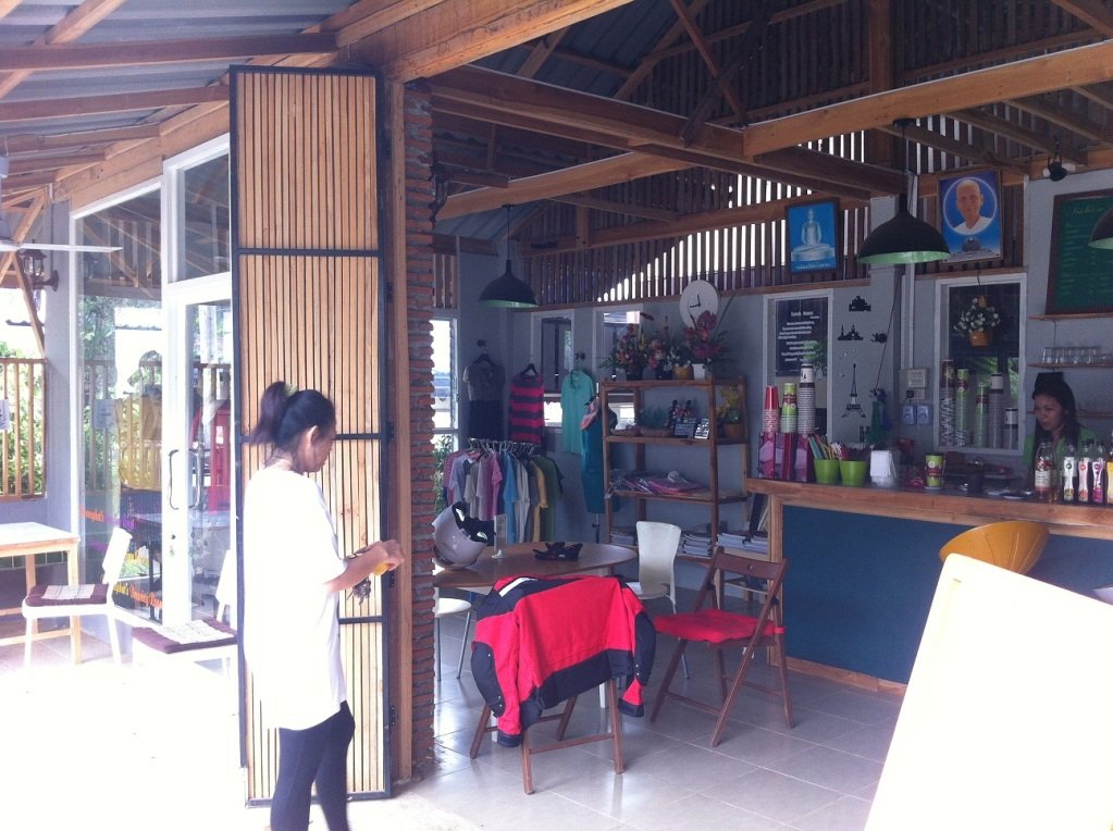
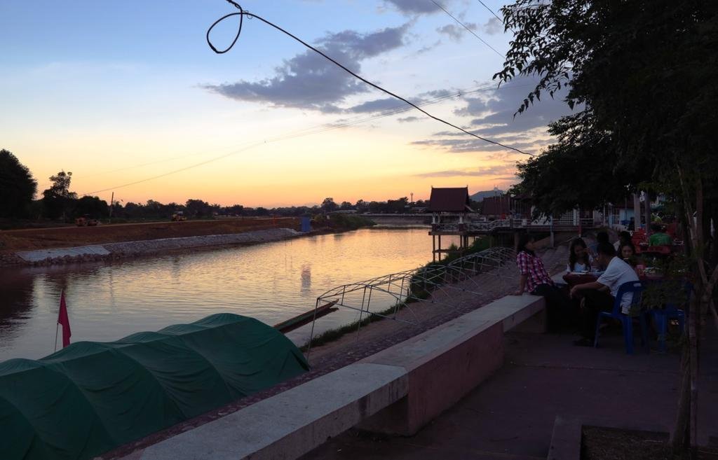
Chiang Rai biker Bob has scouted the route to and partially from Nan to identify any coffee stop prospects. He has recommended something for the ride to Nan but found the route home lacking in suitable stops for a group so the trip home will be without a scheduled place for the breaks. He did break off of our homeward route at some point and wasn't able to check out ALL of the trip home so we may run across something that we find to our liking that he didn't pass. I have attached a few pics of the mid-way coffee stop that Bob sent to me
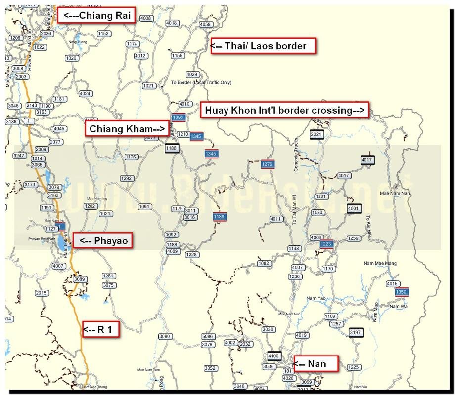
Safety note: The 1148 is a fast road for the most part but it does have some surprise hair-pin turns that could cause problems and pile-ups if people are riding too close. A safe distance between riders is especially important on this route.
First stop is the large PTT station after the police check point at Chiang Kham. This place is also the last big fuel point, as the rest of the fuel options on the way to Nan are very small and lacking in most amenities and the quality of fuel at those small stops may be in doubt.
After leaving that PTT and approaching the approximate mid-way point, there is a new coffee shop next to a small Thai restaurant. Travelling towards Nan on the 1148, you will see a sign showing the way to the Thai Laos market to your left just as you enter a small village called Song Khwae (approx.. 80 km's from Nan). The coffee shop is on the right opposite the KTB ATM sign. There is nothing much before or after that would be suitable. Bob has spoken to the girl who runs the coffee shop and has her number so she knows when we may arrive and get some extra staff in to help out. Coordinates are N 19 deg 21.502 E 100 deg 42.297.
Coming into Nan there is a large Esso gas station just after the airport on the right which will be the meeting point for the route back and pick up the 1091 going through the town. Since many of you are staying in Nan for more than one night and not joining us for the ride home, we won't be looking for, or waiting for, anyone who is not ready to go at 09:00 that morning.
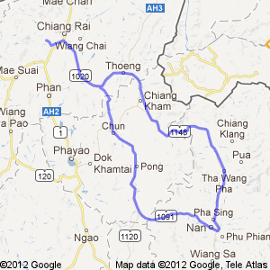
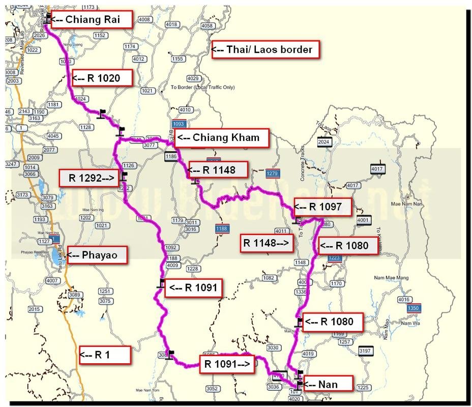
Bob has put together a Google map with turn by turn instructions for us. It does not include the 1097 detour jaunt that several of us will make. His turn by turn itinerary is below:
Starting at Chiang Rai
1. Head southwest 130 m
2. Turn left 700 m
3. Sharp left 110 m
4. Turn right 700 m
5. Turn left 130 m
6. Turn right toward Route 1211 2.3 km
7. Turn left onto Route 1211 160 m
8. Take the 1st right 1.4 km
9. Take the 2nd left 2.1 km
10. Turn right toward Phahon Yothin Rd/Route 1/AH2 1.1 km
11. Turn left onto Phahon Yothin Rd/Route 1/AH2 7.8 km
12. Turn right onto Route 1020/AH3 63.7 km
13. Continue onto Route 1021 91 m
14. Turn left onto Ammat 1/Wiang Thoeng 7 210 m
15. Take the 1st left onto Pratu Plong/Wiang Thoeng 14 71 m
16. Turn left onto Route 1020/AH3 220 m
17. Turn right to stay on Route 1020/AH3 35 m
18. Take the 1st left 110 m
Thoeng Chiang Rai
19. Head west toward Route 1020/AH3 88 m
20. Turn left onto Route 1020/AH3 210 m
21. Make a U-turn 350 m
22. Continue onto Route 1021 25.3 km
23. Continue onto Route 1148 1.6 km
24. Slight right onto Sakda Bannakit 300 m
25. Take the 1st right onto Sakda Bannakit 1 Destination will be on the right 44 m
Chiang Kham หมู่ 15 ศักดาบรรณกิจ 423, Yuan, Chiang Kham, Phayao 56110
26. Head east on Sakda Bannakit 1 toward Sakda Bannakit 350 m
27. Turn right onto Thanon Pisarn/Route 1148 Continue to follow Route 1148 7.5 km
28. Turn left to stay on Route 1148 14.1 km
29. Turn left to stay on Route 1148 19.8 km
30. Turn left to stay on Route 1148 4.4 km
31. Turn left to stay on Route 1148 56 m
32. Turn left to stay on Route 1148 2.3 km
33. Turn left to stay on Route 1148 10.6 km
34. Turn right to stay on Route 1148 1.6 km
35. Turn right to stay on Route 1148 1.7 km
36. Turn left to stay on Route 1148 17.9 km
37. Turn right to stay on Route 1148 33.1 km
38. Turn right onto Route 1080 3.5 km
39. Turn right onto Soi Chueam Sampan 450 m
40. Turn right onto Route 1336 3.2 km
Tha Wang Pha Nan
41. Head northeast on Route 1336 toward Route 1080 64 m
42. Continue onto Route 1080 270 m
43. Slight right to stay on Route 1080 44 m
44. Make a U-turn at Route 1148 22 m
45. Turn right onto Route 1148 15 m
46. Make a U-turn at Route 1080 22 m
47. Turn right onto Route 1080 43.6 km
48. Turn right onto Mahayot 170 m
49. Continue onto Thanon Mahayot 1.6 km
50. Continue onto Mahayot 260 m
51. Turn right onto Thanon Suriyapong 750 m
Thanon Suriyapong
52. Head east on Thanon Suriyapong toward Ariyawong 750 m
53. Turn left onto Mahayot 400 m
54. Continue onto Thanon Mahayot 1.5 km
55. Continue onto Mahayot 110 m
Mahayot
56. Head southwest on Mahayot 110 m
57. Continue onto Thanon Mahayot 1.6 km
58. Continue onto Mahayot 260 m
59. Turn right onto Thanon Suriyapong 950 m
60. Continue onto Route 1091 2.2 km
Route 1091
61. Head northwest on Route 1091 toward นน. 4004 20.8 km
62. Turn right to stay on Route 1091 2.4 km
63. Turn right to stay on Route 1091 19.4 km
64. Turn right 150 m
65. Turn right 220 m
Ban Luang Nan
66. Head west 220 m
67. Take the 2nd left toward Route 1091 150 m
68. Take the 1st right onto Route 1091 4.0 km
69. Turn left to stay on Route 1091 13.8 km
70. Turn right toward Route 1091 1.9 km
71. Take the 2nd left onto Route 1091 75 m
Chiang Muan Phayao
72. Head west on Route 1091 1.9 km
73. Take the 1st right toward Route 1091 1.0 km
74. Continue straight onto Route 1091 37.1 km
75. Turn right 300 m
76. Turn right 70 m
Na Prang, Pong Phayao
77. Head northeast toward Route 1188 700 m
78. Take the 3rd left onto Route 1188 350 m
79. Continue onto Route 1091 27.2 km
80. Turn right 160 m
Chun Phayao
81. Head southwest toward Route 1091 160 m
82. Take the 1st right onto Route 1091 800 m
83. Turn right onto Route 1021 700 m
84. Turn left onto Route 1292 650 m
85. Take the 3rd right to stay on Route 1292 11.0 km
Lo, Chun Phayao
86. Head northwest on Route 1292 toward Route 1126 1.2 km
87. Turn left onto Route 1126 110 m
88. Turn right to stay on Route 1126 3.1 km
89. Slight right onto Route 1292 1.4 km
90. Turn left to stay on Route 1292 900 m
91. Take the 1st right to stay on Route 1292 4.7 km
92. Turn right to stay on Route 1292 800 m
93. Take the 2nd left to stay on Route 1292 700 m
94. Take the 1st left 35 m
Hong Hin, Chun Phayao
95. Head east toward Route 1292 35 m
96. Slight left onto Route 1292 12.0 km
Route 1292
The map that Bob made on Google maps, with the turn points, can be seen here-
Chiang Rai to Route 1292 - Google Maps
