Lone Rider
Blokes Who Can
Chasing Waterfalls and a few other thingies in the south Laos
Most of my trips to Laos are made during the dry season when things are dry and dusty, rivers and waterfalls have very little water flowing through them and the landscape is obscured by smoke and dust. So, for a change a trip during the rainy season to see the difference the rains can make but which at the same time can make things also more difficult to get to them. Starting in the south for some waterfalls and other thingies and ending in the central/northern part of Laos in the hope that the "Paklay" bridge over the Mekong would be ready so that I would be able to drive over the bridge instead of having to take the ferry.
After a 1000 km drive from Chiangmai to Pakse ready for some R&R at the Pakse Hotel followed by a night time visit to the big Buddha at Phou Salao (N15.09541 E105.81182 - be there before 9 in the evening as the lights are switched of at 21.00 hours) on the other side of the Mekong before starting the chase for waterfalls and bridges
 20170907_180602 by Auke Koopmans, on Flickr
 20170907_210254 by Auke Koopmans, on Flickr
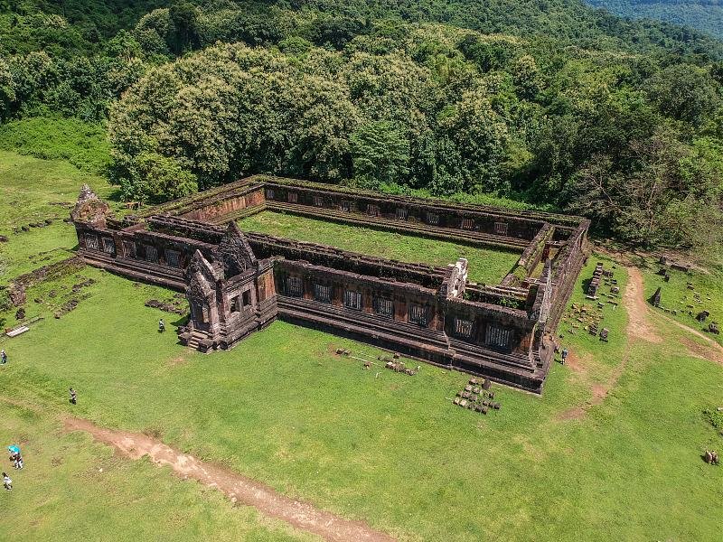
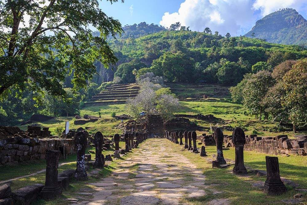
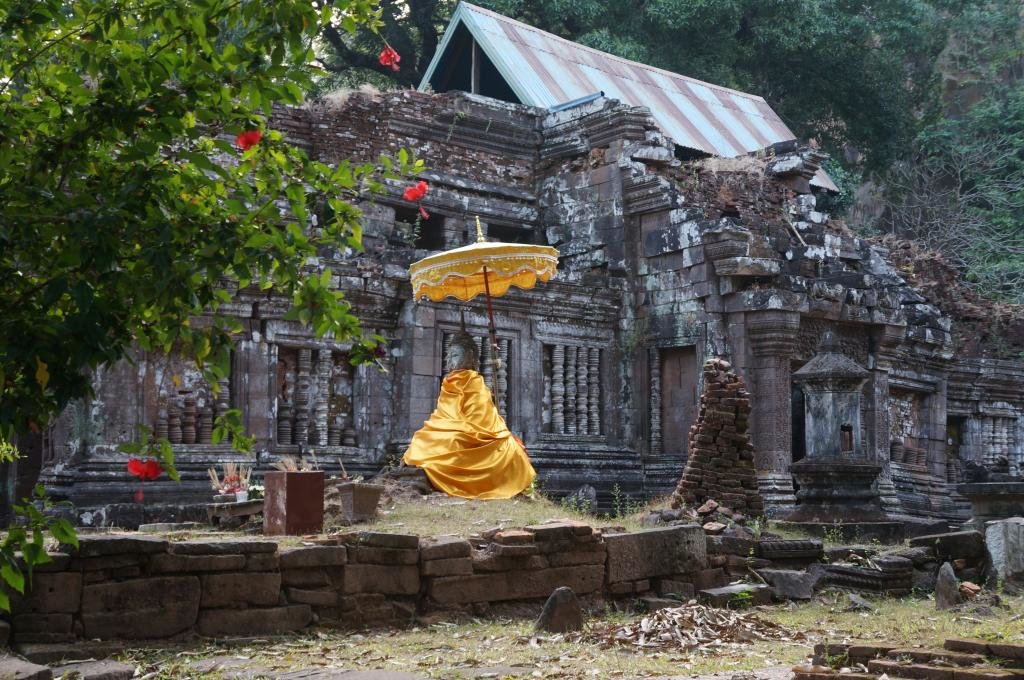
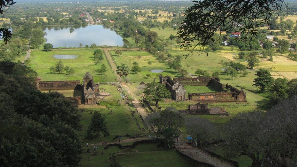
The next morning off for a quick visit to Vat Sisumang (N14.87025 E105.87299) and Vat Phou (N14.84872 E105.82089) before heading east in the general direction of Attapeu
 DSCN0312 by Auke Koopmans, on Flickr
 DSCN 0311 Vat Sisumang by Auke Koopmans, on Flickr
 DSCN0336 by Auke Koopmans, on Flickr
 DSCN0328 by Auke Koopmans, on Flickr
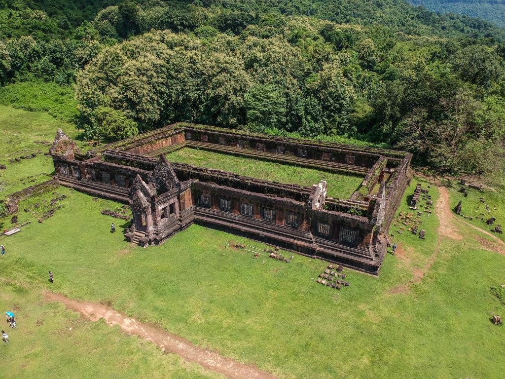
Utayan Bajiang Champasak with Tad Pasousan (N15.27647 E105.92183) north-east of Pakse
 20170908_120848 by Auke Koopmans, on Flickr
Not sure what she was collecting but at least she was having a good laugh about the farang showing an interest in it
 DSCN0353 by Auke Koopmans, on Flickr
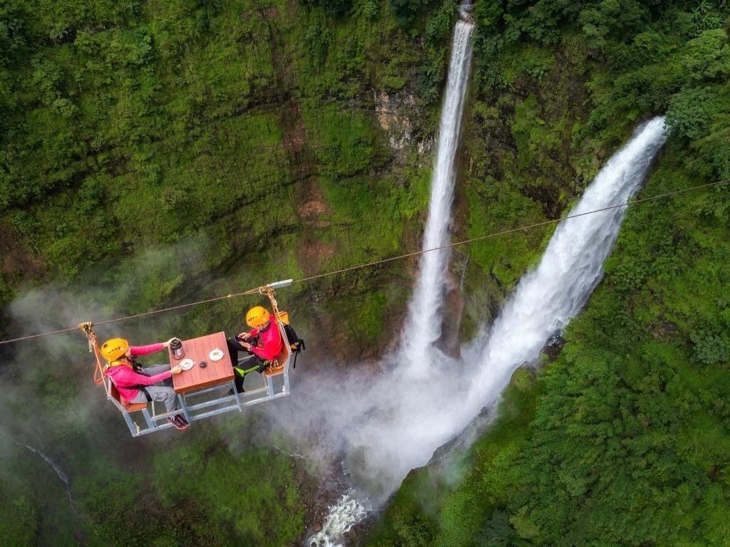
Tad Fane and the new zipline (N15.18250 E106.12677)
 DSCN0354 by Auke Koopmans, on Flickr
Although there were quite a few people visiting the waterfall, there were no takers for the 50 USD zipline over the waterfall with or without a coffee from Paksong Adventures Coffee thrown in
 DSCN0365 by Auke Koopmans, on Flickr

 DSCN0369 by Auke Koopmans, on Flickr
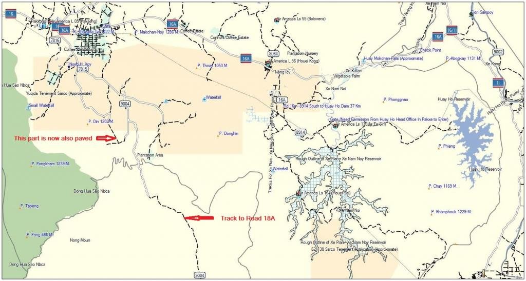
Time for a bit of mapping - a lot of new paved roads have been constructed at the Bolaven Plateau sout of Paksong
After the mapping part again back to the waterfalls - Xe Katamtok (viewpoint located at N15.12592 E106.63813) - still quite a lot of water flowing through the falls even though the Xe Katamtok hydro power project has started operation
 DSCN0373 by Auke Koopmans, on Flickr
Xe Katamtok picture taken by the drone

Xe Katamtok during the dry season

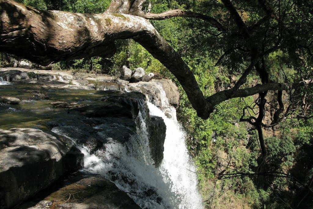
After that we attempted to locate the Houay Makchanh falls again (approximate location at N15.13360 E106.64746) but the area was so overgrown that we could not even find it with the help of the drone so just a few pictures from quite some time ago as well as one taken during the dry season earlier this year


To be continued
Most of my trips to Laos are made during the dry season when things are dry and dusty, rivers and waterfalls have very little water flowing through them and the landscape is obscured by smoke and dust. So, for a change a trip during the rainy season to see the difference the rains can make but which at the same time can make things also more difficult to get to them. Starting in the south for some waterfalls and other thingies and ending in the central/northern part of Laos in the hope that the "Paklay" bridge over the Mekong would be ready so that I would be able to drive over the bridge instead of having to take the ferry.
After a 1000 km drive from Chiangmai to Pakse ready for some R&R at the Pakse Hotel followed by a night time visit to the big Buddha at Phou Salao (N15.09541 E105.81182 - be there before 9 in the evening as the lights are switched of at 21.00 hours) on the other side of the Mekong before starting the chase for waterfalls and bridges
 20170907_180602 by Auke Koopmans, on Flickr
 20170907_210254 by Auke Koopmans, on Flickr
The next morning off for a quick visit to Vat Sisumang (N14.87025 E105.87299) and Vat Phou (N14.84872 E105.82089) before heading east in the general direction of Attapeu
 DSCN0312 by Auke Koopmans, on Flickr
 DSCN 0311 Vat Sisumang by Auke Koopmans, on Flickr
 DSCN0336 by Auke Koopmans, on Flickr
 DSCN0328 by Auke Koopmans, on Flickr
Utayan Bajiang Champasak with Tad Pasousan (N15.27647 E105.92183) north-east of Pakse
 20170908_120848 by Auke Koopmans, on Flickr
Not sure what she was collecting but at least she was having a good laugh about the farang showing an interest in it
 DSCN0353 by Auke Koopmans, on Flickr
Tad Fane and the new zipline (N15.18250 E106.12677)
 DSCN0354 by Auke Koopmans, on Flickr
Although there were quite a few people visiting the waterfall, there were no takers for the 50 USD zipline over the waterfall with or without a coffee from Paksong Adventures Coffee thrown in
 DSCN0365 by Auke Koopmans, on Flickr
 DSCN0369 by Auke Koopmans, on Flickr
Time for a bit of mapping - a lot of new paved roads have been constructed at the Bolaven Plateau sout of Paksong

After the mapping part again back to the waterfalls - Xe Katamtok (viewpoint located at N15.12592 E106.63813) - still quite a lot of water flowing through the falls even though the Xe Katamtok hydro power project has started operation
 DSCN0373 by Auke Koopmans, on Flickr
Xe Katamtok picture taken by the drone

Xe Katamtok during the dry season
After that we attempted to locate the Houay Makchanh falls again (approximate location at N15.13360 E106.64746) but the area was so overgrown that we could not even find it with the help of the drone so just a few pictures from quite some time ago as well as one taken during the dry season earlier this year


To be continued


